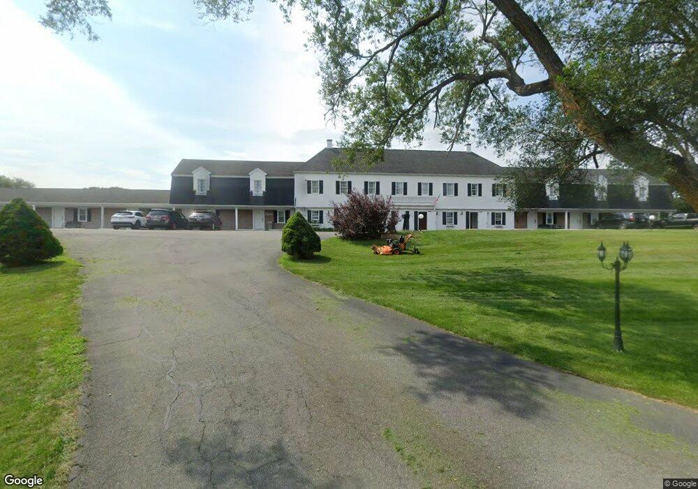
54 Route 6a Sandwich, MA 2563
Estimated Value: $8,473,345
--
Bed
--
Bath
39,202
Sq Ft
$216/Sq Ft
Est. Value
About This Home
This home is located at 54 Route 6a, Sandwich, MA 2563 and is currently estimated at $8,473,345, approximately $216 per square foot. 54 Route 6a is a home located in Barnstable County with nearby schools including Sandwich Middle High School, Waldorf School of Cape Cod, and Bridgeview Montessori School.
Ownership History
Date
Name
Owned For
Owner Type
Purchase Details
Closed on
Jun 6, 2003
Sold by
Jmp Re Holding Corp
Bought by
Sandwich Resort Rt and Patel Kirtikumar
Current Estimated Value
Home Financials for this Owner
Home Financials are based on the most recent Mortgage that was taken out on this home.
Original Mortgage
$820,000
Outstanding Balance
$353,611
Interest Rate
5.45%
Mortgage Type
Commercial
Estimated Equity
$8,119,734
Create a Home Valuation Report for This Property
The Home Valuation Report is an in-depth analysis detailing your home's value as well as a comparison with similar homes in the area
Home Values in the Area
Average Home Value in this Area
Purchase History
| Date | Buyer | Sale Price | Title Company |
|---|---|---|---|
| Sandwich Resort Rt | $3,550,000 | -- |
Source: Public Records
Mortgage History
| Date | Status | Borrower | Loan Amount |
|---|---|---|---|
| Open | Sandwich Resort Rt | $820,000 | |
| Open | Sandwich Resort Rt | $2,350,000 | |
| Previous Owner | Sandwich Resort Rt | $1,411,000 |
Source: Public Records
Tax History Compared to Growth
Tax History
| Year | Tax Paid | Tax Assessment Tax Assessment Total Assessment is a certain percentage of the fair market value that is determined by local assessors to be the total taxable value of land and additions on the property. | Land | Improvement |
|---|---|---|---|---|
| 2025 | $48,871 | $4,623,600 | $1,412,000 | $3,211,600 |
| 2024 | $47,497 | $4,397,900 | $1,303,600 | $3,094,300 |
| 2023 | $46,248 | $4,021,600 | $1,253,700 | $2,767,900 |
| 2022 | $50,609 | $3,845,700 | $1,205,100 | $2,640,600 |
| 2021 | $52,574 | $3,818,000 | $1,158,400 | $2,659,600 |
| 2020 | $53,731 | $3,754,800 | $1,126,800 | $2,628,000 |
| 2019 | $51,286 | $3,581,400 | $1,075,100 | $2,506,300 |
| 2018 | $2,438 | $3,404,600 | $1,026,800 | $2,377,800 |
| 2017 | $49,050 | $3,285,300 | $1,036,200 | $2,249,100 |
| 2016 | $46,570 | $3,218,400 | $980,400 | $2,238,000 |
| 2015 | $46,195 | $3,117,100 | $920,900 | $2,196,200 |
Source: Public Records
Map
Nearby Homes