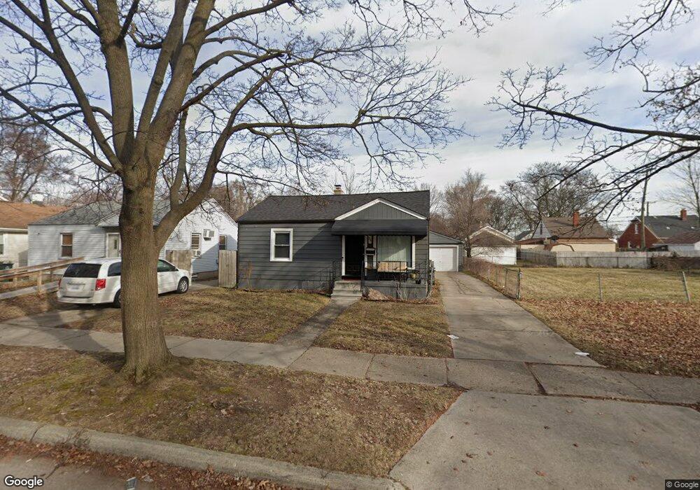
54 W Maxlow Ave Unit Bldg-Unit Hazel Park, MI 48030
Estimated Value: $121,000 - $156,000
2
Beds
1
Bath
719
Sq Ft
$190/Sq Ft
Est. Value
About This Home
This home is located at 54 W Maxlow Ave Unit Bldg-Unit, Hazel Park, MI 48030 and is currently estimated at $136,763, approximately $190 per square foot. 54 W Maxlow Ave Unit Bldg-Unit is a home located in Oakland County with nearby schools including Hazel Park Junior High School and Hazel Park High School.
Ownership History
Date
Name
Owned For
Owner Type
Purchase Details
Closed on
Feb 14, 2024
Sold by
Fontenelle Family Real Estate Llc
Bought by
Cox Kimberly R
Current Estimated Value
Purchase Details
Closed on
Apr 3, 2014
Sold by
Own It Detroit Llc and Fasi Derek
Bought by
Fontenelle Family Real Estate Llc
Purchase Details
Closed on
Feb 19, 2014
Sold by
Bolk Sherri Lynn and James W Revoldt Living Trust
Bought by
Own It Detroit Llc
Purchase Details
Closed on
May 21, 1999
Sold by
Revoldt James W
Bought by
James W Revoldt Tr
Create a Home Valuation Report for This Property
The Home Valuation Report is an in-depth analysis detailing your home's value as well as a comparison with similar homes in the area
Home Values in the Area
Average Home Value in this Area
Purchase History
| Date | Buyer | Sale Price | Title Company |
|---|---|---|---|
| Cox Kimberly R | $150,000 | Embassy Title | |
| Cox Kimberly R | $150,000 | Embassy Title | |
| Fontenelle Family Real Estate Llc | $48,500 | Leading Edge Title Agency | |
| Own It Detroit Llc | $30,000 | None Available | |
| James W Revoldt Tr | -- | -- |
Source: Public Records
Tax History Compared to Growth
Tax History
| Year | Tax Paid | Tax Assessment Tax Assessment Total Assessment is a certain percentage of the fair market value that is determined by local assessors to be the total taxable value of land and additions on the property. | Land | Improvement |
|---|---|---|---|---|
| 2024 | $1,802 | $39,170 | $0 | $0 |
| 2023 | $1,806 | $34,960 | $0 | $0 |
| 2022 | $1,811 | $31,220 | $0 | $0 |
| 2021 | $1,774 | $26,950 | $0 | $0 |
| 2020 | $1,738 | $24,020 | $0 | $0 |
| 2019 | $1,750 | $21,650 | $0 | $0 |
| 2018 | $1,985 | $19,110 | $0 | $0 |
| 2017 | $1,667 | $18,430 | $0 | $0 |
| 2016 | $1,665 | $16,440 | $0 | $0 |
| 2015 | -- | $14,920 | $0 | $0 |
| 2014 | -- | $14,050 | $0 | $0 |
| 2011 | -- | $18,840 | $0 | $0 |
Source: Public Records
Map
Nearby Homes
- 39 W Elza Ave
- 0 W Evelyn Ave Unit 20251032726
- 76 W Bernhard Ave
- 0000 W Milton Ave
- 334 E Milton Ave
- 518 E Maxlow Ave
- 404 W Madge Ave
- 18 W Harry Ave
- 338 W Hayes Ave
- 449 W Evelyn Ave
- 419 W Bernhard Ave
- 508 E Bernhard Ave
- 347 W Harry Ave
- 382 W Hayes Ave
- 32 E George Ave
- 152 W Muir Ave
- 0000 E Muir Ave
- 1811 E Marshall St
- 000 W Muir Ave
- 606 E Milton Ave
- 54 W Maxlow Ave
- 62 W Maxlow Ave
- 36 W Maxlow Ave
- 68 W Maxlow Ave
- 74 W Maxlow Ave
- 30 W Maxlow Ave
- 61 W Evelyn Ave
- 84 W Maxlow Ave
- 39 W Evelyn Ave
- 41 W Evelyn Ave
- 65 W Evelyn Ave
- 29 W Evelyn Ave
- 92 W Maxlow Ave
- 57 W Maxlow Ave
- 65 W Maxlow Ave
- 41 W Maxlow Ave
- 41 W Maxlow Ave
- 21403 John R Rd
- 83 W Evelyn Ave
- 71 W Maxlow Ave