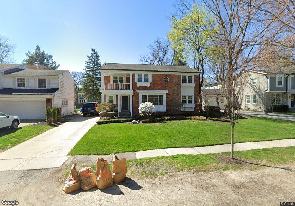
540 Abbey St Birmingham, MI 48009
Estimated Value: $1,009,597 - $1,173,000
4
Beds
3
Baths
2,778
Sq Ft
$389/Sq Ft
Est. Value
About This Home
This home is located at 540 Abbey St, Birmingham, MI 48009 and is currently estimated at $1,079,899, approximately $388 per square foot. 540 Abbey St is a home located in Oakland County with nearby schools including Harlan Elementary School, Derby Middle School, and Ernest W. Seaholm High School.
Ownership History
Date
Name
Owned For
Owner Type
Purchase Details
Closed on
Jun 21, 2011
Sold by
Wu Judie and Wu Stefan
Bought by
Mcbride Michael and Mcbride Kristen
Current Estimated Value
Purchase Details
Closed on
Jun 2, 2009
Sold by
Choinski Martin C and Choinski Cheryl L
Bought by
National City Bank
Create a Home Valuation Report for This Property
The Home Valuation Report is an in-depth analysis detailing your home's value as well as a comparison with similar homes in the area
Home Values in the Area
Average Home Value in this Area
Purchase History
| Date | Buyer | Sale Price | Title Company |
|---|---|---|---|
| Mcbride Michael | $490,000 | Title One Inc | |
| National City Bank | $569,241 | None Available |
Source: Public Records
Tax History
| Year | Tax Paid | Tax Assessment Tax Assessment Total Assessment is a certain percentage of the fair market value that is determined by local assessors to be the total taxable value of land and additions on the property. | Land | Improvement |
|---|---|---|---|---|
| 2025 | $12,282 | $456,610 | $0 | $0 |
| 2024 | $10,842 | $466,300 | $0 | $0 |
| 2023 | $10,390 | $423,850 | $0 | $0 |
| 2022 | $11,140 | $398,900 | $0 | $0 |
| 2021 | $11,238 | $392,760 | $0 | $0 |
| 2020 | $10,013 | $358,290 | $0 | $0 |
| 2019 | $11,331 | $352,580 | $0 | $0 |
| 2018 | $11,244 | $342,010 | $0 | $0 |
| 2017 | $11,225 | $336,670 | $0 | $0 |
| 2016 | $11,246 | $341,030 | $0 | $0 |
| 2015 | -- | $312,830 | $0 | $0 |
| 2014 | -- | $270,940 | $0 | $0 |
| 2011 | -- | $266,350 | $0 | $0 |
Source: Public Records
Map
Nearby Homes
- 777 Wimbleton Dr
- 1330 Oxford Rd
- 1060 Wimbleton Dr
- 000 N Adams Rd
- 1155 Derby Rd Unit 8
- 484 Park St
- 532 Brookside Ave
- 1180 Manchester Rd
- 488 Vinewood Ave
- 551 N Old Woodward Ave Unit 551
- 3826 Village Ct
- 369 N Old Woodward Ave Unit 301
- 369 N Old Woodward Ave Unit 307
- 369 N Old Woodward Ave Unit 206
- 369 N Old Woodward Ave Unit 207
- 670 Oak Ave
- 600 Woodland St
- 1111 N Old Woodward Ave Unit 4
- 1111 N Old Woodward Ave Unit 23
- 1115 N Old Woodward Ave
Your Personal Tour Guide
Ask me questions while you tour the home.