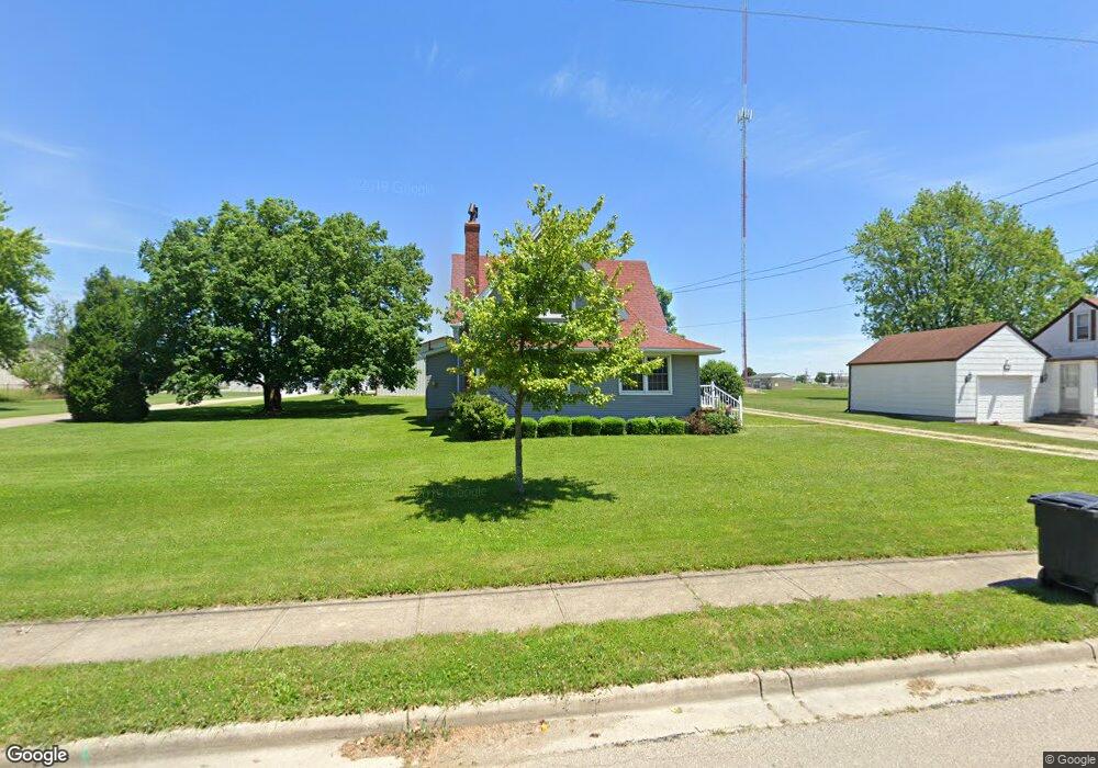
540 Albert Rd Brookville, OH 45309
Estimated Value: $208,000 - $270,000
4
Beds
1
Bath
1,914
Sq Ft
$123/Sq Ft
Est. Value
About This Home
This home is located at 540 Albert Rd, Brookville, OH 45309 and is currently estimated at $235,390, approximately $122 per square foot. 540 Albert Rd is a home located in Montgomery County with nearby schools including Brookville Elementary School, Brookville Intermediate School, and Brookville High School.
Ownership History
Date
Name
Owned For
Owner Type
Purchase Details
Closed on
Oct 31, 2016
Sold by
Vaughn Rebecca L and Vaughn Dale
Bought by
Howard Daniel
Current Estimated Value
Home Financials for this Owner
Home Financials are based on the most recent Mortgage that was taken out on this home.
Original Mortgage
$83,460
Outstanding Balance
$66,462
Interest Rate
3.42%
Mortgage Type
FHA
Estimated Equity
$168,928
Purchase Details
Closed on
Jun 14, 2001
Sold by
Estate Of John Rhoades Jr
Bought by
Rhoades Sara L and Rhoades Sara Ruth
Create a Home Valuation Report for This Property
The Home Valuation Report is an in-depth analysis detailing your home's value as well as a comparison with similar homes in the area
Home Values in the Area
Average Home Value in this Area
Purchase History
| Date | Buyer | Sale Price | Title Company |
|---|---|---|---|
| Howard Daniel | $85,000 | Landmark Title Agency South | |
| Rhoades Sara L | -- | -- |
Source: Public Records
Mortgage History
| Date | Status | Borrower | Loan Amount |
|---|---|---|---|
| Open | Howard Daniel | $83,460 |
Source: Public Records
Tax History
| Year | Tax Paid | Tax Assessment Tax Assessment Total Assessment is a certain percentage of the fair market value that is determined by local assessors to be the total taxable value of land and additions on the property. | Land | Improvement |
|---|---|---|---|---|
| 2025 | $2,972 | $60,970 | $11,020 | $49,950 |
| 2024 | $2,864 | $60,970 | $11,020 | $49,950 |
| 2023 | $2,864 | $60,970 | $11,020 | $49,950 |
| 2022 | $2,541 | $42,050 | $7,600 | $34,450 |
| 2021 | $2,552 | $42,050 | $7,600 | $34,450 |
| 2020 | $2,583 | $42,500 | $8,050 | $34,450 |
| 2019 | $2,359 | $35,500 | $8,050 | $27,450 |
| 2018 | $2,371 | $35,500 | $8,050 | $27,450 |
| 2017 | $2,360 | $35,500 | $8,050 | $27,450 |
| 2016 | $2,203 | $31,740 | $8,050 | $23,690 |
| 2015 | $1,537 | $31,740 | $8,050 | $23,690 |
| 2014 | $1,537 | $31,740 | $8,050 | $23,690 |
| 2012 | -- | $32,250 | $8,050 | $24,200 |
Source: Public Records
Map
Nearby Homes
- 609 Hay Ave
- 104 Meadowlark Ln Unit 905-202
- 421 Market St
- 402 Main St
- 406 Main St
- 232 Maple St
- 7005 E Westbrook Rd
- 144 Evergreen Way
- 208 S Wolf Creek St
- 164 Autumn Maple Ln
- 12 Harshman St
- 115 N Wolf Creek St
- 151 Autumn Maple Ln
- Ashton Plan at Evergreen Trace
- Norway Plan at Evergreen Trace
- Spruce Plan at Evergreen Trace
- Ironwood Plan at Evergreen Trace
- Empress Plan at Evergreen Trace
- Juniper Plan at Evergreen Trace
- Aspen II Plan at Evergreen Trace
Your Personal Tour Guide
Ask me questions while you tour the home.