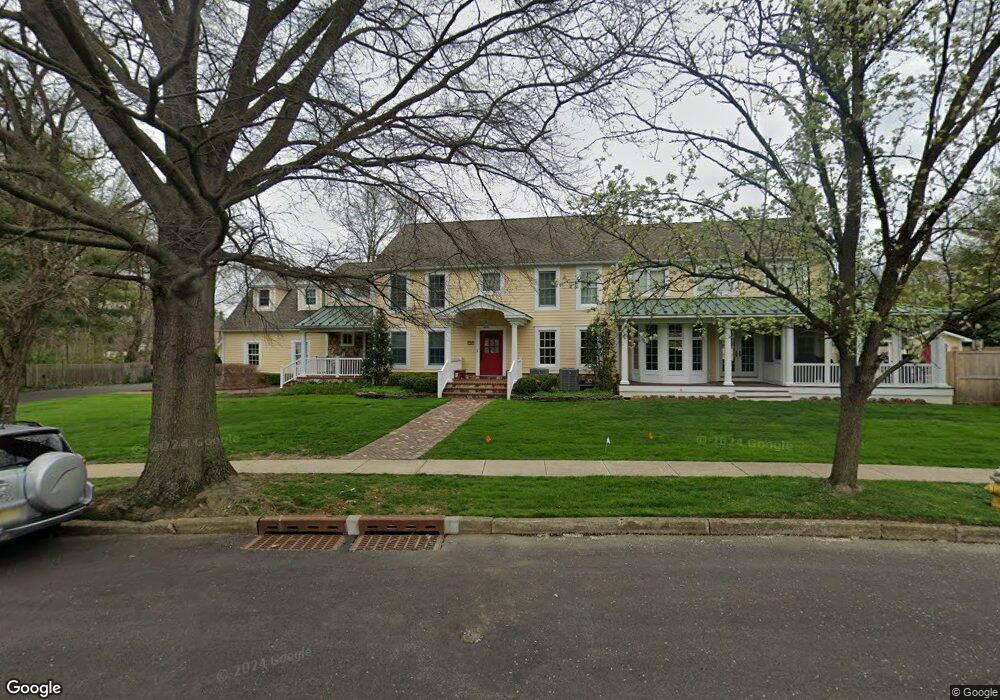
540 Bartram Rd Moorestown, NJ 08057
Estimated Value: $1,339,000 - $1,532,000
Studio
--
Bath
4,618
Sq Ft
$309/Sq Ft
Est. Value
About This Home
This home is located at 540 Bartram Rd, Moorestown, NJ 08057 and is currently estimated at $1,428,635, approximately $309 per square foot. 540 Bartram Rd is a home located in Burlington County with nearby schools including George C. Baker Elementary School, Moorestown Upper Elementary School, and William Allen Middle School.
Ownership History
Date
Name
Owned For
Owner Type
Purchase Details
Closed on
May 25, 2021
Sold by
Barg Riggins R and Barg Riggins Marianne
Bought by
Riggins Richard Paul
Current Estimated Value
Purchase Details
Closed on
Aug 13, 1996
Sold by
Polk Robert O and Polk Carol A
Bought by
Riggins R Paul and Barg Riggins Marianne
Create a Home Valuation Report for This Property
The Home Valuation Report is an in-depth analysis detailing your home's value as well as a comparison with similar homes in the area
Home Values in the Area
Average Home Value in this Area
Purchase History
| Date | Buyer | Sale Price | Title Company |
|---|---|---|---|
| Riggins Richard Paul | -- | None Available | |
| Riggins R Paul | $465,000 | Landis Title Corporation |
Source: Public Records
Tax History
| Year | Tax Paid | Tax Assessment Tax Assessment Total Assessment is a certain percentage of the fair market value that is determined by local assessors to be the total taxable value of land and additions on the property. | Land | Improvement |
|---|---|---|---|---|
| 2025 | $22,029 | $776,500 | $173,800 | $602,700 |
| 2024 | $21,362 | $776,500 | $173,800 | $602,700 |
| 2023 | $21,362 | $776,500 | $173,800 | $602,700 |
| 2022 | $21,144 | $776,500 | $173,800 | $602,700 |
| 2021 | $20,865 | $776,500 | $173,800 | $602,700 |
| 2020 | $20,733 | $776,500 | $173,800 | $602,700 |
| 2019 | $20,368 | $776,500 | $173,800 | $602,700 |
| 2018 | $19,816 | $776,500 | $173,800 | $602,700 |
| 2017 | $19,987 | $776,500 | $173,800 | $602,700 |
| 2016 | $19,917 | $776,500 | $173,800 | $602,700 |
| 2015 | $19,677 | $776,500 | $173,800 | $602,700 |
| 2014 | $18,683 | $776,500 | $173,800 | $602,700 |
Source: Public Records
Map
Nearby Homes
- 700 Lippincott Ave
- 611 New Albany Rd
- 705 Iron Post Rd
- 543 Bethel Ave
- 500 Chester Ave
- 2 Oriole Way
- 863 Golf View Rd
- 17 Cardinal Dr
- 66 E 3rd St
- 2801 Riverton Rd
- 205 E Central Ave
- 80 E 3rd St
- 140 E Central Ave
- 307 Fairview Ave
- 401 W 3rd St
- 133 Plum St Unit 6
- 744 Signal Light Rd
- 504 Wellfleet Rd
- 129 S Church St
- 127 Schooley St
Your Personal Tour Guide
Ask me questions while you tour the home.