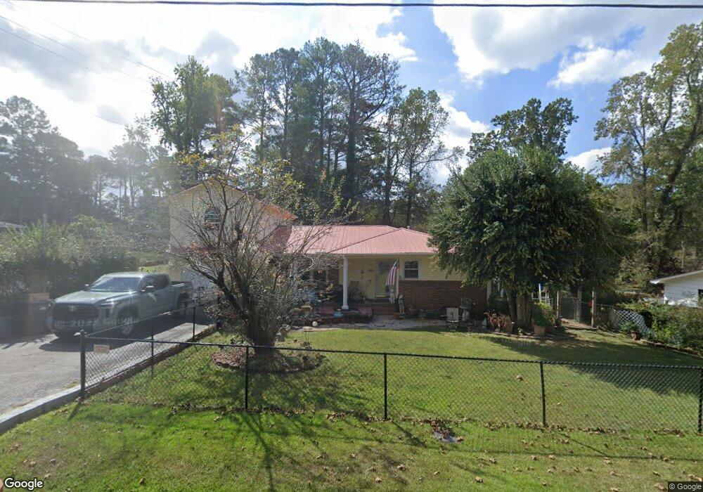
540 Brockford Rd Heflin, AL 36264
Estimated Value: $161,000 - $201,000
--
Bed
--
Bath
1,244
Sq Ft
$147/Sq Ft
Est. Value
About This Home
This home is located at 540 Brockford Rd, Heflin, AL 36264 and is currently estimated at $183,333, approximately $147 per square foot. 540 Brockford Rd is a home located in Cleburne County.
Ownership History
Date
Name
Owned For
Owner Type
Purchase Details
Closed on
Dec 11, 2024
Sold by
Burton Robert William
Bought by
Burton Robert William and Burton Vickie R
Current Estimated Value
Purchase Details
Closed on
Aug 1, 2024
Sold by
Southern Pine Plantations Of Georgia Inc
Bought by
Viessmann Generational Investments Gmbh
Create a Home Valuation Report for This Property
The Home Valuation Report is an in-depth analysis detailing your home's value as well as a comparison with similar homes in the area
Home Values in the Area
Average Home Value in this Area
Purchase History
| Date | Buyer | Sale Price | Title Company |
|---|---|---|---|
| Burton Robert William | -- | None Listed On Document | |
| Viessmann Generational Investments Gmbh | $7,998,907 | None Listed On Document | |
| Viessmann Generational Investments Gmbh | $7,998,907 | None Listed On Document |
Source: Public Records
Tax History Compared to Growth
Tax History
| Year | Tax Paid | Tax Assessment Tax Assessment Total Assessment is a certain percentage of the fair market value that is determined by local assessors to be the total taxable value of land and additions on the property. | Land | Improvement |
|---|---|---|---|---|
| 2024 | $527 | $22,140 | $1,100 | $21,040 |
| 2023 | $490 | $19,874 | $1,074 | $18,800 |
| 2022 | $434 | $19,874 | $1,074 | $18,800 |
| 2021 | $425 | $19,514 | $1,074 | $18,440 |
| 2020 | $388 | $17,962 | $1,182 | $16,780 |
| 2019 | $385 | $17,854 | $1,074 | $16,780 |
| 2018 | $385 | $17,854 | $1,074 | $16,780 |
| 2017 | $359 | $16,794 | $1,074 | $15,720 |
| 2016 | $353 | $8,277 | $0 | $0 |
| 2015 | $353 | $82,770 | $0 | $0 |
| 2014 | $353 | $82,770 | $0 | $0 |
| 2013 | $353 | $82,770 | $0 | $0 |
Source: Public Records
Map
Nearby Homes
- 193 Brown St
- 190 Hillcrest Rd
- 0 Osborn St Unit 1 21413432
- 59 Freeman St
- 44 Freeman St
- 0 Highway 9 Unit 1319111
- 0 Highway 9 Unit 21378462
- 772 Bedwell St
- 760 Bedwell St
- 0 Sugar Hill Dr Unit 29 & 28 21382866
- 357 Perryman Bridge Rd
- 201 Bell St
- 943 Ross St
- 990 Ross St
- 820 Boozer Rd
- 227 Bennett St
- 939 Boozer Rd
- 0 Highway 46 Unit 21430373
- 0 Highway 46 Unit 1.9 21430374
- 0 Highway 46 Unit 2 21430866
- 3091 Highway 78
- 3029 U S 78
- 3135 Highway 78 Unit U
- 3029 Highway 78
- 3066 Highway 78
- 3086 Highway 78
- 3023 Highway 78
- 3124 U S 78
- 3124 Highway 78
- 87 Brown St Unit 87
- 1106 U S 78
- 3106 Highway 78
- 3185 Highway 78
- 221 Bedwell St
- 104 Brown St
- 161 Brown St
- 2967 Highway 78
- 2989 Highway 78
- 101 Brown St
- 65 Hillcrest Rd