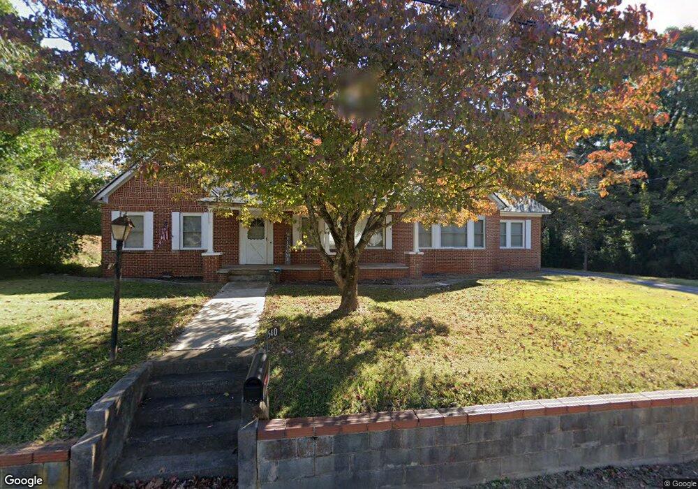
540 Central Ave Demorest, GA 30535
Estimated Value: $298,000 - $341,000
4
Beds
1
Bath
2,184
Sq Ft
$147/Sq Ft
Est. Value
About This Home
This home is located at 540 Central Ave, Demorest, GA 30535 and is currently estimated at $320,740, approximately $146 per square foot. 540 Central Ave is a home located in Habersham County with nearby schools including Demorest Elementary School, Wilbanks Middle School, and Habersham Success Academy.
Ownership History
Date
Name
Owned For
Owner Type
Purchase Details
Closed on
Jun 27, 2025
Sold by
Gore Tommie Oland
Bought by
Alley & Taylor Enterprises Llc
Current Estimated Value
Home Financials for this Owner
Home Financials are based on the most recent Mortgage that was taken out on this home.
Original Mortgage
$200,000
Outstanding Balance
$199,664
Interest Rate
6.89%
Mortgage Type
New Conventional
Estimated Equity
$121,076
Purchase Details
Closed on
Feb 6, 2019
Sold by
Gore Tommie Oland
Bought by
Gore Tommie Oland and Gore Samantha
Home Financials for this Owner
Home Financials are based on the most recent Mortgage that was taken out on this home.
Original Mortgage
$127,373
Interest Rate
5.62%
Mortgage Type
FHA
Purchase Details
Closed on
Oct 2, 2017
Sold by
Harvey Bruce S and Harvey Paige H
Bought by
Gore Tommy and Gore Samantha
Home Financials for this Owner
Home Financials are based on the most recent Mortgage that was taken out on this home.
Original Mortgage
$117,500
Interest Rate
3.82%
Mortgage Type
New Conventional
Purchase Details
Closed on
May 1, 2006
Sold by
Not Provided
Bought by
Harvey Bruce S and Harvey Paige H
Create a Home Valuation Report for This Property
The Home Valuation Report is an in-depth analysis detailing your home's value as well as a comparison with similar homes in the area
Home Values in the Area
Average Home Value in this Area
Purchase History
| Date | Buyer | Sale Price | Title Company |
|---|---|---|---|
| Alley & Taylor Enterprises Llc | $275,000 | -- | |
| Gore Tommie Oland | -- | -- | |
| Gore Tommy | $130,000 | -- | |
| Harvey Bruce S | -- | -- | |
| Harvey Bruce S | $175,000 | -- |
Source: Public Records
Mortgage History
| Date | Status | Borrower | Loan Amount |
|---|---|---|---|
| Open | Alley & Taylor Enterprises Llc | $200,000 | |
| Previous Owner | Gore Tommie Oland | $127,373 | |
| Previous Owner | Gore Tommy | $117,500 |
Source: Public Records
Tax History Compared to Growth
Tax History
| Year | Tax Paid | Tax Assessment Tax Assessment Total Assessment is a certain percentage of the fair market value that is determined by local assessors to be the total taxable value of land and additions on the property. | Land | Improvement |
|---|---|---|---|---|
| 2025 | $4,101 | $130,945 | $28,000 | $102,945 |
| 2024 | $2,826 | $108,876 | $20,000 | $88,876 |
| 2023 | $2,341 | $93,636 | $20,000 | $73,636 |
| 2022 | $2,061 | $79,032 | $16,000 | $63,032 |
| 2021 | $1,593 | $70,716 | $14,400 | $56,316 |
| 2020 | $1,414 | $52,568 | $12,000 | $40,568 |
| 2019 | $1,415 | $52,568 | $12,000 | $40,568 |
| 2018 | $1,309 | $49,000 | $9,880 | $39,120 |
| 2017 | $1,259 | $46,896 | $8,000 | $38,896 |
| 2016 | $1,223 | $117,240 | $8,000 | $38,896 |
| 2015 | $1,208 | $117,240 | $8,000 | $38,896 |
| 2014 | $1,212 | $115,370 | $8,000 | $38,148 |
| 2013 | -- | $46,148 | $8,000 | $38,148 |
Source: Public Records
Map
Nearby Homes
- 876 Central Ave
- 536 Wauka Dr
- 544 Wauka Dr
- Plan 1709 at Habersham Meadows
- Plan 1902 at Habersham Meadows
- Plan 2604 at Habersham Meadows
- Plan 1602-2 at Habersham Meadows
- Plan 3119 at Habersham Meadows
- Plan 2628 at Habersham Meadows
- Plan 2131 at Habersham Meadows
- Plan 2100 at Habersham Meadows
- Plan 2408 at Habersham Meadows
- Plan 3105 at Habersham Meadows
- Plan 2121 at Habersham Meadows
- Plan 1643 at Habersham Meadows
- Plan 2307 at Habersham Meadows
- 523 Wauka Dr
- 539 Wauka Dr
- 545 Wauka Dr
- 515 Wauka Dr
- 115 Wisconsin St
- 500 Central Ave
- 500 Key Largo Ave
- 199 Laurel Ave
- 119 Oak Place
- 116 Wisconsin St
- 143 Oak Place
- 174 Laurel Ave
- 202 Laurel Ave
- 0 Wisconsin St Unit 8437622
- 350 Key Largo Ave
- 230 Laurel Ave
- 110 Nevada St
- 173 Key Largo Ave
- 615 Central Ave
- 188 Wisconsin St
- 257 Hickory Ave
- 154 Florida St
- 229 Hickory Ave
- 0 Florida St