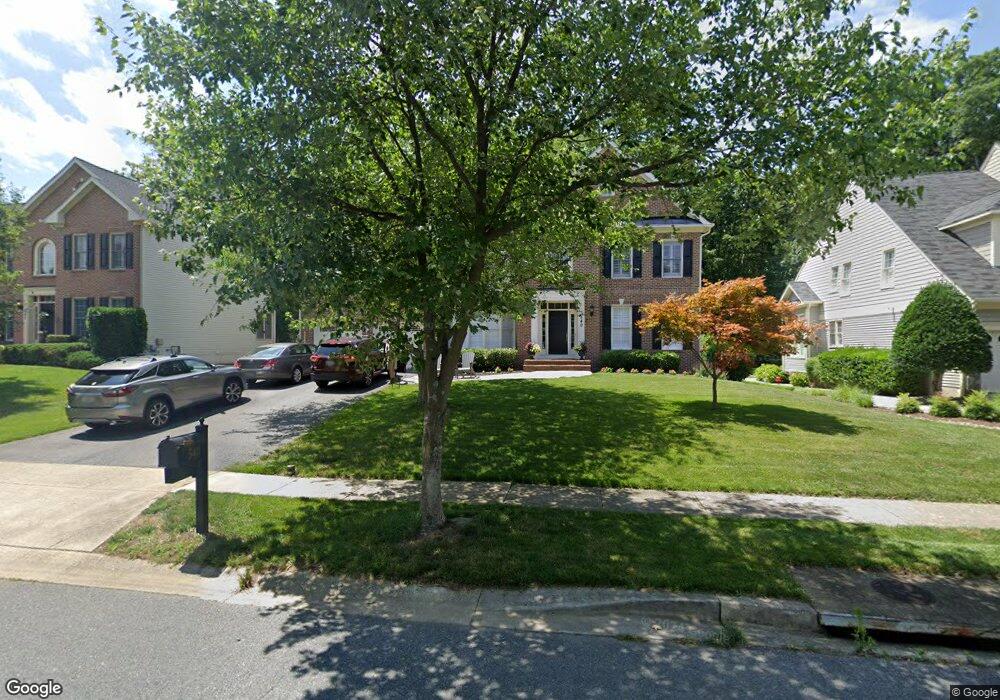
540 Coover Rd Annapolis, MD 21401
Parole NeighborhoodEstimated Value: $940,000 - $1,057,000
--
Bed
5
Baths
4,727
Sq Ft
$215/Sq Ft
Est. Value
About This Home
This home is located at 540 Coover Rd, Annapolis, MD 21401 and is currently estimated at $1,016,348, approximately $215 per square foot. 540 Coover Rd is a home located in Anne Arundel County with nearby schools including Rolling Knolls Elementary School, Wiley H. Bates Middle School, and Annapolis High School.
Ownership History
Date
Name
Owned For
Owner Type
Purchase Details
Closed on
May 6, 2005
Sold by
Swift John M
Bought by
Dunn John T and Dunn Patricia A
Current Estimated Value
Home Financials for this Owner
Home Financials are based on the most recent Mortgage that was taken out on this home.
Original Mortgage
$235,000
Outstanding Balance
$123,395
Interest Rate
5.95%
Mortgage Type
New Conventional
Estimated Equity
$892,953
Purchase Details
Closed on
Jul 24, 2001
Sold by
Thorncroft L C
Bought by
Swift John M and Swift Sharon H
Create a Home Valuation Report for This Property
The Home Valuation Report is an in-depth analysis detailing your home's value as well as a comparison with similar homes in the area
Home Values in the Area
Average Home Value in this Area
Purchase History
| Date | Buyer | Sale Price | Title Company |
|---|---|---|---|
| Dunn John T | $833,000 | -- | |
| Swift John M | $538,165 | -- |
Source: Public Records
Mortgage History
| Date | Status | Borrower | Loan Amount |
|---|---|---|---|
| Open | Dunn John T | $235,000 | |
| Closed | Dunn John T | $500,000 |
Source: Public Records
Tax History Compared to Growth
Tax History
| Year | Tax Paid | Tax Assessment Tax Assessment Total Assessment is a certain percentage of the fair market value that is determined by local assessors to be the total taxable value of land and additions on the property. | Land | Improvement |
|---|---|---|---|---|
| 2025 | $8,882 | $814,467 | -- | -- |
| 2024 | $8,882 | $781,433 | $0 | $0 |
| 2023 | $8,646 | $748,400 | $200,800 | $547,600 |
| 2022 | $8,213 | $744,767 | $0 | $0 |
| 2021 | $16,213 | $741,133 | $0 | $0 |
| 2020 | $7,932 | $737,500 | $220,800 | $516,700 |
| 2019 | $7,808 | $737,500 | $220,800 | $516,700 |
| 2018 | $7,478 | $737,500 | $220,800 | $516,700 |
| 2017 | $7,441 | $812,500 | $0 | $0 |
| 2016 | -- | $804,100 | $0 | $0 |
| 2015 | -- | $795,700 | $0 | $0 |
| 2014 | -- | $787,300 | $0 | $0 |
Source: Public Records
Map
Nearby Homes
- 905 Beacon Way
- 825 Coxswain Way
- 803 Coxswain Way Unit 103
- 803 Coxswain Way Unit 203
- 1809 Labrott Ln
- 2664 Compass Dr
- 2601 Compass Dr
- 2737 Yeomans Lantern Ct
- 2600 Compass Dr
- 772 Ballast Way
- 916 Sextant Way
- 1909 Marconi Cir
- 2671 Cunningham Hole Rd
- 2507 Tudo Ct
- 1012 Mastline Dr
- 930 Astern Way Unit 511
- 930 Astern Way Unit 405
- 930 Astern Way Unit 502
- 930 Astern Way Unit 609
- 1945 Marconi Cir
- 542 Coover Rd
- 538 Coover Rd
- 544 Coover Rd
- 539 Coover Rd
- 901 Plattner Ct
- 546 Coover Rd
- 545 Coover Rd
- 541 Coover Rd
- 903 Plattner Ct
- 543 Coover Rd
- 920 Urciolo Ct
- 0 Coover Rd
- 902 Plattner Ct
- 532 Coover Rd
- 907 Plattner Ct
- 530 Coover Rd
- 924 Urciolo Ct
- 904 Plattner Ct
- 904 Plattner Ct Unit 904
- 550 Coover Rd