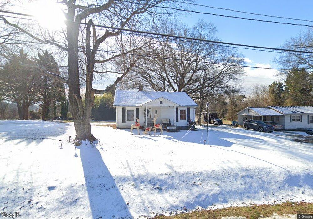
540 E Lexington Rd Mocksville, NC 27028
Estimated Value: $122,254 - $171,000
2
Beds
1
Bath
832
Sq Ft
$175/Sq Ft
Est. Value
About This Home
This home is located at 540 E Lexington Rd, Mocksville, NC 27028 and is currently estimated at $145,564, approximately $174 per square foot. 540 E Lexington Rd is a home located in Davie County with nearby schools including Mocksville Elementary School, South Davie Middle, and Davie County High School.
Ownership History
Date
Name
Owned For
Owner Type
Purchase Details
Closed on
Jul 1, 1996
Current Estimated Value
Create a Home Valuation Report for This Property
The Home Valuation Report is an in-depth analysis detailing your home's value as well as a comparison with similar homes in the area
Home Values in the Area
Average Home Value in this Area
Purchase History
| Date | Buyer | Sale Price | Title Company |
|---|---|---|---|
| -- | -- | -- |
Source: Public Records
Tax History
| Year | Tax Paid | Tax Assessment Tax Assessment Total Assessment is a certain percentage of the fair market value that is determined by local assessors to be the total taxable value of land and additions on the property. | Land | Improvement |
|---|---|---|---|---|
| 2025 | $669 | $68,350 | $25,000 | $43,350 |
| 2023 | $742 | $69,820 | $37,500 | $32,320 |
| 2022 | $746 | $69,820 | $37,500 | $32,320 |
| 2021 | $742 | $69,820 | $37,500 | $32,320 |
| 2020 | $718 | $67,190 | $37,500 | $29,690 |
| 2019 | $718 | $67,190 | $37,500 | $29,690 |
| 2018 | $718 | $67,190 | $37,500 | $29,690 |
| 2017 | $711 | $67,190 | $0 | $0 |
| 2016 | $728 | $68,830 | $0 | $0 |
| 2015 | $728 | $68,830 | $0 | $0 |
| 2014 | -- | $68,830 | $0 | $0 |
| 2013 | -- | $68,830 | $0 | $0 |
Source: Public Records
Map
Nearby Homes
- 107 Charleston Ridge Dr
- 1 lot E Depot St
- 408 Pine St
- 351 Honeysuckle St
- 209 Charleston Ridge Dr
- 135 Winding Creek Rd
- 792 S Main St
- 109 Carriage Cove Cir
- 166 Carriage Cove Cir
- 788 N Main St
- 235 Spring St
- 499 Raymond St
- 210 Birchwood Ln
- 107 Hillcrest St
- 3939 U S Highway 64
- 2082 U S Highway 64 Unit 2
- 3929 U S Highway 64
- 3939 U S Highway 64 Unit 5
- 3929 U S Highway 64 Unit 7
- 214 Holly Ln
Your Personal Tour Guide
Ask me questions while you tour the home.