Estimated Value: $200,782 - $262,000
3
Beds
3
Baths
1,499
Sq Ft
$154/Sq Ft
Est. Value
About This Home
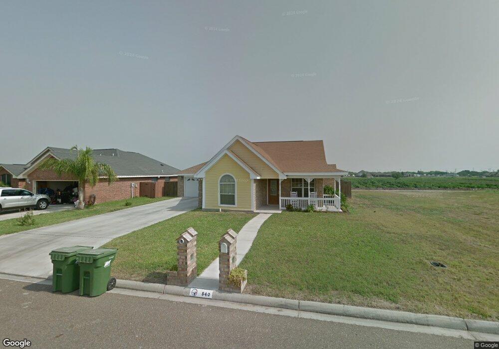
This home is located at 540 Greystone Cir, Alamo, TX 78516 and is currently estimated at $231,196, approximately $154 per square foot. 540 Greystone Cir is a home located in Hidalgo County with nearby schools including Augusto Guerra Elementary, Audie Murphy Middle School, and PSJA Memorial Early College High School.
Ownership History
Date
Name
Owned For
Owner Type
Purchase Details
Closed on
Sep 11, 2008
Sold by
Lopez Cleofas and Lopez Nancy Denise
Bought by
Alanis Denise and Alanis Hernan
Current Estimated Value
Home Financials for this Owner
Home Financials are based on the most recent Mortgage that was taken out on this home.
Original Mortgage
$124,019
Outstanding Balance
$82,569
Interest Rate
6.54%
Mortgage Type
Purchase Money Mortgage
Estimated Equity
$148,627
Create a Home Valuation Report for This Property
The Home Valuation Report is an in-depth analysis detailing your home's value as well as a comparison with similar homes in the area
Home Values in the Area
Average Home Value in this Area
Purchase History
| Date | Buyer | Sale Price | Title Company |
|---|---|---|---|
| Alanis Denise | -- | San Jacinto Title Services |
Source: Public Records
Mortgage History
| Date | Status | Borrower | Loan Amount |
|---|---|---|---|
| Open | Alanis Denise | $124,019 |
Source: Public Records
Tax History Compared to Growth
Tax History
| Year | Tax Paid | Tax Assessment Tax Assessment Total Assessment is a certain percentage of the fair market value that is determined by local assessors to be the total taxable value of land and additions on the property. | Land | Improvement |
|---|---|---|---|---|
| 2025 | $3,040 | $177,369 | -- | -- |
| 2024 | $3,040 | $161,245 | -- | -- |
| 2023 | $3,654 | $146,586 | $0 | $0 |
| 2022 | $3,534 | $132,396 | $0 | $0 |
| 2021 | $3,274 | $120,360 | $36,850 | $83,510 |
| 2020 | $3,318 | $120,360 | $36,850 | $83,510 |
| 2019 | $3,379 | $118,000 | $29,480 | $88,520 |
| 2018 | $3,369 | $118,000 | $29,480 | $88,520 |
| 2017 | $3,482 | $120,102 | $22,110 | $97,992 |
| 2016 | $3,294 | $113,615 | $22,110 | $91,505 |
| 2015 | $2,892 | $114,620 | $22,110 | $92,510 |
Source: Public Records
Map
Nearby Homes
- 843 Brady Ave
- 517 Hunter Dr
- 1118 Country Club Dr
- 516 Hunter Dr
- 520 Country Club Dr
- 709 Carey Ln
- 510 Greystone Cir
- 731 N Tower Rd
- 538 Tulip Cir
- 949 Thomas Ln
- 738 Saint Vincent Dr
- 912 Santa Anna Dr
- 1233 Country Club Dr
- 735 Saint Vincent Dr
- 810 Santa Anna Dr
- 421 Diana Dr
- 503 Shea Dr
- 912 Palm Dr
- 1016 Palm Dr
- 721 Saint Vincent Dr Unit 12
- 542 Greystone Cir
- 536 Greystone Cir
- 550 Greystone Cir
- 849 Ashley Ave
- 534 Greystone Cir
- 534 Greystone Cir Unit 35
- 529 Hunter Dr
- 546 Greystone Cir
- 847 Ashley Ave
- 848 Ashley Ave
- 527 Hunter Dr
- 532 Greystone Cir
- 845 Ashley Ave
- 554 Greystone Cir
- 525 Hunter Dr
- 551 Greystone Cir
- 849 Brady Ave
- 532 Hunter Dr
- 907 Thomas Ln
- 530 Greystone Cir