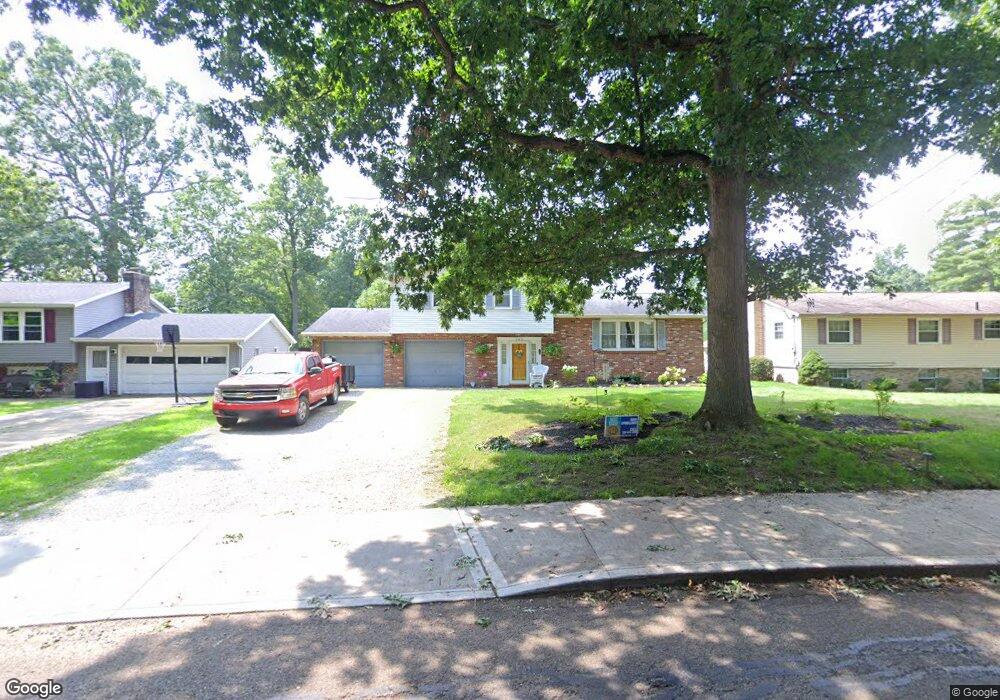
540 Maplewood Dr Alliance, OH 44601
Estimated Value: $205,000 - $246,000
3
Beds
2
Baths
1,196
Sq Ft
$188/Sq Ft
Est. Value
About This Home
This home is located at 540 Maplewood Dr, Alliance, OH 44601 and is currently estimated at $225,141, approximately $188 per square foot. 540 Maplewood Dr is a home located in Stark County with nearby schools including Alliance Elementary School at Rockhill, Alliance Intermediate School at Northside, and Alliance Middle School.
Ownership History
Date
Name
Owned For
Owner Type
Purchase Details
Closed on
Feb 19, 2004
Sold by
Torgersen Marc W and Torgersen Rachel A
Bought by
Torgersen Marc W and Torgersen Rachel A
Current Estimated Value
Purchase Details
Closed on
Nov 12, 2003
Sold by
Shonk Rick A
Bought by
Torgersen Marc W
Home Financials for this Owner
Home Financials are based on the most recent Mortgage that was taken out on this home.
Original Mortgage
$30,000
Outstanding Balance
$13,724
Interest Rate
5.81%
Mortgage Type
Purchase Money Mortgage
Estimated Equity
$211,417
Purchase Details
Closed on
Apr 14, 2000
Sold by
Shonk Rhonda K
Bought by
Shonk Rick A
Purchase Details
Closed on
May 19, 1994
Purchase Details
Closed on
Sep 16, 1993
Create a Home Valuation Report for This Property
The Home Valuation Report is an in-depth analysis detailing your home's value as well as a comparison with similar homes in the area
Home Values in the Area
Average Home Value in this Area
Purchase History
| Date | Buyer | Sale Price | Title Company |
|---|---|---|---|
| Torgersen Marc W | -- | Union Title Company | |
| Torgersen Marc W | $121,000 | Union Title Company | |
| Shonk Rick A | -- | -- | |
| -- | $82,000 | -- | |
| -- | $77,000 | -- |
Source: Public Records
Mortgage History
| Date | Status | Borrower | Loan Amount |
|---|---|---|---|
| Open | Torgersen Marc W | $30,000 |
Source: Public Records
Tax History Compared to Growth
Tax History
| Year | Tax Paid | Tax Assessment Tax Assessment Total Assessment is a certain percentage of the fair market value that is determined by local assessors to be the total taxable value of land and additions on the property. | Land | Improvement |
|---|---|---|---|---|
| 2025 | $2,822 | $67,700 | $9,350 | $58,350 |
| 2024 | $2,205 | $67,700 | $9,350 | $58,350 |
| 2023 | $5,709 | $47,500 | $8,020 | $39,480 |
| 2022 | $1,921 | $47,500 | $8,020 | $39,480 |
| 2021 | $1,923 | $47,500 | $8,020 | $39,480 |
| 2020 | $1,832 | $42,250 | $6,970 | $35,280 |
| 2019 | $1,806 | $42,250 | $6,970 | $35,280 |
| 2018 | $1,814 | $42,250 | $6,970 | $35,280 |
| 2017 | $1,673 | $38,330 | $5,810 | $32,520 |
| 2016 | $1,603 | $36,440 | $5,810 | $30,630 |
| 2015 | $1,617 | $36,440 | $5,810 | $30,630 |
| 2014 | $1,800 | $38,610 | $6,160 | $32,450 |
| 2013 | $898 | $38,610 | $6,160 | $32,450 |
Source: Public Records
Map
Nearby Homes
- 549 Linwood Dr
- 2839 S Rockhill Ave
- 2705 Shunk Ave
- 3101 Ridgehill Ave
- 1059 Oakwood Dr
- 2372 S Union Ave
- 2405 Cherry Ave
- 277 W Carol St
- 236 E Milton St
- 1325 W Beech St
- 2195 Blenheim Ave
- 2460 S Arch Ave
- 2112 Blenheim Ave
- 884 W College Rd
- 2220 Western Ave
- 2408 S Linden Ave
- 555 E Milton St
- 1515 S Rockhill Ave
- 3709 S Union Ave
- 317 E State St
- 2910 Ridgewood Ave
- 510 Maplewood Dr
- 2920 Ridgewood Ave
- 2906 Ridgewood Ave
- 2905 Ridgewood Ave
- 480 Maplewood Dr
- 2831 Belleflower Dr
- 2869 S Rockhill Ave
- 2840 S Rockhill Ave
- 2907 Ridgewood Ave
- 2806 Ridgewood Ave
- 535 Linwood Dr
- 470 Maplewood Dr
- 561 Linwood Dr
- 521 Linwood Dr
- 573 Linwood Dr
- 2811 Belleflower Dr
- 503 Linwood Dr
- 2923 Ridgewood Ave
- 445 Maplewood Dr