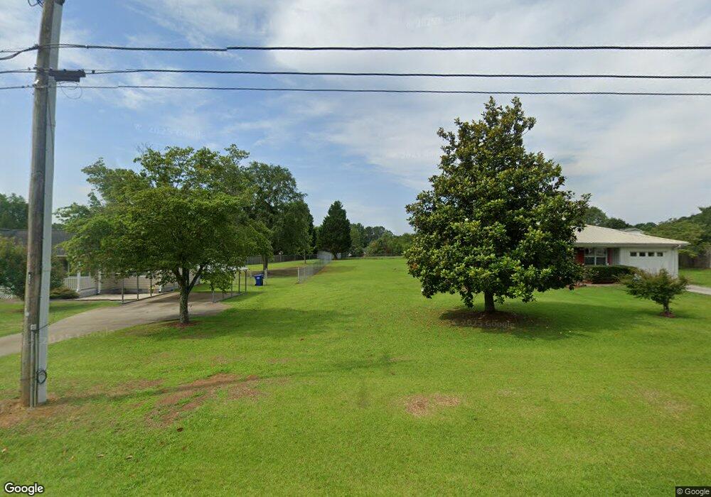
540 Miles Patrick Rd Unit 1 Winder, GA 30680
Estimated Value: $263,000 - $290,000
3
Beds
2
Baths
1,014
Sq Ft
$273/Sq Ft
Est. Value
About This Home
This home is located at 540 Miles Patrick Rd Unit 1, Winder, GA 30680 and is currently estimated at $276,788, approximately $272 per square foot. 540 Miles Patrick Rd Unit 1 is a home located in Barrow County with nearby schools including County Line Elementary School, Russell Middle School, and Winder-Barrow High School.
Ownership History
Date
Name
Owned For
Owner Type
Purchase Details
Closed on
Mar 13, 2015
Sold by
D & G Garrett Limited Partners
Bought by
Ridgeway Rebecca G
Current Estimated Value
Purchase Details
Closed on
May 17, 2005
Sold by
Garrett Duane
Bought by
Garrett Arthur Myron Duane Aka
Purchase Details
Closed on
Aug 5, 2003
Sold by
Manders Jeffrey W
Bought by
Garrett Duane
Purchase Details
Closed on
Jul 1, 2003
Sold by
Manders Jeffery W
Bought by
Clark Robert Wayne
Purchase Details
Closed on
Sep 4, 1997
Sold by
Harvey Dixie
Bought by
Manders Jeffery W
Home Financials for this Owner
Home Financials are based on the most recent Mortgage that was taken out on this home.
Original Mortgage
$63,900
Interest Rate
10.75%
Mortgage Type
New Conventional
Purchase Details
Closed on
Sep 7, 1993
Bought by
Seymour Dixie R
Create a Home Valuation Report for This Property
The Home Valuation Report is an in-depth analysis detailing your home's value as well as a comparison with similar homes in the area
Home Values in the Area
Average Home Value in this Area
Purchase History
| Date | Buyer | Sale Price | Title Company |
|---|---|---|---|
| Ridgeway Rebecca G | -- | -- | |
| D & G Garrett Limited Parnters | -- | -- | |
| Garrett Arthur Myron Duane Aka | -- | -- | |
| Garrett Duane | $82,400 | -- | |
| Clark Robert Wayne | -- | -- | |
| Manders Jeffery W | $71,000 | -- | |
| Seymour Dixie R | $61,000 | -- |
Source: Public Records
Mortgage History
| Date | Status | Borrower | Loan Amount |
|---|---|---|---|
| Previous Owner | Manders Jeffery W | $63,900 |
Source: Public Records
Tax History Compared to Growth
Tax History
| Year | Tax Paid | Tax Assessment Tax Assessment Total Assessment is a certain percentage of the fair market value that is determined by local assessors to be the total taxable value of land and additions on the property. | Land | Improvement |
|---|---|---|---|---|
| 2024 | $2,303 | $80,966 | $20,800 | $60,166 |
| 2023 | $2,296 | $80,966 | $20,800 | $60,166 |
| 2022 | $2,028 | $58,496 | $17,200 | $41,296 |
| 2021 | $1,889 | $50,958 | $12,000 | $38,958 |
| 2020 | $1,614 | $45,116 | $12,000 | $33,116 |
| 2019 | $1,376 | $37,274 | $10,000 | $27,274 |
| 2018 | $1,373 | $37,274 | $10,000 | $27,274 |
| 2017 | $854 | $28,625 | $8,800 | $19,825 |
| 2016 | $945 | $27,086 | $8,800 | $18,286 |
| 2015 | $351 | $27,312 | $8,800 | $18,512 |
| 2014 | $190 | $24,226 | $5,488 | $18,738 |
| 2013 | -- | $23,364 | $5,488 | $17,876 |
Source: Public Records
Map
Nearby Homes
- 980 Lake Rockwell Way
- 746 Baskins Cir
- 412 Regan Dr
- 926 Live Oak Ct Unit 2
- 615 Wellington Dr
- 27 Creekside Dr
- 0 E Northcrest Dr Unit 10648147
- 469 Plantation Dr
- 401 N 5th Ave
- 318 Ryan Rd
- 436 Northcrest Dr
- The Paisley Plan at Rockwell Farms
- The Rockwell Plan at Rockwell Farms
- The Barnes Plan at Rockwell Farms
- The Reynolds Plan at Rockwell Farms
- The Austin Plan at Rockwell Farms
- The Logan Plan at Rockwell Farms
- The Rose II Plan at Rockwell Farms
- 381 W Candler St
- 172 Settle St
- 536 Miles Patrick Rd
- 102 Ashwood Dr Unit 1
- 104 Ashwood Dr
- 104 Ashwood Dr Unit 1
- 109 Northridge Dr
- 111 Northridge Dr
- 106 Ashwood Dr
- 106 Ashwood Dr
- 105 Northridge Dr
- 539 Miles Patrick Rd
- 543 Miles Patrick Rd
- 113 Northridge Dr
- 535 Miles Patrick Rd
- 399 N Ridge Ln
- 103 Ashwood Dr
- 115 Northridge Dr
- 551 Miles Patrick Rd
- 531 Miles Patrick Rd
- 547 Miles Patrick Rd
- 107 Ashwood Dr
