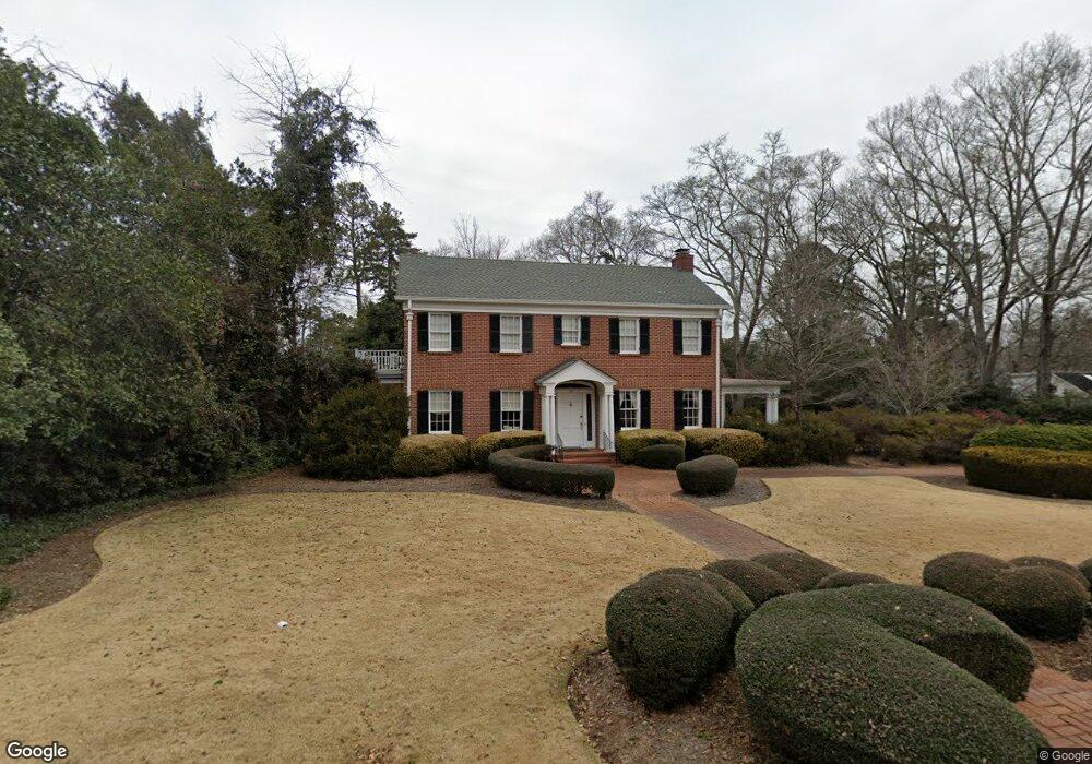
540 Milledge Cir Unit 4 Athens, GA 30606
Five Points NeighborhoodEstimated Value: $1,176,000 - $1,509,000
--
Bed
2
Baths
3,525
Sq Ft
$386/Sq Ft
Est. Value
About This Home
This home is located at 540 Milledge Cir Unit 4, Athens, GA 30606 and is currently estimated at $1,359,564, approximately $385 per square foot. 540 Milledge Cir Unit 4 is a home located in Clarke County with nearby schools including Barrow Elementary School, Clarke Middle School, and Clarke Central High School.
Ownership History
Date
Name
Owned For
Owner Type
Purchase Details
Closed on
Jan 13, 2004
Sold by
Smith James Loran
Bought by
Smith Myrna Warren
Current Estimated Value
Purchase Details
Closed on
Jun 9, 1994
Sold by
Smith Myrna Warren and Loran Smith J
Bought by
Smith James Loran
Purchase Details
Closed on
Sep 24, 1991
Sold by
Smith Myrna Warren and Loran Smith J
Bought by
Smith Myrna Warren
Purchase Details
Closed on
Jul 25, 1991
Sold by
Smith Myrna Warren
Bought by
Smith Myrna Warren and Loran Smith J
Create a Home Valuation Report for This Property
The Home Valuation Report is an in-depth analysis detailing your home's value as well as a comparison with similar homes in the area
Home Values in the Area
Average Home Value in this Area
Purchase History
| Date | Buyer | Sale Price | Title Company |
|---|---|---|---|
| Smith Myrna Warren | -- | -- | |
| Smith James Loran | -- | -- | |
| Smith Myrna Warren | -- | -- | |
| Smith Myrna Warren | -- | -- |
Source: Public Records
Tax History Compared to Growth
Tax History
| Year | Tax Paid | Tax Assessment Tax Assessment Total Assessment is a certain percentage of the fair market value that is determined by local assessors to be the total taxable value of land and additions on the property. | Land | Improvement |
|---|---|---|---|---|
| 2025 | $9,307 | $608,037 | $112,000 | $496,037 |
| 2024 | $9,307 | $535,667 | $112,000 | $423,667 |
| 2023 | $9,409 | $470,875 | $112,000 | $358,875 |
| 2022 | $8,082 | $394,018 | $112,000 | $282,018 |
| 2021 | $7,421 | $314,721 | $112,000 | $202,721 |
| 2020 | $6,710 | $262,862 | $112,000 | $150,862 |
| 2019 | $6,691 | $256,969 | $112,000 | $144,969 |
| 2018 | $6,691 | $256,969 | $112,000 | $144,969 |
| 2017 | $0 | $256,969 | $112,000 | $144,969 |
| 2016 | $6,601 | $250,486 | $112,000 | $138,486 |
| 2015 | $6,392 | $235,540 | $100,000 | $135,540 |
| 2014 | $5,826 | $194,940 | $64,800 | $130,140 |
Source: Public Records
Map
Nearby Homes
- 490 Mcwhorter Dr
- 590 Highland Ave
- 495 Woodlawn Ave
- 104 W Lake Ct
- 577 W Cloverhurst Ave
- 589 W Lake Dr
- 275 Westview Dr
- 169 Fortson Cir
- 2019 S Lumpkin St
- 997 S Milledge Ave Unit 2
- 997 S Milledge Ave Unit 3
- 997 S Milledge Ave Unit 1
- 997 S Milledge Ave Unit 4
- 224 Fortson Dr
- 206 Fortson Dr
- 164 Plum Nelly Rd
- 175 Tillman Ln
- 1055 Baxter St Unit 504
- 265 Springdale St
- 338 Springdale St
- 540 Milledge Cir
- 550 Milledge Cir
- 510 Milledge Cir
- 525 Milledge Cir
- 535 Milledge Cir
- 155 Rock Glenn Rd
- 111 Rock Glen Rd
- 111 Rock Glenn Rd
- 513 Milledge Cir
- 570 Milledge Cir
- 545 Milledge Cir
- 105 Rock Glenn Rd
- 190 Highland Terrace
- 120 Woodland Way
- 175 Rock Glenn Rd
- 110 Woodland Way
- 655 Mcwhorter Dr
- 175 Rock Glen Rd
- 555 Milledge Cir