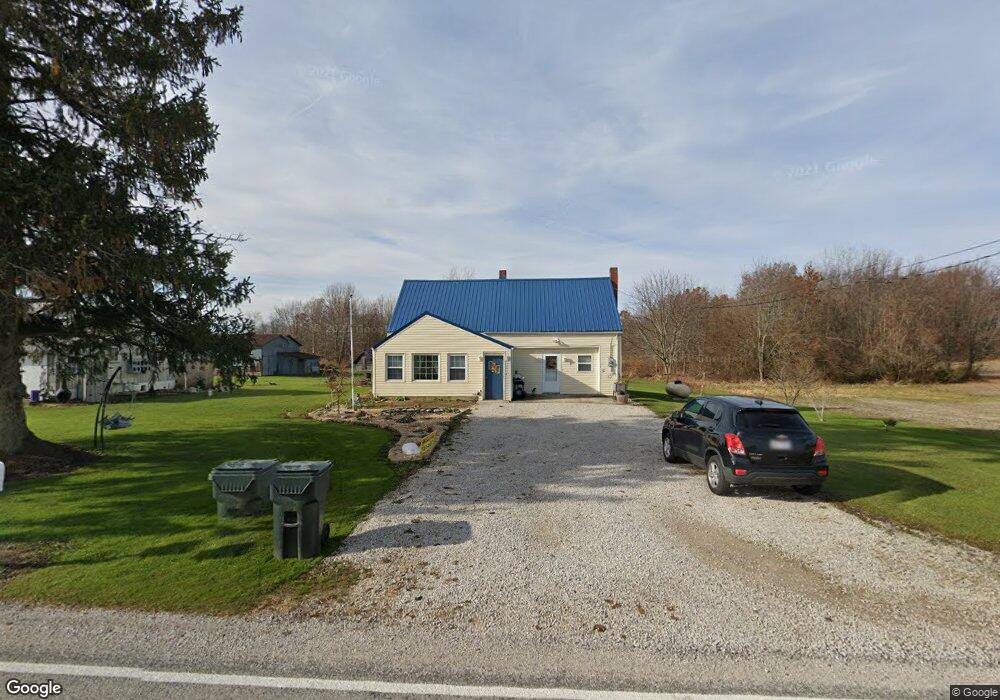
540 S Horning Rd Mansfield, OH 44903
Estimated Value: $242,114 - $280,000
3
Beds
1
Bath
1,532
Sq Ft
$165/Sq Ft
Est. Value
About This Home
This home is located at 540 S Horning Rd, Mansfield, OH 44903 and is currently estimated at $252,779, approximately $164 per square foot. 540 S Horning Rd is a home with nearby schools including Stingel Elementary School, Ontario Middle School, and Ontario High School.
Ownership History
Date
Name
Owned For
Owner Type
Purchase Details
Closed on
Dec 4, 2014
Sold by
Brown Anna M
Bought by
Brown Paul G and Brown Kimberly A
Current Estimated Value
Purchase Details
Closed on
May 30, 2000
Sold by
Brown Anna M
Bought by
Brown Paul G and Brown Kimberly A
Create a Home Valuation Report for This Property
The Home Valuation Report is an in-depth analysis detailing your home's value as well as a comparison with similar homes in the area
Home Values in the Area
Average Home Value in this Area
Purchase History
| Date | Buyer | Sale Price | Title Company |
|---|---|---|---|
| Brown Paul G | -- | Attorney | |
| Brown Paul G | $50,000 | -- |
Source: Public Records
Mortgage History
| Date | Status | Borrower | Loan Amount |
|---|---|---|---|
| Closed | Brown Paul G | $0 |
Source: Public Records
Tax History Compared to Growth
Tax History
| Year | Tax Paid | Tax Assessment Tax Assessment Total Assessment is a certain percentage of the fair market value that is determined by local assessors to be the total taxable value of land and additions on the property. | Land | Improvement |
|---|---|---|---|---|
| 2024 | $1,517 | $66,830 | $51,420 | $15,410 |
| 2023 | $1,517 | $66,830 | $51,420 | $15,410 |
| 2022 | $1,223 | $50,210 | $38,360 | $11,850 |
| 2021 | $1,225 | $50,210 | $38,360 | $11,850 |
| 2020 | $1,313 | $50,210 | $38,360 | $11,850 |
| 2019 | $1,597 | $43,820 | $31,970 | $11,850 |
| 2018 | $1,413 | $43,820 | $31,970 | $11,850 |
| 2017 | $1,390 | $43,820 | $31,970 | $11,850 |
| 2016 | $1,607 | $37,770 | $25,570 | $12,200 |
| 2015 | $1,138 | $37,770 | $25,570 | $12,200 |
| 2014 | $1,140 | $37,770 | $25,570 | $12,200 |
| 2012 | $350 | $33,510 | $21,310 | $12,200 |
Source: Public Records
Map
Nearby Homes
- 4663 Millsboro Rd W
- 8080 State Route 309
- 1009 State Route 314 S
- 3880 Horizon Dr
- 7865 Anker Dr
- 0 Alexander Dr
- 332 Maynard Ave
- 445 Rudy Rd
- 7775 Millsboro Rd
- 9563 County Road 20
- 4825 Lincoln Hwy
- 0 Rudy Rd
- 207 Maynard Ave
- 5263 Lincoln Hwy
- 56 Lexington Ontario Rd
- 880 S Thoman St
- 0.2 Bibich Ct
- 0.3 Bibich Ct
- 0.1 Bibich Ct
- 3516 Muirfield
- 509 S Horning Rd
- 443 S Horning Rd
- 5020 Lime Rd
- 427 S Horning Rd
- 5036 Lime Rd
- 672 S Horning Rd
- 672 S Horning Rd
- 5094 Lime Rd
- 5115 Lime Rd
- 5001 Flowers Rd
- 4951 Flowers Rd
- 362 S Horning Rd
- 5132 Lime Rd
- 728 S Horning Rd
- 717 S Horning Rd
- 5164 Lime Rd
- 5102 Lime Rd
- 754 S Horning Rd
- 756 S Horning Rd
- 735 S Horning Rd