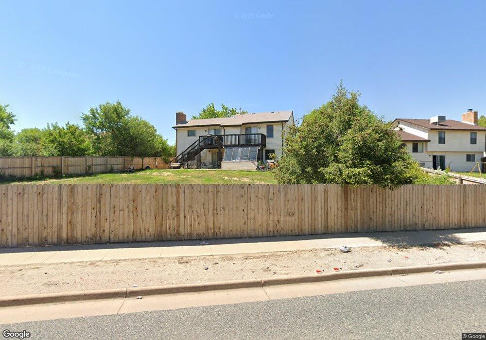
540 S Laredo Cir Aurora, CO 80017
Centre Pointe NeighborhoodEstimated Value: $472,000 - $555,000
4
Beds
3
Baths
2,395
Sq Ft
$213/Sq Ft
Est. Value
About This Home
This home is located at 540 S Laredo Cir, Aurora, CO 80017 and is currently estimated at $510,893, approximately $213 per square foot. 540 S Laredo Cir is a home located in Arapahoe County with nearby schools including Tollgate Elementary School of Expeditionary Learning, Mrachek Middle School, and Gateway High School.
Ownership History
Date
Name
Owned For
Owner Type
Purchase Details
Closed on
Jul 9, 2015
Sold by
Lawler Tony Douglas
Bought by
Lawler Tony Douglas and Tweedy Diane
Current Estimated Value
Home Financials for this Owner
Home Financials are based on the most recent Mortgage that was taken out on this home.
Original Mortgage
$202,400
Outstanding Balance
$158,969
Interest Rate
4.07%
Mortgage Type
New Conventional
Estimated Equity
$351,924
Purchase Details
Closed on
Aug 7, 2009
Sold by
Jobson Edward S and Murrell Douglas E
Bought by
Lawler Tony Douglas
Home Financials for this Owner
Home Financials are based on the most recent Mortgage that was taken out on this home.
Original Mortgage
$200,305
Interest Rate
5.31%
Mortgage Type
FHA
Purchase Details
Closed on
Apr 1, 1981
Sold by
Conversion Arapco
Bought by
Conversion Arapco
Purchase Details
Closed on
Jul 4, 1776
Bought by
Conversion Arapco
Create a Home Valuation Report for This Property
The Home Valuation Report is an in-depth analysis detailing your home's value as well as a comparison with similar homes in the area
Home Values in the Area
Average Home Value in this Area
Purchase History
| Date | Buyer | Sale Price | Title Company |
|---|---|---|---|
| Lawler Tony Douglas | -- | First American Title Ins Co | |
| Lawler Tony Douglas | $204,000 | Land Title Guarantee Company | |
| Conversion Arapco | -- | -- | |
| Conversion Arapco | -- | -- |
Source: Public Records
Mortgage History
| Date | Status | Borrower | Loan Amount |
|---|---|---|---|
| Open | Lawler Tony Douglas | $202,400 | |
| Closed | Lawler Tony Douglas | $200,305 |
Source: Public Records
Tax History Compared to Growth
Tax History
| Year | Tax Paid | Tax Assessment Tax Assessment Total Assessment is a certain percentage of the fair market value that is determined by local assessors to be the total taxable value of land and additions on the property. | Land | Improvement |
|---|---|---|---|---|
| 2024 | $3,140 | $33,781 | -- | -- |
| 2023 | $3,140 | $33,781 | $0 | $0 |
| 2022 | $2,817 | $28,050 | $0 | $0 |
| 2021 | $2,907 | $28,050 | $0 | $0 |
| 2020 | $2,380 | $22,858 | $0 | $0 |
| 2019 | $2,367 | $22,858 | $0 | $0 |
| 2018 | $2,171 | $20,527 | $0 | $0 |
| 2017 | $1,888 | $20,527 | $0 | $0 |
| 2016 | $1,919 | $20,425 | $0 | $0 |
| 2015 | $1,852 | $20,425 | $0 | $0 |
| 2014 | $1,243 | $13,197 | $0 | $0 |
| 2013 | -- | $16,140 | $0 | $0 |
Source: Public Records
Map
Nearby Homes
- 497 S Memphis Way Unit 17
- 477 S Memphis Way Unit 11
- 467 S Memphis Way Unit 17
- 16001 E Alaska Place Unit 7
- 16001 E Alaska Place Unit 1
- 444 S Kittredge St Unit 205
- 491 S Kalispell Way Unit 207
- 491 S Kalispell Way Unit 305
- 481 S Kalispell Way Unit 306
- 611 S Laredo Cir
- 431 S Kalispell Way Unit 308
- 401 S Kalispell Way Unit 104
- 401 S Kalispell Way Unit 206
- 15875 E Custer Dr
- 16135 E Exposition Dr
- 16136 E Exposition Dr
- 16094 E Exposition Dr
- 16405 E Kentucky Ave
- 17055 E Alameda Pkwy
- 17054 E Virginia Ave
- 550 S Laredo Cir
- 520 S Laredo Cir
- 560 S Laredo Cir
- 559 S Laredo Cir
- 505 S Memphis Way
- 515 S Memphis Way
- 510 S Laredo Cir
- 529 S Laredo Cir
- 570 S Laredo Cir
- 579 S Laredo Cir
- 535 S Memphis Way
- 516 S Kittredge Way
- 506 S Laredo Cir
- 16255 E Alaska Place Unit 18
- 16255 E Alaska Place Unit 17
- 16255 E Alaska Place Unit 16
- 16255 E Alaska Place Unit 15
- 16255 E Alaska Place Unit 14
- 16255 E Alaska Place Unit 13
- 16255 E Alaska Place Unit 12