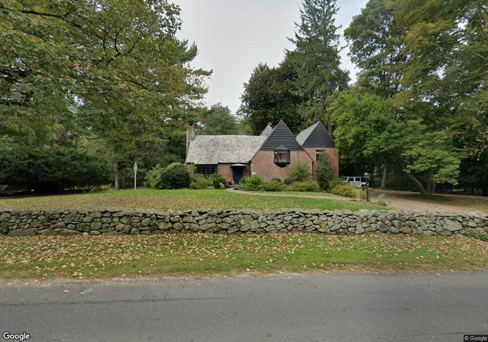
540 Scofieldtown Rd Stamford, CT 06903
North Stamford NeighborhoodEstimated Value: $1,194,000 - $1,396,000
4
Beds
4
Baths
3,544
Sq Ft
$357/Sq Ft
Est. Value
About This Home
This home is located at 540 Scofieldtown Rd, Stamford, CT 06903 and is currently estimated at $1,264,332, approximately $356 per square foot. 540 Scofieldtown Rd is a home located in Fairfield County with nearby schools including Northeast Elementary School, Turn of River School, and Westhill High School.
Ownership History
Date
Name
Owned For
Owner Type
Purchase Details
Closed on
Jul 3, 1996
Sold by
Johnson Norman W and Johnson Donna L
Bought by
Hamilton Colin J and Byer Marion
Current Estimated Value
Home Financials for this Owner
Home Financials are based on the most recent Mortgage that was taken out on this home.
Original Mortgage
$330,400
Outstanding Balance
$23,336
Interest Rate
7.98%
Mortgage Type
Unknown
Estimated Equity
$1,240,996
Create a Home Valuation Report for This Property
The Home Valuation Report is an in-depth analysis detailing your home's value as well as a comparison with similar homes in the area
Home Values in the Area
Average Home Value in this Area
Purchase History
| Date | Buyer | Sale Price | Title Company |
|---|---|---|---|
| Hamilton Colin J | $413,000 | -- |
Source: Public Records
Mortgage History
| Date | Status | Borrower | Loan Amount |
|---|---|---|---|
| Open | Hamilton Colin J | $108,000 | |
| Open | Hamilton Colin J | $200,000 | |
| Open | Hamilton Colin J | $330,400 |
Source: Public Records
Tax History Compared to Growth
Tax History
| Year | Tax Paid | Tax Assessment Tax Assessment Total Assessment is a certain percentage of the fair market value that is determined by local assessors to be the total taxable value of land and additions on the property. | Land | Improvement |
|---|---|---|---|---|
| 2025 | $14,689 | $631,260 | $266,000 | $365,260 |
| 2024 | $14,367 | $631,260 | $266,000 | $365,260 |
| 2023 | $15,441 | $631,260 | $266,000 | $365,260 |
| 2022 | $13,691 | $519,970 | $201,930 | $318,040 |
| 2021 | $13,504 | $519,970 | $201,930 | $318,040 |
| 2020 | $13,171 | $519,970 | $201,930 | $318,040 |
| 2019 | $13,171 | $519,970 | $201,930 | $318,040 |
| 2018 | $12,713 | $519,970 | $201,930 | $318,040 |
| 2017 | $14,821 | $579,160 | $220,290 | $358,870 |
| 2016 | $14,375 | $579,160 | $220,290 | $358,870 |
| 2015 | $13,981 | $579,160 | $220,290 | $358,870 |
| 2014 | $13,500 | $579,160 | $220,290 | $358,870 |
Source: Public Records
Map
Nearby Homes
- 185 Haviland Rd
- 42 Hannahs Rd
- 295 Haviland Rd
- 27 Wellington Dr
- 164 Janes Ln
- 107 Deepwood Rd
- 19 Skymeadow Dr
- 105 N Stamford Rd
- 40 Hoyclo Rd
- 239 E Hunting Ridge Rd
- 271 Hunting Ridge Rd
- 49 Pinner Ln
- 210 Red Fox Rd
- 30 Partridge Rd
- 95 Foxwood Rd
- 40 Wildwood Rd
- 45 Opper Rd
- 150 Wildwood Rd
- 185 Interlaken Rd
- 49 Alexandra Dr
- 553 Scofieldtown Rd
- 564 Scofieldtown Rd
- 10 Haviland Rd
- 549 Scofieldtown Rd
- 527 Scofieldtown Rd
- 23 Spinning Wheel Ln
- 28 Haviland Rd
- 510 Scofieldtown Rd
- 519 Scofieldtown Rd
- 578 Scofieldtown Rd
- 578 Scofieldtown Rd Unit cottage
- 39 Spinning Wheel Ln
- 511 Scofieldtown Rd
- 14 Spinning Wheel Ln
- 44 Haviland Rd
- 505 Scofieldtown Rd
- 490 Scofieldtown Rd
- 56 Haviland Rd
- 594 Scofieldtown Rd
- 65 Haviland Rd