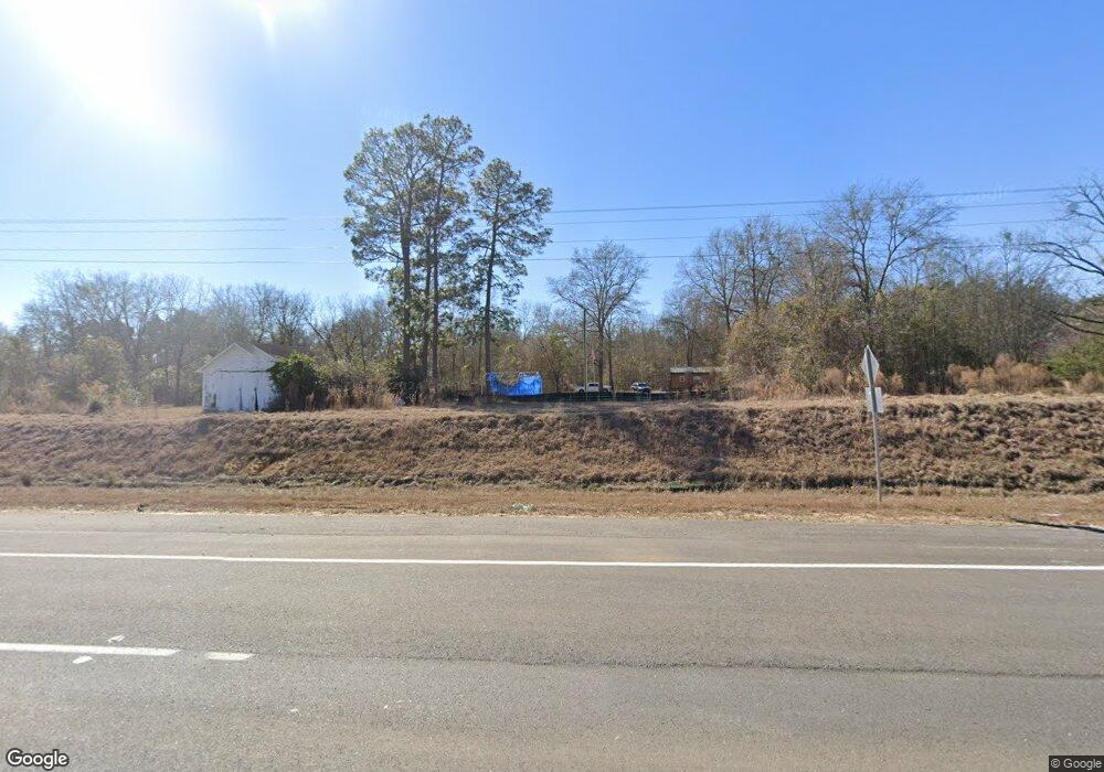
Estimated Value: $251,760 - $303,000
--
Bed
1
Bath
608
Sq Ft
$465/Sq Ft
Est. Value
About This Home
This home is located at 5400 Us Highway 1 S, Lyons, GA 30436 and is currently estimated at $282,587, approximately $464 per square foot. 5400 Us Highway 1 S is a home located in Toombs County with nearby schools including Toombs County High School.
Ownership History
Date
Name
Owned For
Owner Type
Purchase Details
Closed on
Oct 15, 2007
Sold by
Stanley Farms Llc
Bought by
Morocco Donald A
Current Estimated Value
Home Financials for this Owner
Home Financials are based on the most recent Mortgage that was taken out on this home.
Original Mortgage
$165,000
Outstanding Balance
$102,314
Interest Rate
6.26%
Mortgage Type
New Conventional
Estimated Equity
$180,273
Purchase Details
Closed on
Oct 20, 2004
Sold by
Spell Earle Estate Of
Bought by
Stanley Farms Llc
Create a Home Valuation Report for This Property
The Home Valuation Report is an in-depth analysis detailing your home's value as well as a comparison with similar homes in the area
Home Values in the Area
Average Home Value in this Area
Purchase History
| Date | Buyer | Sale Price | Title Company |
|---|---|---|---|
| Morocco Donald A | $185,000 | -- | |
| Stanley Farms Llc | $105,600 | -- |
Source: Public Records
Mortgage History
| Date | Status | Borrower | Loan Amount |
|---|---|---|---|
| Open | Morocco Donald A | $165,000 |
Source: Public Records
Tax History Compared to Growth
Tax History
| Year | Tax Paid | Tax Assessment Tax Assessment Total Assessment is a certain percentage of the fair market value that is determined by local assessors to be the total taxable value of land and additions on the property. | Land | Improvement |
|---|---|---|---|---|
| 2024 | $1,564 | $68,973 | $45,048 | $23,925 |
| 2023 | $1,574 | $67,242 | $45,048 | $22,194 |
| 2022 | $1,093 | $46,709 | $28,155 | $18,554 |
| 2021 | $1,074 | $44,597 | $28,155 | $16,442 |
| 2020 | $625 | $25,364 | $22,524 | $2,840 |
| 2019 | $1,064 | $45,045 | $20,187 | $24,858 |
| 2018 | $1,064 | $45,045 | $20,187 | $24,858 |
| 2017 | $1,035 | $43,677 | $20,187 | $23,490 |
| 2016 | $1,019 | $42,971 | $20,187 | $22,784 |
| 2015 | -- | $42,576 | $27,227 | $15,350 |
| 2014 | -- | $42,576 | $27,227 | $15,350 |
Source: Public Records
Map
Nearby Homes
- 218 Hidden Hammock Dr
- 334 Hidden Hammock
- 1645 Glynn James Rd
- 0 Thompson Level Rd
- 212 Marvin Church Rd
- 4822 Georgia 15
- 1686 Georgia 56
- 0 Us Highway 1 Unit 10526168
- 3242 Cedar Crossing Vidalia Rd
- 4262 Ga Highway 15
- 274 Cedarwood Subdivision Rd
- 287 Quail Dr
- 240 Hawk Trail
- 789 B Hitchcock Rd
- 2.01 ACRES Clifford Rogers Rd
- 6.80 AC Scarlet Rd
- 6.80 AC Scarlet Rd
- 143 Sadie Galbreath Rd
- 849 Hammond Church Rd
- 00 Simpson Rd
- 1300 Lawson Rd
- 1277 Lawson Rd
- 1303 Lawson Rd
- 1315 Lawson Rd
- 1188 Lawson Rd
- 1188 Lawson Rd
- 1188 Lawson Rd
- 1319 Lawson Rd
- 1309 Lawson Rd
- 1313 Lawson Rd
- 5172 Us Highway 1 S
- 1044 Lawson Rd
- 186 Four Acre Rd
- 764 Lawson Rd
- 5016 Us Highway 1 S
- 5501 Us Highway 1 S
- 224 Kenneth Abbott Rd
- 5 acres Lawson Rd
- 0 Lawson Rd Unit 11937
- 0 Lawson Rd
