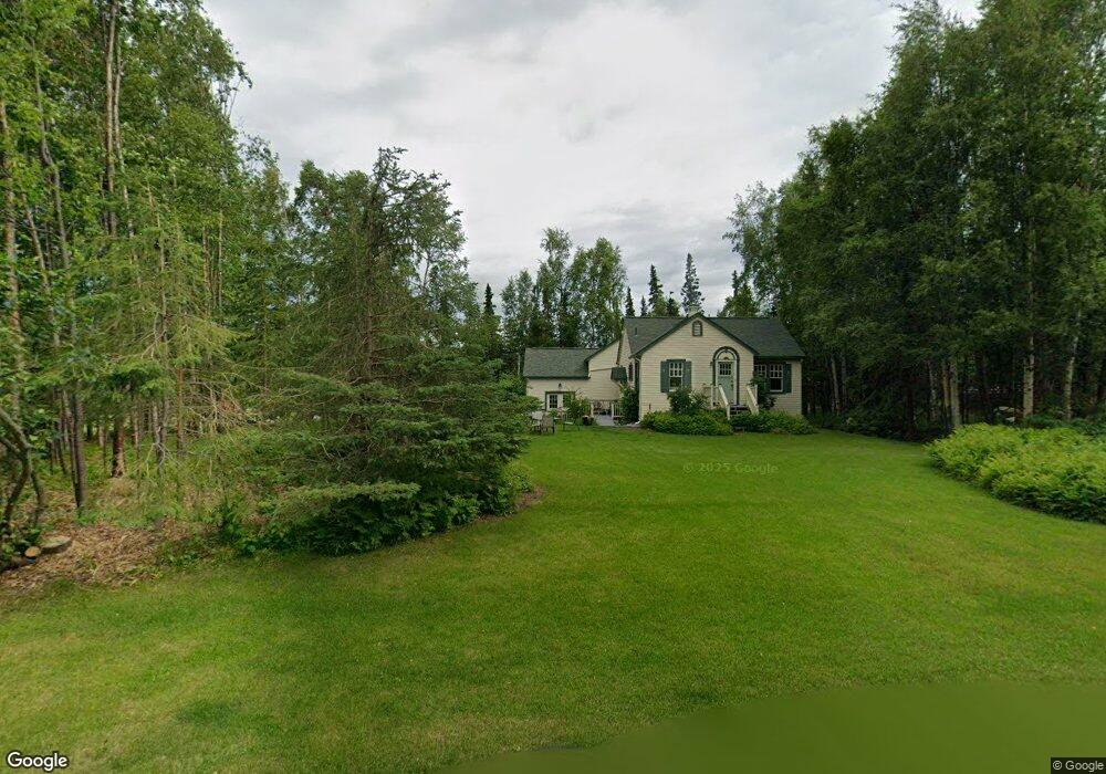
5401 E 131st Ave Anchorage, AK 99516
Huffman-O'Malley NeighborhoodEstimated Value: $317,000 - $453,279
1
Bed
2
Baths
860
Sq Ft
$469/Sq Ft
Est. Value
About This Home
This home is located at 5401 E 131st Ave, Anchorage, AK 99516 and is currently estimated at $403,426, approximately $469 per square foot. 5401 E 131st Ave is a home located in Anchorage Municipality with nearby schools including Huffman Elementary School, Goldenview Middle School, and South Anchorage High School.
Ownership History
Date
Name
Owned For
Owner Type
Purchase Details
Closed on
Jun 25, 2025
Sold by
Susan G Cross Living Trust and Cross Susan G
Bought by
Thompson Jerel G and Thompson Dana M
Current Estimated Value
Home Financials for this Owner
Home Financials are based on the most recent Mortgage that was taken out on this home.
Original Mortgage
$340,000
Outstanding Balance
$339,127
Interest Rate
6.81%
Mortgage Type
Seller Take Back
Estimated Equity
$64,299
Create a Home Valuation Report for This Property
The Home Valuation Report is an in-depth analysis detailing your home's value as well as a comparison with similar homes in the area
Home Values in the Area
Average Home Value in this Area
Purchase History
| Date | Buyer | Sale Price | Title Company |
|---|---|---|---|
| Thompson Jerel G | -- | Stewart Title Company |
Source: Public Records
Mortgage History
| Date | Status | Borrower | Loan Amount |
|---|---|---|---|
| Open | Thompson Jerel G | $340,000 |
Source: Public Records
Tax History
| Year | Tax Paid | Tax Assessment Tax Assessment Total Assessment is a certain percentage of the fair market value that is determined by local assessors to be the total taxable value of land and additions on the property. | Land | Improvement |
|---|---|---|---|---|
| 2025 | $5,510 | $413,900 | $96,300 | $317,600 |
| 2024 | $5,510 | $405,600 | $91,800 | $313,800 |
| 2023 | $2,069 | $371,200 | $88,300 | $282,900 |
| 2022 | $2,189 | $353,100 | $88,300 | $264,800 |
| 2021 | $4,971 | $321,300 | $88,300 | $233,000 |
| 2020 | $1,586 | $321,300 | $88,300 | $233,000 |
| 2019 | $1,529 | $311,200 | $88,300 | $222,900 |
| 2018 | $3,575 | $310,200 | $99,900 | $210,300 |
| 2017 | $3,765 | $300,100 | $99,900 | $200,200 |
| 2016 | $2,373 | $312,000 | $99,900 | $212,100 |
| 2015 | $2,373 | $302,400 | $95,900 | $206,500 |
| 2014 | $2,373 | $228,300 | $73,600 | $154,700 |
Source: Public Records
Map
Nearby Homes
- 5345 Heritage Heights Dr
- L2 Totem Rd
- 0000 E 113th Ave
- 10960 Totem Rd
- 0 Rd
- L5 Griffin Rd
- 4905 de Armoun Rd
- 6640 O'Malley Rd
- 12800 Foster Rd
- 6820 Gunnison Dr
- 3641 E Klatt Rd
- 4600 de Armoun Rd
- 13492 de Palatis Cir
- 000 de Palatis Cir
- 6815 Double Tree Ct
- 4500 Shoshoni Ave
- 12850 Tara Ln
- 3751 Eastwind Dr
- 6770 Round Tree Dr
- 3928 Pyrenean Cir
- 5421 E 131st Ave
- 12200 Freedom Rd
- 12220 Freedom Rd
- 5680 Heritage Heights Dr
- 5441 E 131st Ave
- 5410 E 131st Ave
- 5646 Heritage Heights Dr
- 5612 Heritage Heights Dr
- 5732 Heritage Heights Dr
- 12201 Heritage Rd
- 12320 Freedom Rd
- 12221 Heritage Rd
- 12321 Freedom Rd
- 12320 Liberty Rd
- L24 B2 Heritage Heights Dr
- L19 B2 Heritage Heights Dr
- L14 B2 Heritage Heights Dr
- L25 B2 Heritage Heights Dr
- L11 B1 Heritage Heights Dr
- L10 B1 Heritage Heights Dr
Your Personal Tour Guide
Ask me questions while you tour the home.