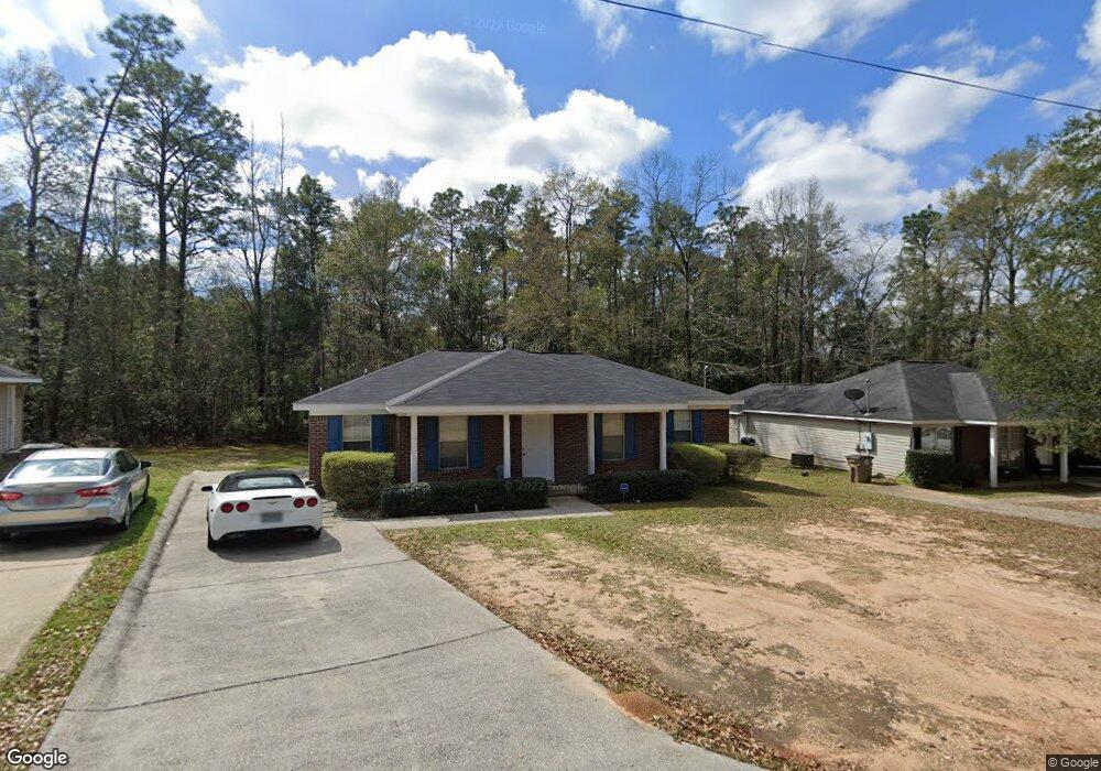
5401 Forest Ridge Rd S Mobile, AL 36618
Colonial Heights NeighborhoodEstimated Value: $155,000 - $170,000
3
Beds
2
Baths
1,373
Sq Ft
$118/Sq Ft
Est. Value
About This Home
This home is located at 5401 Forest Ridge Rd S, Mobile, AL 36618 and is currently estimated at $162,230, approximately $118 per square foot. 5401 Forest Ridge Rd S is a home located in Mobile County with nearby schools including John Will Elementary School, CL Scarborough Middle School, and Mattie T Blount High School.
Ownership History
Date
Name
Owned For
Owner Type
Purchase Details
Closed on
Jun 1, 2023
Sold by
Smallwood Tellis S and Smallwood Kimberly C
Bought by
Smallwood Tellis S and Smallwood Kimberly C
Current Estimated Value
Home Financials for this Owner
Home Financials are based on the most recent Mortgage that was taken out on this home.
Original Mortgage
$128,000
Outstanding Balance
$124,602
Interest Rate
6.43%
Mortgage Type
New Conventional
Estimated Equity
$37,628
Purchase Details
Closed on
May 14, 2004
Sold by
First Realty Resources Inc
Bought by
Smallwood Tellis S and Martin Kimberly C
Home Financials for this Owner
Home Financials are based on the most recent Mortgage that was taken out on this home.
Original Mortgage
$97,598
Interest Rate
5.49%
Mortgage Type
FHA
Create a Home Valuation Report for This Property
The Home Valuation Report is an in-depth analysis detailing your home's value as well as a comparison with similar homes in the area
Home Values in the Area
Average Home Value in this Area
Purchase History
| Date | Buyer | Sale Price | Title Company |
|---|---|---|---|
| Smallwood Tellis S | $500 | None Listed On Document | |
| Smallwood Tellis S | -- | -- |
Source: Public Records
Mortgage History
| Date | Status | Borrower | Loan Amount |
|---|---|---|---|
| Open | Smallwood Tellis S | $128,000 | |
| Previous Owner | Smallwood Tellis S | $97,598 |
Source: Public Records
Tax History Compared to Growth
Tax History
| Year | Tax Paid | Tax Assessment Tax Assessment Total Assessment is a certain percentage of the fair market value that is determined by local assessors to be the total taxable value of land and additions on the property. | Land | Improvement |
|---|---|---|---|---|
| 2024 | $727 | $12,140 | $2,000 | $10,140 |
| 2023 | $714 | $9,510 | $2,000 | $7,510 |
| 2022 | $544 | $9,600 | $2,000 | $7,600 |
| 2021 | $555 | $9,790 | $2,000 | $7,790 |
| 2020 | $562 | $9,880 | $2,000 | $7,880 |
| 2019 | $545 | $9,640 | $0 | $0 |
| 2018 | $557 | $9,820 | $0 | $0 |
| 2017 | $568 | $10,000 | $0 | $0 |
| 2016 | $447 | $8,100 | $0 | $0 |
| 2013 | $640 | $10,240 | $0 | $0 |
Source: Public Records
Map
Nearby Homes
- 1401 Forest Ridge Rd E
- 913 David Langan Dr W
- 5609 Diane Ct
- 5415 Overlook Rd
- 914 David Langan Dr W
- 5512 Overlook Rd
- 1116 Druid Dr
- 1004 Heidi St
- 5361 Moffett Rd
- 1600 Decatur St
- 1701 Crestwood Dr
- 4924 Brooke Ct
- 5405 Moffett Rd
- 1058 Matterhorn St
- 1313 Innsbruck Dr
- 5859 Chalet Dr N
- 5850 Overlook Rd
- 1804 N University Blvd
- 1804 N University Blvd Unit 4
- 5855 Zeigler Blvd
- 5405 Forest Ridge Rd S
- 5397 Forest Ridge Rd S
- 5409 Forest Ridge Rd S
- 5391 Forest Ridge Rd S
- 1301 Forest Ridge Rd E
- 5408 Forest Ridge Rd S
- 1296 Forest Ridge Rd E
- 5413 Forest Ridge Rd S
- 5412 Forest Ridge Rd S
- 1302 Forest Ridge Rd E
- 1309 Forest Ridge Rd E
- 5417 Forest Ridge Rd S
- 1306 Forest Ridge Rd E
- 1310 Forest Ridge Rd E
- 1300 Forest Ridge Rd W
- 1311 Forest Ridge Rd E
- 1314 Forest Ridge Rd E
- 1308 Forest Ridge Rd W
- 0 N University Blvd Unit A 0203187
- 0 N University Blvd Unit 618197