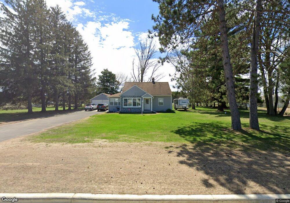
5401 Stewart Ave Wausau, WI 54401
Estimated Value: $170,000 - $239,000
3
Beds
1
Bath
1,660
Sq Ft
$125/Sq Ft
Est. Value
About This Home
This home is located at 5401 Stewart Ave, Wausau, WI 54401 and is currently estimated at $207,358, approximately $124 per square foot. 5401 Stewart Ave is a home located in Marathon County with nearby schools including Stettin Elementary School, John Muir Middle School, and West High School.
Ownership History
Date
Name
Owned For
Owner Type
Purchase Details
Closed on
Oct 30, 2020
Sold by
Knoblock Paul A
Bought by
Volm Travis
Current Estimated Value
Home Financials for this Owner
Home Financials are based on the most recent Mortgage that was taken out on this home.
Original Mortgage
$124,645
Outstanding Balance
$110,916
Interest Rate
2.8%
Mortgage Type
New Conventional
Estimated Equity
$96,442
Purchase Details
Closed on
Aug 14, 2020
Sold by
Kania Aaron and Kania Ashley
Bought by
Knoblock Paul A
Purchase Details
Closed on
Jan 21, 2010
Sold by
Beckman Roger L and Beckman Margaret A
Bought by
Kania Aaron
Home Financials for this Owner
Home Financials are based on the most recent Mortgage that was taken out on this home.
Original Mortgage
$73,641
Interest Rate
4.87%
Mortgage Type
FHA
Create a Home Valuation Report for This Property
The Home Valuation Report is an in-depth analysis detailing your home's value as well as a comparison with similar homes in the area
Home Values in the Area
Average Home Value in this Area
Purchase History
| Date | Buyer | Sale Price | Title Company |
|---|---|---|---|
| Volm Travis | $128,500 | None Available | |
| Knoblock Paul A | $70,000 | None Available | |
| Kania Aaron | $37,500 | None Available | |
| Kania Aaron | $37,500 | None Available |
Source: Public Records
Mortgage History
| Date | Status | Borrower | Loan Amount |
|---|---|---|---|
| Open | Volm Travis | $124,645 | |
| Previous Owner | Kania Aaron | $73,641 |
Source: Public Records
Tax History Compared to Growth
Tax History
| Year | Tax Paid | Tax Assessment Tax Assessment Total Assessment is a certain percentage of the fair market value that is determined by local assessors to be the total taxable value of land and additions on the property. | Land | Improvement |
|---|---|---|---|---|
| 2024 | $3,028 | $170,900 | $35,600 | $135,300 |
| 2023 | $2,811 | $122,100 | $35,600 | $86,500 |
| 2022 | $2,789 | $122,100 | $35,600 | $86,500 |
| 2021 | $2,706 | $122,100 | $35,600 | $86,500 |
| 2020 | $2,185 | $97,000 | $35,600 | $61,400 |
| 2019 | $2,255 | $94,400 | $35,600 | $58,800 |
| 2018 | $2,432 | $94,400 | $35,600 | $58,800 |
| 2017 | $2,213 | $94,400 | $35,600 | $58,800 |
| 2016 | $2,141 | $94,400 | $35,600 | $58,800 |
| 2015 | $2,340 | $94,400 | $35,600 | $58,800 |
| 2014 | $2,148 | $91,200 | $30,200 | $61,000 |
Source: Public Records
Map
Nearby Homes
- 210 Bluestone Dr
- 303 Rimrock Rd
- 5713 Birchwood Dr
- 6007 Birchwood Dr
- 210 S 45th Ave
- 212 Windtree Dr
- 6603 Conner Davis Dr
- 4615 Rib River Trail
- 6607 Morgan Creek Dr
- 206 N 44th Ave
- 116 S 68th Ave
- 6011 Stettin Dr
- 310 Lisbeth Rd
- 3401 Christian Ave
- 227815 Sharptail Rd
- 10.80 Acres N 72nd Ave
- 2812 Hubbill Ave
- 145683 Flint Creek Cir
- 231747 Twin Fawn Trail
- 231781 Twin Fawn Trail
- 5407 Stewart Ave
- 5307 Stewart Ave
- 5411 Stewart Ave
- 5503 Stewart Ave
- 5301 Stewart Ave
- 5504 Stewart Ave
- 5509 Stewart Ave
- 5213 Stewart Ave
- 5512 Stewart Ave
- 5211 Stewart Ave
- 5601 Stewart Ave
- 5301 Packer Dr
- 5602 Stewart Ave
- 5213 Packer Dr
- 601-615 S 56th Ave
- 601 S 56th Ave
- 601 S 56th Ave
- 608 S 56th Ave
- 505 S 56th Ave
- 5606 Stewart Ave