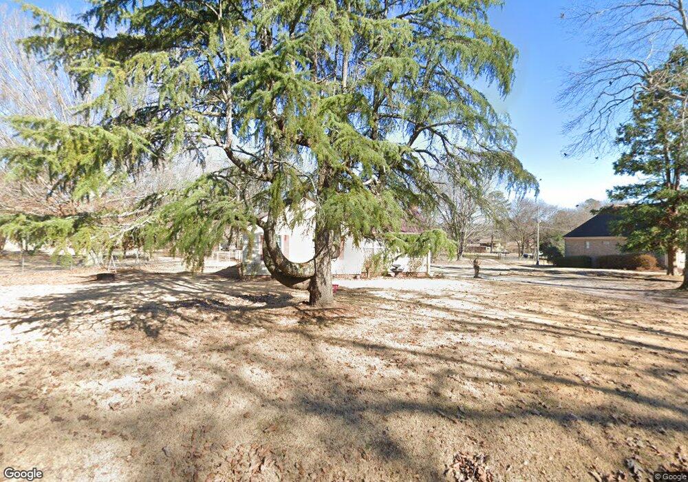
5401 Sutherland Rd Mount Olive, AL 35117
Estimated Value: $268,000 - $311,381
3
Beds
2
Baths
2,042
Sq Ft
$142/Sq Ft
Est. Value
About This Home
This home is located at 5401 Sutherland Rd, Mount Olive, AL 35117 and is currently estimated at $290,595, approximately $142 per square foot. 5401 Sutherland Rd is a home located in Jefferson County with nearby schools including Mt. Olive Elementary School, Bragg Middle School, and Gardendale High School.
Ownership History
Date
Name
Owned For
Owner Type
Purchase Details
Closed on
Dec 20, 2019
Sold by
Graham Larry E
Bought by
Hogeland Barry W and Hogeland Kelly C
Current Estimated Value
Home Financials for this Owner
Home Financials are based on the most recent Mortgage that was taken out on this home.
Original Mortgage
$132,224
Outstanding Balance
$116,575
Interest Rate
3.6%
Mortgage Type
VA
Estimated Equity
$174,021
Purchase Details
Closed on
Dec 15, 2011
Sold by
Deutsche Bank
Bought by
Graham Larry E and Graham Phyllis A
Create a Home Valuation Report for This Property
The Home Valuation Report is an in-depth analysis detailing your home's value as well as a comparison with similar homes in the area
Home Values in the Area
Average Home Value in this Area
Purchase History
| Date | Buyer | Sale Price | Title Company |
|---|---|---|---|
| Hogeland Barry W | $128,000 | -- | |
| Graham Larry E | $105,000 | -- |
Source: Public Records
Mortgage History
| Date | Status | Borrower | Loan Amount |
|---|---|---|---|
| Open | Hogeland Barry W | $132,224 |
Source: Public Records
Tax History
| Year | Tax Paid | Tax Assessment Tax Assessment Total Assessment is a certain percentage of the fair market value that is determined by local assessors to be the total taxable value of land and additions on the property. | Land | Improvement |
|---|---|---|---|---|
| 2024 | $957 | $23,460 | -- | -- |
| 2022 | $813 | $17,280 | $3,860 | $13,420 |
| 2021 | $623 | $13,500 | $3,860 | $9,640 |
| 2020 | $1,258 | $13,500 | $3,860 | $9,640 |
| 2019 | $1,258 | $25,100 | $0 | $0 |
| 2018 | $1,161 | $23,180 | $0 | $0 |
| 2017 | $1,143 | $22,820 | $0 | $0 |
| 2016 | $1,103 | $22,020 | $0 | $0 |
| 2015 | $1,103 | $21,600 | $0 | $0 |
| 2014 | $1,395 | $24,580 | $0 | $0 |
| 2013 | $1,395 | $23,220 | $0 | $0 |
Source: Public Records
Map
Nearby Homes
- 2700 Mount Olive Rd
- 372 Oakhurst St
- 2575 Mount Olive Rd
- 5224 Elm Rd
- 475 Springdale Rd
- 331 Oakhurst St
- 5632 Mckinney Rd
- 5628 Boling Rd
- 5551 Shady Grove Rd
- 5648 Boling Rd
- 5113 Biddle Cir
- 971 Westwood Rd
- 2901 Mount Olive Rd
- 5190 Memory Ln
- 2936 Mount Olive Rd
- 2945 Mount Olive Rd
- 5473 Newfound Rd
- 671 Longwood Place
- 2270 and 2274 Mount Olive Rd
- 2263 Mount Olive Rd
- 5395 Sutherland Rd
- 700 Glenridge Trail
- 5431 Sutherland Rd
- 5417 Sutherland Rd
- 5392 Sutherland Rd
- 5383 Sutherland Rd
- 5449 Sutherland Rd Unit 4
- 5379 Sutherland Rd
- 726 Glenridge Trail
- 727 Glenridge Trail
- 5442 Sutherland Rd
- 5361 Sutherland Rd
- 5370 Sutherland Rd
- 5465 Sutherland Rd
- 5458 Sutherland Rd
- 5469 Sutherland Rd
- 5400 Sutherland Rd
- 617 Springdale Rd
- 638 Greenwood Cir
- 5432 Powers Rd
Your Personal Tour Guide
Ask me questions while you tour the home.