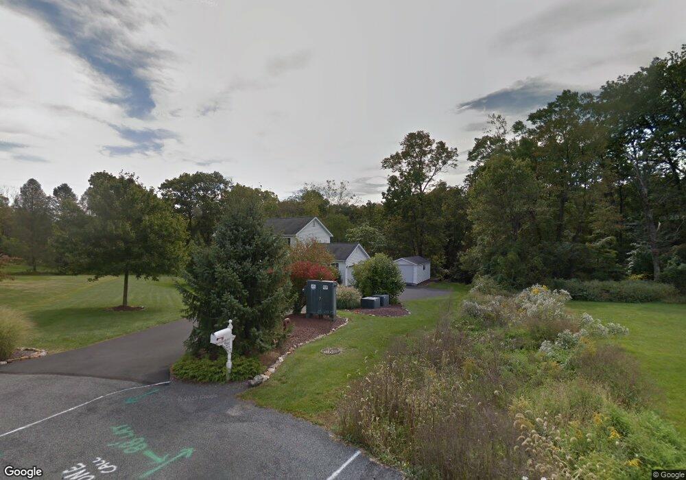
5403 Devonshire Ct Laurys Station, PA 18059
North Whitehall Township NeighborhoodEstimated Value: $540,540 - $650,000
4
Beds
3
Baths
2,102
Sq Ft
$281/Sq Ft
Est. Value
About This Home
This home is located at 5403 Devonshire Ct, Laurys Station, PA 18059 and is currently estimated at $591,635, approximately $281 per square foot. 5403 Devonshire Ct is a home located in Lehigh County with nearby schools including Tussing Elementary School, Ironton Elementary School, and Cavelero Mid High School.
Ownership History
Date
Name
Owned For
Owner Type
Purchase Details
Closed on
Jul 30, 2004
Sold by
Causa Jason A and Peil Michelle
Bought by
Hargrove Mark A and Hargrove Mary E
Current Estimated Value
Home Financials for this Owner
Home Financials are based on the most recent Mortgage that was taken out on this home.
Original Mortgage
$100,000
Interest Rate
6.2%
Mortgage Type
Purchase Money Mortgage
Purchase Details
Closed on
May 19, 2000
Sold by
Cole Richard K and Cole Diann
Bought by
Causa Jason A and Peil Michelle
Create a Home Valuation Report for This Property
The Home Valuation Report is an in-depth analysis detailing your home's value as well as a comparison with similar homes in the area
Home Values in the Area
Average Home Value in this Area
Purchase History
| Date | Buyer | Sale Price | Title Company |
|---|---|---|---|
| Hargrove Mark A | $314,900 | -- | |
| Causa Jason A | $188,000 | -- |
Source: Public Records
Mortgage History
| Date | Status | Borrower | Loan Amount |
|---|---|---|---|
| Closed | Hargrove Mark A | $100,000 |
Source: Public Records
Tax History Compared to Growth
Tax History
| Year | Tax Paid | Tax Assessment Tax Assessment Total Assessment is a certain percentage of the fair market value that is determined by local assessors to be the total taxable value of land and additions on the property. | Land | Improvement |
|---|---|---|---|---|
| 2025 | $6,289 | $283,300 | $79,400 | $203,900 |
| 2024 | $5,915 | $283,300 | $79,400 | $203,900 |
| 2023 | $5,745 | $283,300 | $79,400 | $203,900 |
| 2022 | $5,720 | $283,300 | $203,900 | $79,400 |
| 2021 | $5,720 | $283,300 | $79,400 | $203,900 |
| 2020 | $5,720 | $283,300 | $79,400 | $203,900 |
| 2019 | $5,570 | $283,300 | $79,400 | $203,900 |
| 2018 | $5,459 | $283,300 | $79,400 | $203,900 |
| 2017 | $5,380 | $283,300 | $79,400 | $203,900 |
| 2016 | -- | $283,300 | $79,400 | $203,900 |
| 2015 | -- | $283,300 | $79,400 | $203,900 |
| 2014 | -- | $283,300 | $79,400 | $203,900 |
Source: Public Records
Map
Nearby Homes
- 5474 Ashley Dr
- 5443 Caitlyn Dr
- 1135 Sherwood Dr
- 1321 Rising Sun Rd
- 1110 Greenbriar Ln
- 1070 Aspen St Unit 170
- 1086 Birch St Unit 286
- 1074 Birch St
- 1021 Aspen St
- 1041 Dogwood St
- 1022 Dogwood St Unit 422
- 0 Riverview Dr Unit 754406
- 0 Riverview Dr Unit 754578
- 1214 Clearview Rd
- 390 Long Lane Rd
- Arbor Plan at Brook Hill Estates
- Linden Plan at Brook Hill Estates
- Copper Beech Plan at Brook Hill Estates
- Beacon Pointe Hometown Plan at Brook Hill Estates
- 1990 Settlers Ridge Rd
- 5411 Devonshire Ct
- 5211 Egypt Rd
- 5404 Devonshire Ct
- 5419 Devonshire Ct
- 5420 Devonshire Ct
- 5442 Ashley Dr
- 5450 Ashley Dr
- 5434 Ashley Dr
- 5427 Devonshire Ct
- 5428 Devonshire Ct
- 5426 Ashley Dr Unit 10
- 5426 Ashley Dr Unit Brandywine
- 5426 Ashley Dr
- 5426 Ashley Dr Unit LOT 1
- 5436 Devonshire Ct
- 5458 Ashley Dr
- 5439 Ashley Dr
- 5435 Devonshire Ct
- 5444 Devonshire Ct
- 5418 Ashley Dr