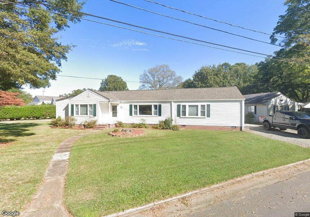
5404 Jo Ann Dr Portsmouth, VA 23703
Churchland NeighborhoodEstimated Value: $374,000 - $416,000
4
Beds
3
Baths
2,176
Sq Ft
$180/Sq Ft
Est. Value
About This Home
This home is located at 5404 Jo Ann Dr, Portsmouth, VA 23703 and is currently estimated at $392,100, approximately $180 per square foot. 5404 Jo Ann Dr is a home located in Portsmouth City with nearby schools including Churchland Elementary School, Churchland Academy Elementary School, and Churchland Middle School.
Ownership History
Date
Name
Owned For
Owner Type
Purchase Details
Closed on
May 24, 2013
Sold by
Frankson Jacqueline A
Bought by
Thomas Michael
Current Estimated Value
Home Financials for this Owner
Home Financials are based on the most recent Mortgage that was taken out on this home.
Original Mortgage
$211,450
Outstanding Balance
$149,120
Interest Rate
3.45%
Mortgage Type
VA
Estimated Equity
$242,980
Create a Home Valuation Report for This Property
The Home Valuation Report is an in-depth analysis detailing your home's value as well as a comparison with similar homes in the area
Home Values in the Area
Average Home Value in this Area
Purchase History
| Date | Buyer | Sale Price | Title Company |
|---|---|---|---|
| Thomas Michael | $207,000 | -- |
Source: Public Records
Mortgage History
| Date | Status | Borrower | Loan Amount |
|---|---|---|---|
| Open | Thomas Michael | $211,450 |
Source: Public Records
Tax History Compared to Growth
Tax History
| Year | Tax Paid | Tax Assessment Tax Assessment Total Assessment is a certain percentage of the fair market value that is determined by local assessors to be the total taxable value of land and additions on the property. | Land | Improvement |
|---|---|---|---|---|
| 2025 | $171 | $308,690 | $93,600 | $215,090 |
| 2024 | $171 | $302,470 | $93,600 | $208,870 |
| 2023 | $3,762 | $300,920 | $93,600 | $207,320 |
| 2022 | $3,620 | $266,660 | $78,000 | $188,660 |
| 2021 | $3,004 | $231,060 | $42,400 | $188,660 |
| 2020 | $2,876 | $221,260 | $40,380 | $180,880 |
| 2019 | $2,674 | $205,710 | $40,380 | $165,330 |
| 2018 | $2,573 | $197,940 | $40,380 | $157,560 |
| 2017 | $2,472 | $190,160 | $40,380 | $149,780 |
| 2016 | $2,472 | $190,160 | $40,380 | $149,780 |
| 2015 | $2,472 | $190,160 | $40,380 | $149,780 |
| 2014 | $2,415 | $190,160 | $40,380 | $149,780 |
Source: Public Records
Map
Nearby Homes
- 3315 Camellia Dr
- 5516 Bingham Dr
- 10AC Cedar Ln
- 5300 Larkspur Rd
- 3604 Lilac Dr
- 4959 Briarwood Ln
- 4955 Briarwood Ln
- 3432 Carter Rd
- 3509 Spence Rd
- 5806 Fawkes St
- 5304 High St W
- 4008 Oakhurst Rd
- 5220 Clover Hill Dr
- 5302 High St W
- 3425 Cedar Ln
- 5911 Dunkirk St
- 3101 Laurel Ln
- 3110 Sterling Way Unit 62
- 4808 Thornwood St
- 6002 Campbell St
- 3901 Marsha St Unit Road
- 5400 Jo Ann Dr
- 5408 Jo Ann Dr
- 5409 Jo-Ann Dr
- 3905 Marsha St
- 5405 Jo Ann Dr
- 5409 Jo Ann Dr
- 5212 W Norfolk Rd
- 5413 Jo Ann Dr
- 5208 W Norfolk Rd
- 3900 Gertrude St
- 3909 Marsha St
- 5412 Jo Ann Dr
- 5300 W Norfolk Rd
- 3904 Marsha St
- 3904 Marsha St Unit B
- 5417 Jo Ann Dr
- 5204 W Norfolk Rd
- 3904 Gertrude St
- 5421 Jo Ann Dr