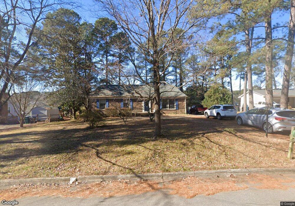
5404 Newhall Rd Durham, NC 27713
South Durham NeighborhoodEstimated Value: $383,053 - $419,000
3
Beds
2
Baths
1,714
Sq Ft
$235/Sq Ft
Est. Value
About This Home
This home is located at 5404 Newhall Rd, Durham, NC 27713 and is currently estimated at $402,763, approximately $234 per square foot. 5404 Newhall Rd is a home located in Durham County with nearby schools including Parkwood Elementary, Lowe's Grove Middle, and Hillside High School.
Ownership History
Date
Name
Owned For
Owner Type
Purchase Details
Closed on
May 16, 2001
Sold by
Marsten Kent M and Marsten Becky B
Bought by
Martin Robert M and Sosna Martin Gail H
Current Estimated Value
Home Financials for this Owner
Home Financials are based on the most recent Mortgage that was taken out on this home.
Original Mortgage
$157,500
Outstanding Balance
$59,159
Interest Rate
7.11%
Estimated Equity
$343,604
Create a Home Valuation Report for This Property
The Home Valuation Report is an in-depth analysis detailing your home's value as well as a comparison with similar homes in the area
Home Values in the Area
Average Home Value in this Area
Purchase History
| Date | Buyer | Sale Price | Title Company |
|---|---|---|---|
| Martin Robert M | $157,500 | -- |
Source: Public Records
Mortgage History
| Date | Status | Borrower | Loan Amount |
|---|---|---|---|
| Open | Martin Robert M | $157,500 |
Source: Public Records
Tax History
| Year | Tax Paid | Tax Assessment Tax Assessment Total Assessment is a certain percentage of the fair market value that is determined by local assessors to be the total taxable value of land and additions on the property. | Land | Improvement |
|---|---|---|---|---|
| 2025 | $3,922 | $395,689 | $169,200 | $226,489 |
| 2024 | $2,869 | $205,698 | $37,962 | $167,736 |
| 2023 | $2,694 | $205,698 | $37,962 | $167,736 |
| 2022 | $2,633 | $205,698 | $37,962 | $167,736 |
| 2021 | $2,620 | $205,698 | $37,962 | $167,736 |
| 2020 | $2,559 | $205,698 | $37,962 | $167,736 |
| 2019 | $2,559 | $205,698 | $37,962 | $167,736 |
| 2018 | $2,357 | $173,765 | $35,150 | $138,615 |
| 2017 | $2,340 | $173,765 | $35,150 | $138,615 |
| 2016 | $2,261 | $173,765 | $35,150 | $138,615 |
| 2015 | $2,784 | $201,128 | $37,096 | $164,032 |
| 2014 | $2,784 | $201,128 | $37,096 | $164,032 |
Source: Public Records
Map
Nearby Homes
- 5504 Pelham Rd
- 6353 Grandale Dr
- 1446 Clermont Rd
- 1621 Clermont Rd
- 104 Deblyn Ct
- 7 Scenic Ct
- 111 Wenonah Way
- 1509 Clermont Rd Unit T27
- 1509 Clermont Rd Unit T24
- 5907 Rustic Wood Ln
- 109 Settlers Mill Ln
- 1510 Haventree Rd
- 43 Redbud Ct
- 4 Green Springs Ct
- 7 Travis Cir
- 7 Monteith Ct
- 1010 Sturbridge Dr
- 1 Haycox Ct
- 1526 Euclid Rd
- 903 Limerick Ln
- 5400 Newhall Rd
- 5408 Newhall Rd
- 5324 Newhall Rd
- 5407 Newhall Rd
- 5412 Newhall Rd
- 102 Montclair Cir
- 5411 Newhall Rd
- 106 Montclair Cir
- 102 Maybank Ct
- 112 Montclair Cir
- 5417 Newhall Rd
- 106 Maybank Ct
- 101 Montclair Cir
- 116 Montclair Cir
- 5316 Newhall Rd
- 108 Maybank Ct
- 140 Montclair Cir
- 105 Montclair Cir
- 120 Montclair Cir
- 5317 Newhall Rd
Your Personal Tour Guide
Ask me questions while you tour the home.