Estimated Value: $439,000 - $724,188
4
Beds
3
Baths
2,750
Sq Ft
$229/Sq Ft
Est. Value
About This Home
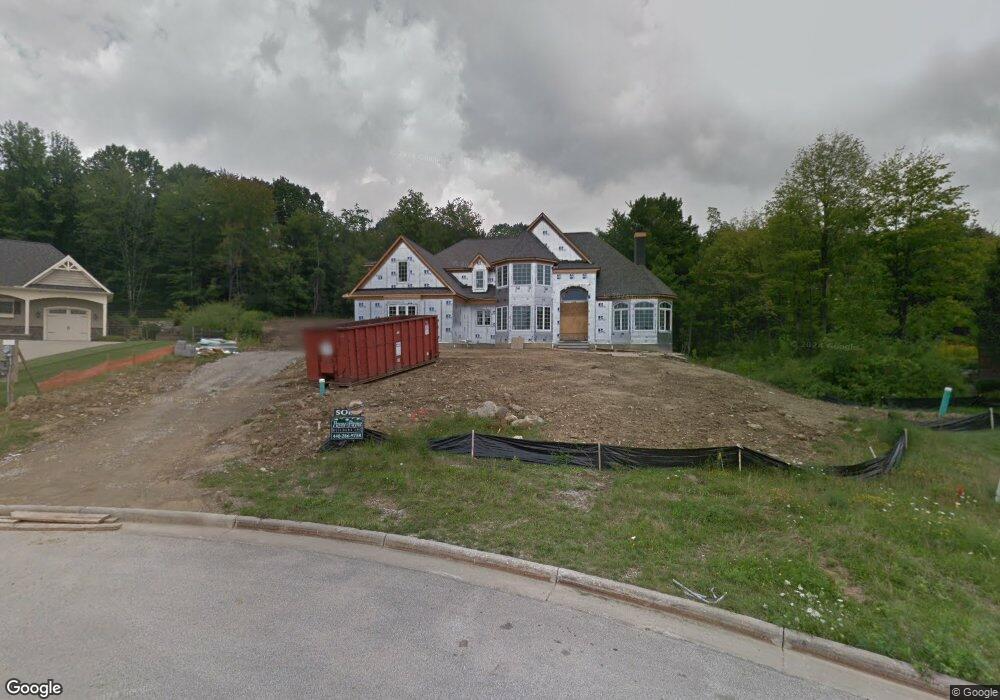
This home is located at 5405 Brookside Trail, Solon, OH 44139 and is currently estimated at $628,797, approximately $228 per square foot. 5405 Brookside Trail is a home with nearby schools including Dorothy E Lewis Elementary School, Orchard Middle School, and Solon Middle School.
Ownership History
Date
Name
Owned For
Owner Type
Purchase Details
Closed on
Mar 14, 2013
Sold by
M W Miozzi Homes Inc
Bought by
Malec Chris and Malec Melanie
Current Estimated Value
Home Financials for this Owner
Home Financials are based on the most recent Mortgage that was taken out on this home.
Original Mortgage
$601,600
Outstanding Balance
$430,555
Interest Rate
3.49%
Mortgage Type
New Conventional
Estimated Equity
$198,242
Create a Home Valuation Report for This Property
The Home Valuation Report is an in-depth analysis detailing your home's value as well as a comparison with similar homes in the area
Home Values in the Area
Average Home Value in this Area
Purchase History
| Date | Buyer | Sale Price | Title Company |
|---|---|---|---|
| Malec Chris | $199,000 | Us Title |
Source: Public Records
Mortgage History
| Date | Status | Borrower | Loan Amount |
|---|---|---|---|
| Open | Malec Chris | $601,600 |
Source: Public Records
Tax History
| Year | Tax Paid | Tax Assessment Tax Assessment Total Assessment is a certain percentage of the fair market value that is determined by local assessors to be the total taxable value of land and additions on the property. | Land | Improvement |
|---|---|---|---|---|
| 2024 | $11,092 | $202,685 | $56,315 | $146,370 |
| 2023 | $12,372 | $184,810 | $32,030 | $152,780 |
| 2022 | $12,345 | $184,800 | $32,030 | $152,780 |
| 2021 | $12,205 | $184,800 | $32,030 | $152,780 |
| 2020 | $13,082 | $181,160 | $31,400 | $149,770 |
| 2019 | $12,671 | $517,600 | $89,700 | $427,900 |
| 2018 | $11,856 | $181,160 | $31,400 | $149,770 |
| 2017 | $12,545 | $189,320 | $51,520 | $137,800 |
| 2016 | $12,426 | $188,440 | $51,520 | $136,920 |
| 2015 | $12,367 | $188,440 | $51,520 | $136,920 |
| 2014 | $12,825 | $188,450 | $47,710 | $140,740 |
Source: Public Records
Map
Nearby Homes
- 5496 Stone Creek
- 30705 Cannon Rd
- 30875 Cannon Rd
- 5560 Elm Hill Dr
- S/L 12 Neptune Oval
- S/L 1 Neptune Oval
- S/L 2 Neptune Oval
- S/L 3 Neptune Oval
- S/L 11 Neptune Oval
- S/L 4 Neptune Oval
- S/L 13 Neptune Oval
- 5068 Neptune Oval
- 5060 Neptune Oval
- 5270 Brainard Rd
- 32760 Ledge Hill Dr
- 32957 Springside Ln
- 300 Woodridge Ln
- 5151 Som Center Rd
- 5721 Som Center Rd Unit 25
- 5721 Som Center Rd Unit 18
- 5425 Brookside Trail
- 3 S/L Brookside Trail
- 10 S/L Brookside Rd
- 2 S/L Brookside Trail
- 10 S/L Brookside Trail
- 2 Brookside Trail
- 10 Brookside Trail
- 3 Brookside Trail
- 5 Brookside Trail
- 5445 Cannon Rd
- 5456 Stone Creek Dr
- 5448 Stone Creek Dr
- 30455 Cannon Rd
- 5464 Stone Creek Dr
- 5440 Cannon Rd
- 5432 Stone Creek Dr
- 5465 Cannon Rd
- 5472 Stone Creek Dr
- 5485 Brookside Trail
Your Personal Tour Guide
Ask me questions while you tour the home.