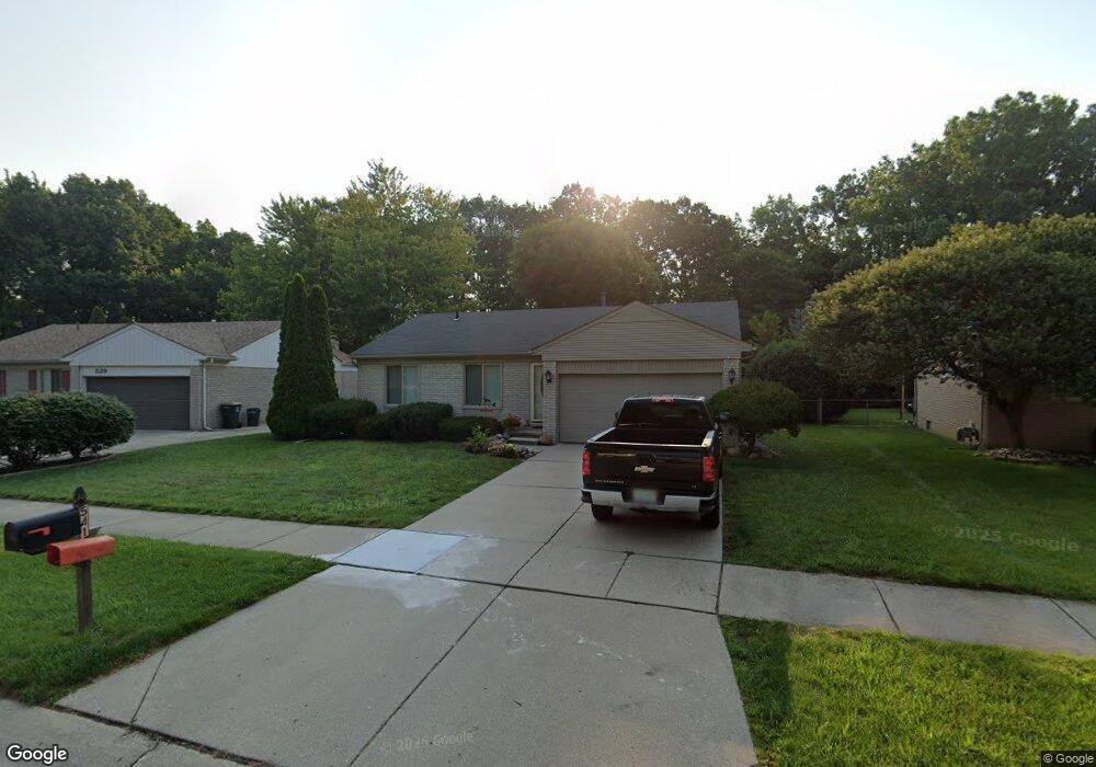
541 Buckingham Rd Canton, MI 48188
Estimated Value: $293,945 - $396,000
Studio
2
Baths
1,304
Sq Ft
$260/Sq Ft
Est. Value
About This Home
This home is located at 541 Buckingham Rd, Canton, MI 48188 and is currently estimated at $339,486, approximately $260 per square foot. 541 Buckingham Rd is a home located in Wayne County with nearby schools including Canton High School, Discovery Middle School, and Salem High School.
Ownership History
Date
Name
Owned For
Owner Type
Purchase Details
Closed on
Mar 10, 2015
Sold by
Smith James T
Bought by
Smith James T and Smith Deborah A
Current Estimated Value
Home Financials for this Owner
Home Financials are based on the most recent Mortgage that was taken out on this home.
Original Mortgage
$120,000
Outstanding Balance
$43,141
Interest Rate
3.67%
Mortgage Type
New Conventional
Estimated Equity
$296,345
Purchase Details
Closed on
Mar 19, 1996
Sold by
Smith James T
Bought by
Smith Sheree L
Create a Home Valuation Report for This Property
The Home Valuation Report is an in-depth analysis detailing your home's value as well as a comparison with similar homes in the area
Home Values in the Area
Average Home Value in this Area
Purchase History
| Date | Buyer | Sale Price | Title Company |
|---|---|---|---|
| Smith James T | -- | Progressive Title | |
| Smith Sheree L | $28,400 | -- |
Source: Public Records
Mortgage History
| Date | Status | Borrower | Loan Amount |
|---|---|---|---|
| Open | Smith James T | $120,000 |
Source: Public Records
Tax History
| Year | Tax Paid | Tax Assessment Tax Assessment Total Assessment is a certain percentage of the fair market value that is determined by local assessors to be the total taxable value of land and additions on the property. | Land | Improvement |
|---|---|---|---|---|
| 2025 | $1,816 | $175,800 | $0 | $0 |
| 2024 | $1,764 | $161,800 | $0 | $0 |
| 2023 | $1,682 | $146,700 | $0 | $0 |
| 2022 | $3,716 | $134,800 | $0 | $0 |
| 2021 | $3,606 | $131,700 | $0 | $0 |
| 2020 | $3,559 | $124,900 | $0 | $0 |
| 2019 | $3,501 | $115,430 | $0 | $0 |
| 2018 | $1,429 | $115,640 | $0 | $0 |
| 2017 | $3,597 | $116,000 | $0 | $0 |
| 2016 | $3,184 | $114,200 | $0 | $0 |
| 2015 | $7,854 | $103,810 | $0 | $0 |
| 2013 | $7,609 | $79,320 | $0 | $0 |
| 2010 | -- | $86,780 | $40,310 | $46,470 |
Source: Public Records
Map
Nearby Homes
- 39234 Gloucester St
- 709 Foothill Dr
- 43149 Wilderness Dr
- 127 S John Hix St
- 00000 Avondale St
- 312 Brookfield Dr Unit 4
- 285 Carson Dr Unit 156
- 0 Cherry Hill Unit 16924
- 38478 Loruss Ave
- 314 Marigold Cir Unit 49
- 308 Marigold Cir Unit 54
- 312 Marigold Cir Unit 52
- 1786 Daisey Ln Unit 32
- 714 Autumn Ridge Dr Unit 64
- 870 N Lotz Rd
- 41060 Northwind Dr
- 40049 Rolling Green Ct
- 457 N Sybald St
- 41226 Southwind Dr Unit 138
- 901 N Hix Rd
- 553 Buckingham Rd
- 529 Buckingham Rd
- 565 Buckingham Rd
- 517 Buckingham Rd
- 577 Buckingham Rd
- 505 Buckingham Rd
- 540 Buckingham Rd
- 528 Buckingham Rd
- 39388 Dillingham St
- 552 Buckingham Rd
- 39675 Wales St
- 454 Surrey Heights
- 493 Buckingham Rd
- 0 Buckingham Rd
- 39500 Wales St
- 564 Buckingham Rd
- 39614 Randall St
- 39626 Randall St
- 39385 Dillingham St
- 440 Surrey Heights
Your Personal Tour Guide
Ask me questions while you tour the home.