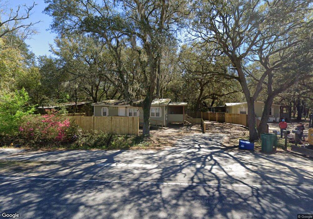
541 County Highway 83a W Freeport, FL 32439
Estimated Value: $250,000 - $351,000
3
Beds
2
Baths
1,656
Sq Ft
$182/Sq Ft
Est. Value
About This Home
This home is located at 541 County Highway 83a W, Freeport, FL 32439 and is currently estimated at $300,669, approximately $181 per square foot. 541 County Highway 83a W is a home located in Walton County with nearby schools including Freeport Elementary School, Freeport Middle School, and Freeport Senior High School.
Ownership History
Date
Name
Owned For
Owner Type
Purchase Details
Closed on
Mar 23, 2023
Sold by
Whoolery Robert S and Whoolery Kristen N
Bought by
Classic Commercial Exteriors
Current Estimated Value
Purchase Details
Closed on
Jun 30, 2016
Sold by
Reece Jimmy C
Bought by
Whoolery Robert S and Whoolery Kristen N
Home Financials for this Owner
Home Financials are based on the most recent Mortgage that was taken out on this home.
Original Mortgage
$154,241
Interest Rate
3.58%
Purchase Details
Closed on
Mar 18, 2015
Sold by
Knight Robert Richard
Bought by
Reece Jimmy C
Create a Home Valuation Report for This Property
The Home Valuation Report is an in-depth analysis detailing your home's value as well as a comparison with similar homes in the area
Home Values in the Area
Average Home Value in this Area
Purchase History
| Date | Buyer | Sale Price | Title Company |
|---|---|---|---|
| Classic Commercial Exteriors | $275,000 | Mitchell Land & Title | |
| Classic Commercial Exteriors | $275,000 | Mitchell Land & Title | |
| Whoolery Robert S | $150,000 | Bradley Title Inc | |
| Whoolery Robert S | $150,000 | Bradley Title Inc | |
| Reece Jimmy C | $30,000 | Bradley Title Llc | |
| Reece Jimmy C | $30,000 | Bradley Title Llc |
Source: Public Records
Mortgage History
| Date | Status | Borrower | Loan Amount |
|---|---|---|---|
| Previous Owner | Whoolery Robert S | $154,241 |
Source: Public Records
Tax History
| Year | Tax Paid | Tax Assessment Tax Assessment Total Assessment is a certain percentage of the fair market value that is determined by local assessors to be the total taxable value of land and additions on the property. | Land | Improvement |
|---|---|---|---|---|
| 2025 | $1,626 | $192,552 | $30,000 | $162,552 |
| 2024 | $1,252 | $166,792 | $4,240 | $162,552 |
| 2023 | $1,252 | $121,166 | $0 | $0 |
| 2022 | $1,156 | $142,074 | $4,706 | $137,368 |
| 2021 | $994 | $105,171 | $3,474 | $101,697 |
| 2020 | $916 | $91,034 | $3,000 | $88,034 |
| 2019 | $894 | $89,240 | $3,000 | $86,240 |
| 2018 | $869 | $86,103 | $0 | $0 |
| 2017 | $860 | $84,760 | $3,000 | $81,760 |
| 2016 | $745 | $71,587 | $0 | $0 |
| 2015 | $373 | $31,363 | $0 | $0 |
| 2014 | $737 | $68,591 | $0 | $0 |
Source: Public Records
Map
Nearby Homes
- 198 Blaze Blvd
- 530 Lightning Bug Ln
- 55 Sweet Tea Ln
- 500 Meadow Lake Dr
- 454 Lightning Bug Ln
- 221 Sweet Tea Ln
- 0 Hatcher Cemetery Rd
- 93 Dusky Way
- 183 Meadow Lake Dr
- 371 Lightning Bug Ln Unit Lot 23
- 208 Meadow Lake Dr
- 629 Meadow Lake Dr
- 466 Brighton Cove
- 56 Secluded Cir
- 221 Picnic Place
- 30 Hammock Oaks Blvd
- 206 Brighton Cove
- 41 Twain Trail
- 42 Cypress Ln
- 18 Canopy Cove
- 561 County Highway 83a W
- 435 W 83a Hwy Unit Building F
- 435 W 83a Hwy Unit Building A
- 435 W 83a Hwy Unit Building B
- 435 W 83a Hwy Unit A
- 6.72 ACRES Bay Loop Rd
- 624 W Bayloop Rd
- 624 County Highway 83a W
- 187 Short Cut Rd
- 215 Short Cut Rd
- 165 Pintail Blvd
- 165 Blaze Blvd
- 177 Pintail Blvd
- 189 Pintail Blvd
- 157 Blaze Blvd
- 205 Pintail Blvd
- 145 Blaze Blvd
- 219 Pintail Blvd
- 137 Blaze Blvd
- 127 Blaze Blvd
Your Personal Tour Guide
Ask me questions while you tour the home.