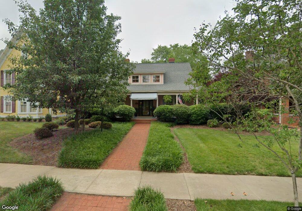
541 Davie Ave Statesville, NC 28677
Estimated Value: $404,000 - $469,000
4
Beds
3
Baths
3,131
Sq Ft
$141/Sq Ft
Est. Value
About This Home
This home is located at 541 Davie Ave, Statesville, NC 28677 and is currently estimated at $442,743, approximately $141 per square foot. 541 Davie Ave is a home located in Iredell County with nearby schools including Third Creek Elementary School, Third Creek Middle School, and Statesville High School.
Ownership History
Date
Name
Owned For
Owner Type
Purchase Details
Closed on
Feb 23, 2024
Sold by
Kimball Robert R and Kimball Marian F
Bought by
Rob And Marian Kimball Trust and Kimball
Current Estimated Value
Purchase Details
Closed on
Nov 1, 1996
Purchase Details
Closed on
Nov 1, 1995
Purchase Details
Closed on
Jan 1, 1989
Purchase Details
Closed on
Jun 1, 1981
Purchase Details
Closed on
Jun 1, 1980
Create a Home Valuation Report for This Property
The Home Valuation Report is an in-depth analysis detailing your home's value as well as a comparison with similar homes in the area
Home Values in the Area
Average Home Value in this Area
Purchase History
| Date | Buyer | Sale Price | Title Company |
|---|---|---|---|
| Rob And Marian Kimball Trust | -- | None Listed On Document | |
| Rob And Marian Kimball Trust | -- | None Listed On Document | |
| -- | $172,500 | -- | |
| -- | $158,500 | -- | |
| -- | $155,000 | -- | |
| -- | -- | -- | |
| -- | $19,000 | -- |
Source: Public Records
Tax History Compared to Growth
Tax History
| Year | Tax Paid | Tax Assessment Tax Assessment Total Assessment is a certain percentage of the fair market value that is determined by local assessors to be the total taxable value of land and additions on the property. | Land | Improvement |
|---|---|---|---|---|
| 2024 | $3,592 | $347,120 | $32,000 | $315,120 |
| 2023 | $3,592 | $347,120 | $32,000 | $315,120 |
| 2022 | $2,823 | $243,920 | $16,000 | $227,920 |
| 2021 | $2,823 | $243,920 | $16,000 | $227,920 |
| 2020 | $2,823 | $243,920 | $16,000 | $227,920 |
| 2019 | $2,799 | $243,920 | $16,000 | $227,920 |
| 2018 | $2,482 | $229,070 | $17,600 | $211,470 |
| 2017 | $2,434 | $229,070 | $17,600 | $211,470 |
| 2016 | $2,434 | $229,070 | $17,600 | $211,470 |
| 2015 | $2,200 | $229,070 | $17,600 | $211,470 |
| 2014 | $1,937 | $210,650 | $17,600 | $193,050 |
Source: Public Records
Map
Nearby Homes
- 213 Ramsey Ct Unit 213
- 640 Davie Ave
- 314 Euclid Ave
- 824 Davie Ave
- 504 Holland Dr
- 709 E Front St
- 322 Salisbury Rd
- 621 E Sharpe St
- 821 Wood St
- 320 S Oakwood Dr
- 445 Newton Ave
- Lot 1 Magnolia St
- 531 Whittington Place
- 506 Broadway Ct
- 915 Brookwood Ct
- 537 Falls St
- 520 Margaret Dr
- 000 Broadway Ct
- 533 Broadway Ct
- 245 Garfield St
- 535 Davie Ave
- 213 Park St
- 601 Davie Ave
- 601 Davie Ave Unit A
- 527 Davie Ave
- 223 Ramsey Ct
- 221 Ramsey Ct
- 217 Ramsey Ct Unit 217
- 219 Ramsey Ct Unit 219
- 542 Davie Ave
- 211 Ramsey Ct Unit 211
- 215 Park St
- 207 Ramsey Ct
- 532 Davie Ave
- 519 Davie Ave
- 201 Ramsey Ct
- 203 Ramsey Ct
- 216 Park St
- 604 Davie Ave
- 227 Ramsey Ct