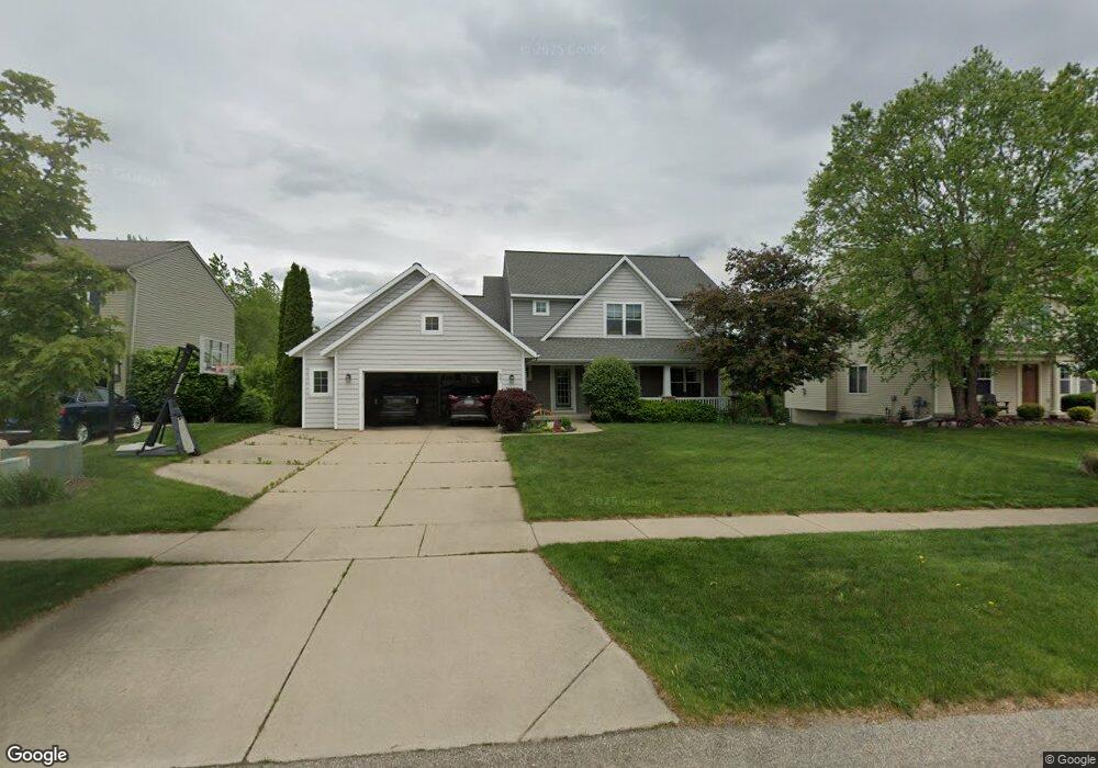
541 Firestone Dr SE Unit 104 Byron Center, MI 49315
Estimated Value: $516,873 - $581,000
4
Beds
3
Baths
2,492
Sq Ft
$219/Sq Ft
Est. Value
About This Home
This home is located at 541 Firestone Dr SE Unit 104, Byron Center, MI 49315 and is currently estimated at $545,468, approximately $218 per square foot. 541 Firestone Dr SE Unit 104 is a home located in Kent County with nearby schools including Countryside Elementary School, Robert L. Nickels Intermediate School, and Byron Center West Middle School.
Ownership History
Date
Name
Owned For
Owner Type
Purchase Details
Closed on
May 5, 2015
Sold by
Greskowiak Gary and Greskowiak Ronda
Bought by
Greskowiak Gary L and Gary L Greskowiak Trust
Current Estimated Value
Purchase Details
Closed on
Dec 17, 2004
Sold by
Bosgraaf Builders Inc
Bought by
Greskowiak Gary and Greskowiak Ronda
Home Financials for this Owner
Home Financials are based on the most recent Mortgage that was taken out on this home.
Original Mortgage
$297,150
Outstanding Balance
$150,198
Interest Rate
5.87%
Mortgage Type
Purchase Money Mortgage
Estimated Equity
$395,270
Purchase Details
Closed on
Sep 3, 2004
Sold by
Bobo Llc
Bought by
Bosgraaf Builders Inc
Home Financials for this Owner
Home Financials are based on the most recent Mortgage that was taken out on this home.
Original Mortgage
$212,450
Interest Rate
5.85%
Mortgage Type
Construction
Create a Home Valuation Report for This Property
The Home Valuation Report is an in-depth analysis detailing your home's value as well as a comparison with similar homes in the area
Home Values in the Area
Average Home Value in this Area
Purchase History
| Date | Buyer | Sale Price | Title Company |
|---|---|---|---|
| Greskowiak Gary L | -- | None Available | |
| Greskowiak Gary | $312,812 | Metropolitan Title Company | |
| Bosgraaf Builders Inc | $61,000 | Metropolitan Title Company |
Source: Public Records
Mortgage History
| Date | Status | Borrower | Loan Amount |
|---|---|---|---|
| Open | Greskowiak Gary | $297,150 | |
| Previous Owner | Bosgraaf Builders Inc | $212,450 |
Source: Public Records
Tax History Compared to Growth
Tax History
| Year | Tax Paid | Tax Assessment Tax Assessment Total Assessment is a certain percentage of the fair market value that is determined by local assessors to be the total taxable value of land and additions on the property. | Land | Improvement |
|---|---|---|---|---|
| 2025 | $3,217 | $246,900 | $0 | $0 |
| 2024 | $3,217 | $237,900 | $0 | $0 |
| 2022 | $2,930 | $196,000 | $0 | $0 |
| 2021 | $4,059 | $183,000 | $0 | $0 |
| 2020 | $2,832 | $180,900 | $0 | $0 |
| 2019 | $3,784 | $170,800 | $0 | $0 |
| 2018 | $3,784 | $153,600 | $20,000 | $133,600 |
| 2017 | $0 | $138,900 | $0 | $0 |
| 2016 | $0 | $132,500 | $0 | $0 |
| 2015 | -- | $132,500 | $0 | $0 |
| 2013 | -- | $117,000 | $0 | $0 |
Source: Public Records
Map
Nearby Homes
- 650 Braeside Dr SE Unit 50
- 752 Stevenspoint SE Unit 22
- 681 Braeside Dr SE Unit 78
- 7749 Turtle Dove Dr SE
- 307 Golden Eagle Dr SE
- 7677 Skylark Dr SE
- 883 84th St SE
- 1001 Cobblestone Way Dr SE
- 52 Monticello St SW
- 45 Nueville St SW
- 8480 Division Ave S
- 7575 Regal Ave SE
- 1117 Peaceful Dr
- 7868 High Knoll Dr
- 111 76th St SE
- 101 76th St SE
- 8283 Cook's Corner Dr
- The Stockton Plan at Cooks Crossing
- The Amber Plan at Cooks Crossing
- The Brinley Plan at Cooks Crossing
- 547 Firestone Dr SE Unit 105
- 540 Firestone Dr SE Unit 108
- 548 Firestone Dr SE Unit 107
- 555 Firestone Dr SE Unit 106
- 532 Firestone Dr SE Unit 109
- 527 Firestone Dr SE Unit 102
- 561 Firestone Dr SE
- 524 Firestone Dr SE Unit 110
- 562 Firestone Dr SE
- 519 Firestone Dr SE Unit 101
- 551 Oldfield Dr SE Unit 119
- 565 Oldfield Dr SE Unit 120
- 543 Oldfield Dr SE
- 516 Firestone Dr SE Unit 111
- 573 Firestone Dr SE
- 531 Oldfield Dr SE Unit 117
- 511 Firestone Dr SE Unit 100
- 576 Firestone Dr SE Unit 25
- 508 Firestone Dr SE Unit 112
- 569 Oldfield Dr SE