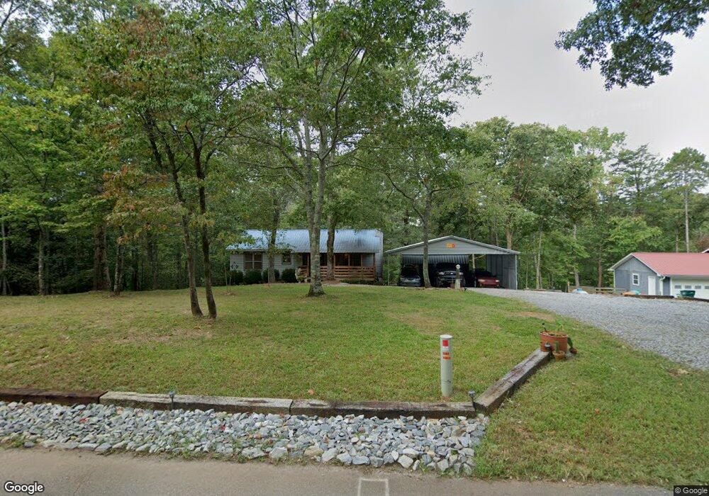
541 Grindle Bridge Rd Dahlonega, GA 30533
Estimated Value: $280,000 - $419,000
--
Bed
2
Baths
1,188
Sq Ft
$287/Sq Ft
Est. Value
About This Home
This home is located at 541 Grindle Bridge Rd, Dahlonega, GA 30533 and is currently estimated at $340,597, approximately $286 per square foot. 541 Grindle Bridge Rd is a home located in Lumpkin County with nearby schools including Lumpkin County High School.
Ownership History
Date
Name
Owned For
Owner Type
Purchase Details
Closed on
Oct 18, 2004
Sold by
Vickers Patrick B and Vickers Mary M
Bought by
Nash Leviticus D and Nash Jessica E
Current Estimated Value
Purchase Details
Closed on
Feb 20, 2004
Sold by
Vickers Patrick B
Bought by
Vickers Patrick B and Vickers Mary M
Purchase Details
Closed on
Feb 5, 2004
Sold by
Bank Of America Na
Bought by
Vickers Patrick B
Purchase Details
Closed on
May 6, 2003
Sold by
Wheeler Thomas H
Bought by
Bank Of America Na
Purchase Details
Closed on
Jun 28, 2000
Sold by
Wheeler Thomas H
Bought by
Wheeler Thomas H
Purchase Details
Closed on
Mar 1, 1998
Sold by
Porter Christopher
Bought by
United Comunity Bank
Purchase Details
Closed on
Feb 27, 1998
Sold by
Porter Christopher
Bought by
Porter Christopher
Create a Home Valuation Report for This Property
The Home Valuation Report is an in-depth analysis detailing your home's value as well as a comparison with similar homes in the area
Home Values in the Area
Average Home Value in this Area
Purchase History
| Date | Buyer | Sale Price | Title Company |
|---|---|---|---|
| Nash Leviticus D | $121,000 | -- | |
| Vickers Patrick B | -- | -- | |
| Vickers Patrick B | $89,900 | -- | |
| Bank Of America Na | -- | -- | |
| Wheeler Thomas H | -- | -- | |
| Wheeler Thomas H | $112,000 | -- | |
| United Comunity Bank | -- | -- | |
| Porter Christopher | -- | -- | |
| Porter Christopher | $7,800 | -- |
Source: Public Records
Tax History Compared to Growth
Tax History
| Year | Tax Paid | Tax Assessment Tax Assessment Total Assessment is a certain percentage of the fair market value that is determined by local assessors to be the total taxable value of land and additions on the property. | Land | Improvement |
|---|---|---|---|---|
| 2024 | $2,047 | $89,026 | $11,020 | $78,006 |
| 2023 | $1,183 | $69,854 | $11,020 | $58,834 |
| 2022 | $1,432 | $59,834 | $11,020 | $48,814 |
| 2021 | $1,244 | $50,607 | $11,020 | $39,587 |
| 2020 | $1,250 | $49,371 | $11,020 | $38,351 |
| 2019 | $1,261 | $49,371 | $11,020 | $38,351 |
| 2018 | $1,210 | $44,638 | $11,020 | $33,618 |
| 2017 | $1,182 | $42,850 | $11,020 | $31,830 |
| 2016 | $1,127 | $39,676 | $11,020 | $28,656 |
| 2015 | $1,002 | $39,676 | $11,020 | $28,656 |
| 2014 | $1,002 | $40,022 | $11,020 | $29,002 |
| 2013 | -- | $40,366 | $11,020 | $29,346 |
Source: Public Records
Map
Nearby Homes
- 1063 Grindle Bridge Rd
- 651 Hester Rd
- 45 Chestatee River Ridge
- 499 Old Deer Path Way
- 987 Peaceful Valley Dr
- 0 Christy Ln Unit 10577382
- 0 Hester Rd Unit 7591226
- 0 Waterfall Dr Unit 9 10472076
- 31 Valhalla Dr
- 55 Santa Pera Dr
- 3145 Town Creek Church Rd
- 0 Valhalla Dr Unit 10600404
- 242 Hooper Rd
- 3395 Asbury Mill Rd
- 410 Whiskey Still Dr
- 174 Leighs Crossing
- 4936 Town Creek Rd
- 2339 Thomas Rd
- 2832 Asbury Mill Rd
- 0 Horseshoe Bend Rd Unit 10571975
- 599 Grindle Bridge Rd
- 539 Grindle Bridge Rd
- 629 Grindle Bridge Rd Unit 5
- 629 Grindle Bridge Rd
- 629 Grindle Bridge Rd Unit 629
- 537 Grindle Bridge Rd
- 564 Grindle Bridge Rd
- 652 Grindle Bridge Rd
- 254 High Shoals Dr
- 691 Grindle Bridge Rd
- 691 Grindle Bridge Rd Unit 7
- 232 High Shoals Dr
- 499 Grindle Bridge Rd
- 783 Grindle Bridge Rd
- 719 Grindle Bridge Rd
- 013 River Rock Dr
- L13 River Rock Dr
- L30 River Rock Dr
- 0 River Rock Dr Unit 5925239
- 0 River Rock Dr Unit 8,9,9A 8277828