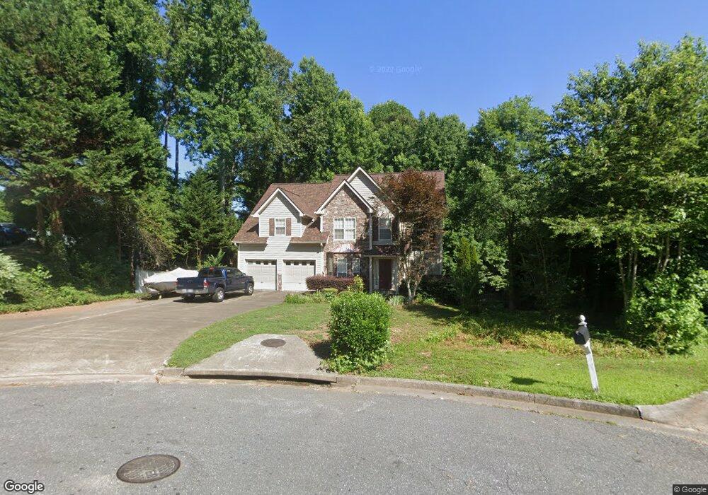
541 Matthew Dr Canton, GA 30115
Estimated Value: $374,522 - $401,000
3
Beds
3
Baths
1,978
Sq Ft
$196/Sq Ft
Est. Value
About This Home
This home is located at 541 Matthew Dr, Canton, GA 30115 and is currently estimated at $387,761, approximately $196 per square foot. 541 Matthew Dr is a home located in Cherokee County with nearby schools including Avery Elementary School, Creekland Middle School, and Creekview High School.
Ownership History
Date
Name
Owned For
Owner Type
Purchase Details
Closed on
Dec 20, 2004
Sold by
Lamkin Harry B and Lamkin Karen
Bought by
Gay Larry E
Current Estimated Value
Home Financials for this Owner
Home Financials are based on the most recent Mortgage that was taken out on this home.
Original Mortgage
$17,400
Interest Rate
5.11%
Mortgage Type
Unknown
Purchase Details
Closed on
Sep 15, 1999
Sold by
Saggese John
Bought by
Lamkin Harry B and Lamkin Karen L
Home Financials for this Owner
Home Financials are based on the most recent Mortgage that was taken out on this home.
Original Mortgage
$148,900
Interest Rate
7.91%
Mortgage Type
VA
Purchase Details
Closed on
May 2, 1997
Sold by
Turner Jimmy
Bought by
Saggese John
Home Financials for this Owner
Home Financials are based on the most recent Mortgage that was taken out on this home.
Original Mortgage
$10,075
Interest Rate
7.98%
Mortgage Type
New Conventional
Create a Home Valuation Report for This Property
The Home Valuation Report is an in-depth analysis detailing your home's value as well as a comparison with similar homes in the area
Home Values in the Area
Average Home Value in this Area
Purchase History
| Date | Buyer | Sale Price | Title Company |
|---|---|---|---|
| Gay Larry E | $174,000 | -- | |
| Lamkin Harry B | $146,000 | -- | |
| Saggese John | $20,000 | -- |
Source: Public Records
Mortgage History
| Date | Status | Borrower | Loan Amount |
|---|---|---|---|
| Closed | Gay Larry E | $17,400 | |
| Open | Gay Larry E | $139,200 | |
| Previous Owner | Lamkin Harry B | $148,900 | |
| Previous Owner | Saggese John | $10,075 |
Source: Public Records
Tax History Compared to Growth
Tax History
| Year | Tax Paid | Tax Assessment Tax Assessment Total Assessment is a certain percentage of the fair market value that is determined by local assessors to be the total taxable value of land and additions on the property. | Land | Improvement |
|---|---|---|---|---|
| 2024 | $488 | $140,196 | $24,000 | $116,196 |
| 2023 | $296 | $139,276 | $24,000 | $115,276 |
| 2022 | $338 | $112,868 | $20,800 | $92,068 |
| 2021 | $348 | $96,040 | $14,400 | $81,640 |
| 2020 | $347 | $88,840 | $12,800 | $76,040 |
| 2019 | $347 | $84,720 | $12,800 | $71,920 |
| 2018 | $356 | $82,320 | $12,800 | $69,520 |
| 2017 | $366 | $189,800 | $11,200 | $64,720 |
| 2016 | $378 | $183,800 | $11,200 | $62,320 |
| 2015 | $381 | $157,100 | $11,200 | $51,640 |
| 2014 | $328 | $135,700 | $8,640 | $45,640 |
Source: Public Records
Map
Nearby Homes
- 3365 Confederate Point
- 5916 Governors Walk Dr
- 0 Governors Walk Dr Unit 7294252
- 224 River Terrace
- 222 River Terrace
- 445 Milton Dr
- 515 Riverview Ln
- 111 Point View Dr
- 117 Point View Dr
- 131 Point View Dr
- 145 Point View Dr
- - Bluffs Pkwy
- 0 Reed St Unit 7646438
- 3492 A Ball Ground Hwy
- 3492 Ball Ground Hwy
- 619 Elmwood St
- 621 Elmwood St
- 131 Riverwatch Ct
- 539 Matthew Dr
- 564 Matthew Dr Unit 2
- 562 Matthew Dr
- 537 Matthew Dr Unit 2
- 560 Matthew Dr
- 558 Matthew Dr Unit 24
- 558 Matthew Dr
- 558 Matthew Dr Unit 558
- 535 Matthew Dr Unit 2
- 556 Matthew Dr Unit 2
- 3399 Confederate Point
- 533 Matthew Dr Unit 2
- 3379 Confederate Point
- 554 Matthew Dr Unit 2
- 3419 Confederate Point
- 531 Matthew Dr Unit 2
- 552 Matthew Dr Unit 2
- 529 Matthew Dr
- 550 Matthew Dr Unit 2
- Lot 23 Confederate Point