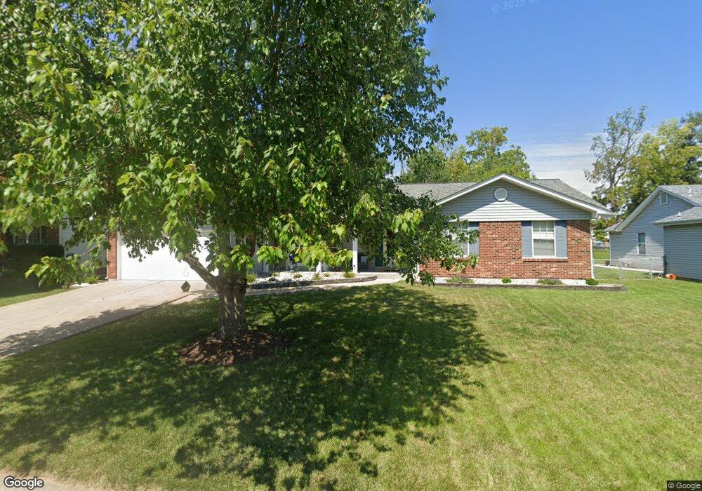
541 Pioneer Dr Saint Peters, MO 63376
Estimated Value: $321,340 - $339,000
3
Beds
2
Baths
1,508
Sq Ft
$219/Sq Ft
Est. Value
About This Home
This home is located at 541 Pioneer Dr, Saint Peters, MO 63376 and is currently estimated at $330,585, approximately $219 per square foot. 541 Pioneer Dr is a home located in St. Charles County with nearby schools including Dr. Bernard J. Dubray Middle School, Fort Zumwalt East High School, and All Saints Catholic School.
Ownership History
Date
Name
Owned For
Owner Type
Purchase Details
Closed on
Sep 9, 2000
Sold by
Rodebush Diane L and Rodebush Randall L
Bought by
Karrenbrock Randall L and Karrenbrock Diane L
Current Estimated Value
Home Financials for this Owner
Home Financials are based on the most recent Mortgage that was taken out on this home.
Original Mortgage
$35,000
Interest Rate
8.01%
Purchase Details
Closed on
Nov 4, 1998
Sold by
Rodebush Diane L
Bought by
Rodebush Diane L
Purchase Details
Closed on
May 15, 1998
Sold by
Rodebush William C
Bought by
Rodebush Diane L
Create a Home Valuation Report for This Property
The Home Valuation Report is an in-depth analysis detailing your home's value as well as a comparison with similar homes in the area
Home Values in the Area
Average Home Value in this Area
Purchase History
| Date | Buyer | Sale Price | Title Company |
|---|---|---|---|
| Karrenbrock Randall L | -- | Investors Title | |
| Rodebush Diane L | -- | -- | |
| Rodebush Diane L | -- | -- |
Source: Public Records
Mortgage History
| Date | Status | Borrower | Loan Amount |
|---|---|---|---|
| Closed | Karrenbrock Randall L | $35,000 |
Source: Public Records
Tax History Compared to Growth
Tax History
| Year | Tax Paid | Tax Assessment Tax Assessment Total Assessment is a certain percentage of the fair market value that is determined by local assessors to be the total taxable value of land and additions on the property. | Land | Improvement |
|---|---|---|---|---|
| 2025 | $3,441 | $53,128 | -- | -- |
| 2024 | $3,441 | $48,198 | -- | -- |
| 2023 | $3,438 | $48,198 | $0 | $0 |
| 2022 | $3,183 | $41,808 | $0 | $0 |
| 2021 | $3,179 | $41,808 | $0 | $0 |
| 2020 | $2,973 | $37,889 | $0 | $0 |
| 2019 | $2,966 | $37,889 | $0 | $0 |
| 2018 | $2,924 | $35,895 | $0 | $0 |
| 2017 | $2,910 | $35,895 | $0 | $0 |
| 2016 | $2,584 | $31,766 | $0 | $0 |
| 2015 | $2,420 | $31,766 | $0 | $0 |
| 2014 | $2,392 | $30,787 | $0 | $0 |
Source: Public Records
Map
Nearby Homes
- 622 Settlers Cir
- 568 Prairie Home Dr
- 809 Estes Park Dr
- 7418 Mexico Rd #100 Rd
- 763 Estes Park Dr
- 7 Belmont Dr
- 20 Churchill Downs Dr
- 14 Horizon Dr
- 1 Jamaica Dr
- 36 Jamestown Dr
- 20 Jamestown Dr
- 27 Sunny Hill Blvd
- 4 Green Pines Ct
- 406 S Church St Unit 128
- 24 Saint David Dr
- 1844 Sterling Oaks Dr
- 138 Rhythm Point Dr
- 420 Cambridge Place Unit 2
- 426 Cambridge Place
- 2013 Chestnut Pines Ct
- 543 Pioneer Dr
- 539 Pioneer Dr
- 545 Pioneer Dr
- 537 Pioneer Dr
- 540 Pioneer Dr
- 538 Pioneer Dr
- 542 Pioneer Dr
- 536 Pioneer Dr
- 535 Pioneer Dr
- 547 Pioneer Dr
- 101 Frontiers Edge Dr
- 544 Pioneer Dr
- 583 Prairie Home Dr
- 585 Prairie Home Dr
- 533 Pioneer Dr
- 581 Prairie Home Dr
- 549 Pioneer Dr
- 587 Prairie Home Dr
- 103 Frontiers Edge Dr
- 579 Prairie Home Dr