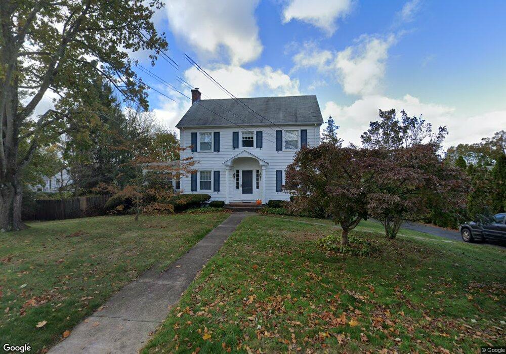
541 Ridge Rd Middletown, CT 06457
Estimated Value: $392,571 - $452,000
3
Beds
2
Baths
1,966
Sq Ft
$218/Sq Ft
Est. Value
About This Home
This home is located at 541 Ridge Rd, Middletown, CT 06457 and is currently estimated at $428,643, approximately $218 per square foot. 541 Ridge Rd is a home located in Middlesex County with nearby schools including Farm Hill School, St John Paul II School, and The Independent Day School.
Ownership History
Date
Name
Owned For
Owner Type
Purchase Details
Closed on
Oct 30, 2025
Sold by
Molski Marshall M and Molski Kimberly C
Bought by
Molski Ft and Molski
Current Estimated Value
Purchase Details
Closed on
Mar 19, 1993
Sold by
Prevost Ann F
Bought by
Molski Marshall M and Cotter Kimberly A
Home Financials for this Owner
Home Financials are based on the most recent Mortgage that was taken out on this home.
Original Mortgage
$115,000
Interest Rate
7.75%
Mortgage Type
Purchase Money Mortgage
Create a Home Valuation Report for This Property
The Home Valuation Report is an in-depth analysis detailing your home's value as well as a comparison with similar homes in the area
Home Values in the Area
Average Home Value in this Area
Purchase History
| Date | Buyer | Sale Price | Title Company |
|---|---|---|---|
| Molski Ft | -- | -- | |
| Molski Marshall M | $154,900 | -- |
Source: Public Records
Mortgage History
| Date | Status | Borrower | Loan Amount |
|---|---|---|---|
| Previous Owner | Molski Marshall M | $130,000 | |
| Previous Owner | Molski Marshall M | $115,000 | |
| Previous Owner | Molski Marshall M | $100,000 |
Source: Public Records
Tax History Compared to Growth
Tax History
| Year | Tax Paid | Tax Assessment Tax Assessment Total Assessment is a certain percentage of the fair market value that is determined by local assessors to be the total taxable value of land and additions on the property. | Land | Improvement |
|---|---|---|---|---|
| 2025 | $7,525 | $203,320 | $64,330 | $138,990 |
| 2024 | $7,200 | $203,320 | $64,330 | $138,990 |
| 2023 | $6,834 | $203,320 | $64,330 | $138,990 |
| 2022 | $6,088 | $147,570 | $40,630 | $106,940 |
| 2021 | $6,061 | $147,570 | $40,630 | $106,940 |
| 2020 | $6,051 | $147,570 | $40,630 | $106,940 |
| 2019 | $6,080 | $147,570 | $40,630 | $106,940 |
| 2018 | $5,871 | $147,570 | $40,630 | $106,940 |
| 2017 | $6,503 | $168,110 | $53,450 | $114,660 |
| 2016 | $6,372 | $168,110 | $53,450 | $114,660 |
| 2015 | $6,232 | $168,110 | $53,450 | $114,660 |
| 2014 | $6,225 | $168,110 | $53,450 | $114,660 |
Source: Public Records
Map
Nearby Homes
- 77 Lindsey Rd
- 347 Farm Hill Rd
- 0 Arbutus St Unit 24065180
- 50 Garfield Ave
- 44 Trailside Crossing
- 1 Russell St Unit 15
- 1 Russell St Unit 11
- 154 Front St
- 4 Hillside Ct
- 73 Durant St
- 56 Bidwell Terrace
- 66 Durant Terrace
- 58 Durant Terrace
- 15 Kent Ct
- 37 Front St
- 10 Lorelei Cir
- 55 Lorelei Cir
- 42 Saybrook Rd
- 128 Highland Ave
- 498 Pine St