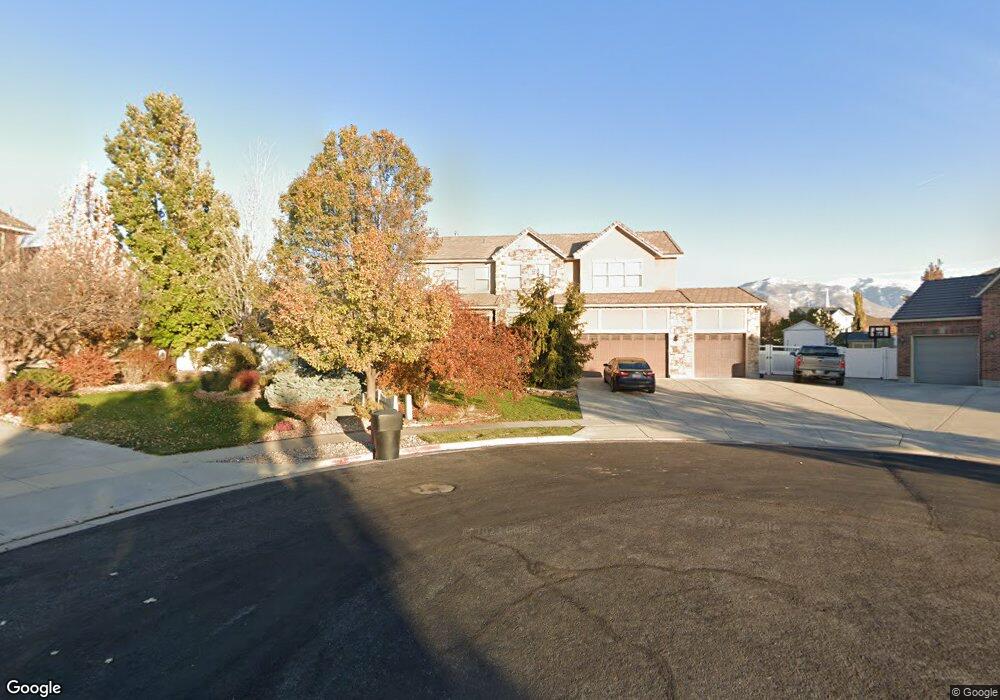
541 Threshing Way Ct Kaysville, UT 84037
West Kaysville NeighborhoodEstimated Value: $769,260 - $926,000
3
Beds
3
Baths
2,839
Sq Ft
$294/Sq Ft
Est. Value
About This Home
This home is located at 541 Threshing Way Ct, Kaysville, UT 84037 and is currently estimated at $834,565, approximately $293 per square foot. 541 Threshing Way Ct is a home with nearby schools including Columbia Elementary School, Farmington High, and Centennial Junior High School.
Ownership History
Date
Name
Owned For
Owner Type
Purchase Details
Closed on
Feb 6, 2008
Sold by
Anderson Reulon Guy
Bought by
Anderson Reulon Guy and Anderson Catherine Ann
Current Estimated Value
Home Financials for this Owner
Home Financials are based on the most recent Mortgage that was taken out on this home.
Original Mortgage
$330,250
Outstanding Balance
$208,569
Interest Rate
6.17%
Mortgage Type
Purchase Money Mortgage
Estimated Equity
$625,996
Purchase Details
Closed on
Dec 28, 2006
Sold by
Anderson Reulon Guy
Bought by
Anderson Reulon Guy and Anderson Catherine Ann
Home Financials for this Owner
Home Financials are based on the most recent Mortgage that was taken out on this home.
Original Mortgage
$332,000
Interest Rate
6.16%
Mortgage Type
New Conventional
Purchase Details
Closed on
Jun 30, 2006
Sold by
Anderson Reulon Guy
Bought by
Anderson Reulon Guy and Anderson Catherine Ann
Home Financials for this Owner
Home Financials are based on the most recent Mortgage that was taken out on this home.
Original Mortgage
$36,550
Interest Rate
6.18%
Mortgage Type
Stand Alone Second
Purchase Details
Closed on
Jun 28, 2006
Sold by
Richmond American Homes Of Utah Inc
Bought by
Anderson Reulon Guy
Home Financials for this Owner
Home Financials are based on the most recent Mortgage that was taken out on this home.
Original Mortgage
$36,550
Interest Rate
6.18%
Mortgage Type
Stand Alone Second
Create a Home Valuation Report for This Property
The Home Valuation Report is an in-depth analysis detailing your home's value as well as a comparison with similar homes in the area
Home Values in the Area
Average Home Value in this Area
Purchase History
| Date | Buyer | Sale Price | Title Company |
|---|---|---|---|
| Anderson Reulon Guy | -- | First American Title | |
| Anderson Reulon Guy | -- | First American Title | |
| Anderson Reulon Guy | -- | First American Title | |
| Anderson Reulon Guy | -- | First American Title | |
| Anderson Reulon Guy | -- | Accommodation | |
| Anderson Reulon Guy | -- | First American Title |
Source: Public Records
Mortgage History
| Date | Status | Borrower | Loan Amount |
|---|---|---|---|
| Open | Anderson Reulon Guy | $330,250 | |
| Previous Owner | Anderson Reulon Guy | $332,000 | |
| Previous Owner | Anderson Reulon Guy | $36,550 | |
| Previous Owner | Anderson Reulon Guy | $292,050 |
Source: Public Records
Tax History Compared to Growth
Tax History
| Year | Tax Paid | Tax Assessment Tax Assessment Total Assessment is a certain percentage of the fair market value that is determined by local assessors to be the total taxable value of land and additions on the property. | Land | Improvement |
|---|---|---|---|---|
| 2025 | $3,667 | $406,450 | $201,323 | $205,127 |
| 2024 | $3,667 | $386,650 | $176,969 | $209,681 |
| 2023 | $3,749 | $700,000 | $326,251 | $373,749 |
| 2022 | $3,838 | $402,050 | $178,886 | $223,164 |
| 2021 | $3,458 | $543,000 | $192,081 | $350,919 |
| 2020 | $3,126 | $478,000 | $162,357 | $315,643 |
| 2019 | $3,057 | $459,000 | $170,460 | $288,540 |
| 2018 | $2,832 | $424,000 | $141,017 | $282,983 |
| 2016 | $2,502 | $196,900 | $63,526 | $133,374 |
| 2015 | $2,607 | $194,755 | $63,526 | $131,229 |
| 2014 | $2,563 | $194,954 | $59,186 | $135,768 |
| 2013 | -- | $178,613 | $51,203 | $127,410 |
Source: Public Records
Map
Nearby Homes
- 453 Country Mill Dr
- 382 W Parkway Dr
- 447 W June Dr
- 384 Christine Way
- 52 S Grandison Ct E Unit 83-R
- 1346 W Blackbird Ln Unit 3
- 109 S Rock Loft Ridge Dr Unit 56-R
- 159 S Rock Loft Ridge Dr Unit 59-R
- 209 N Rock Loft Ridge E Unit 32-R
- 180 S Rock Loft Ridge Dr E Unit 7-R
- 246 N Rock Loft Ridge Dr Unit 36-R
- 22 S Rock Loft Ridge Dr Unit 16-R
- 34 S Rock Loft Ridge Dr Unit 85-R
- 190 N Rock Loft Ridge Dr Unit 40-R
- 75 S Grandison Ct E Unit 69-R
- 93 S Rock Loft Ridge Dr Unit 55-R
- 167 S Grandison E Unit 74-R
- 127 S Rock Loft Ridge Dr Unit 57-R
- 28 N Rock Loft Ridge Dr Unit 46-R
- 96 S Rock Loft Ridge Dr Unit 12-R
- 553 Threshing Way Ct
- 544 Threshing Way Ct
- 565 Threshing Way Ct
- 540 Treading Ln
- 556 Threshing Way Ct
- 552 Treading Ln
- 398 W Spring Flower Cir Unit 224
- 568 Threshing Way Ct
- 577 Threshing Way Ct
- 564 Treading Ln
- 571 Harvest Field Cir
- 580 Threshing Way Ct
- 390 W Spring Flower Cir Unit 225
- 390 W Spring Flower Cir
- 579 Harvest Field Cir
- 397 W Spring Flower Cir Unit 223
- 397 W Spring Flower Cir
- 446 Wheat Ridge Cir
- 439 Wheat Ridge Cir Unit 230
- 439 Wheat Ridge Cir