Estimated Value: $233,000 - $268,000
3
Beds
2
Baths
1,517
Sq Ft
$163/Sq Ft
Est. Value
About This Home
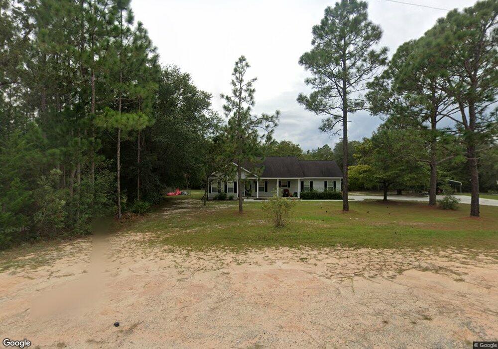
This home is located at 541 Tyre Rd, Jesup, GA 31545 and is currently estimated at $247,309, approximately $163 per square foot. 541 Tyre Rd is a home located in Wayne County with nearby schools including Martha Rawls Smith Elementary School, Arthur Williams Middle School, and Wayne County High School.
Ownership History
Date
Name
Owned For
Owner Type
Purchase Details
Closed on
Nov 14, 2016
Sold by
Michael T
Bought by
Tribout Dale L
Current Estimated Value
Purchase Details
Closed on
Jun 21, 2007
Sold by
Beasley Derrick N
Bought by
Wildes Michael T and Wildes Jessica
Home Financials for this Owner
Home Financials are based on the most recent Mortgage that was taken out on this home.
Original Mortgage
$127,000
Interest Rate
6.35%
Mortgage Type
New Conventional
Purchase Details
Closed on
Dec 1, 1996
Purchase Details
Closed on
May 1, 1986
Create a Home Valuation Report for This Property
The Home Valuation Report is an in-depth analysis detailing your home's value as well as a comparison with similar homes in the area
Home Values in the Area
Average Home Value in this Area
Purchase History
| Date | Buyer | Sale Price | Title Company |
|---|---|---|---|
| Tribout Dale L | $135,000 | -- | |
| Wildes Michael T | $137,000 | -- | |
| -- | $3,500 | -- | |
| -- | -- | -- |
Source: Public Records
Mortgage History
| Date | Status | Borrower | Loan Amount |
|---|---|---|---|
| Previous Owner | Wildes Michael T | $127,000 |
Source: Public Records
Tax History Compared to Growth
Tax History
| Year | Tax Paid | Tax Assessment Tax Assessment Total Assessment is a certain percentage of the fair market value that is determined by local assessors to be the total taxable value of land and additions on the property. | Land | Improvement |
|---|---|---|---|---|
| 2024 | $2,134 | $80,557 | $7,650 | $72,907 |
| 2023 | $2,102 | $71,590 | $7,650 | $63,940 |
| 2022 | $1,605 | $50,984 | $7,650 | $43,334 |
| 2021 | $1,719 | $50,984 | $7,650 | $43,334 |
| 2020 | $1,779 | $50,984 | $7,650 | $43,334 |
| 2019 | $1,832 | $50,984 | $7,650 | $43,334 |
| 2018 | $1,832 | $50,984 | $7,650 | $43,334 |
| 2017 | $1,577 | $50,984 | $7,650 | $43,334 |
| 2016 | $1,376 | $50,984 | $7,650 | $43,334 |
| 2014 | $1,380 | $50,984 | $7,650 | $43,334 |
| 2013 | -- | $50,984 | $7,650 | $43,334 |
Source: Public Records
Map
Nearby Homes
- 1276 Spring Grove Rd
- 95 Mayflower Rd
- 177 Bunion Rd
- 75 Woodlawn Dr
- 260 Pine Ridge Rd
- 186 Community Cir
- 15 Paris Dr
- Lot 1,2,3 Rayonier Rd
- 125 Pleasant Way
- 1275 Rayonier Rd
- 143 Caleb Cir
- 200 W Melody Dr
- 440 Oak Island Estates Rd
- 556 Caleb Cir
- 1 Palm Island Cir
- 0 Palm Island Cir
- 98 Saint Simons St
- 290 Yellow Pine Rd
- 141 Nichols Rd