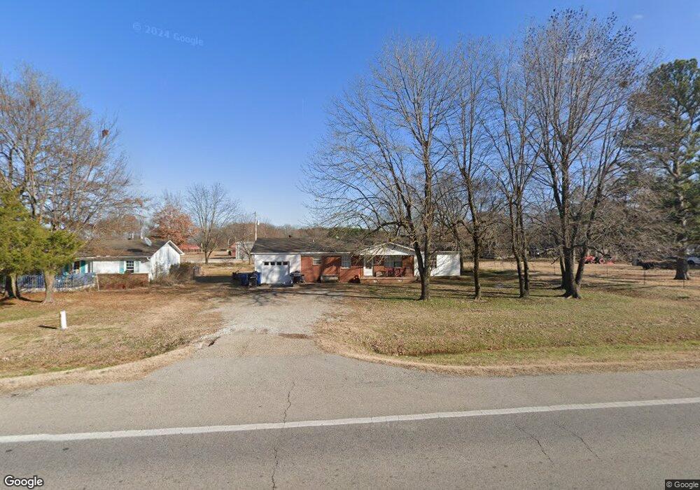
5410 Highway 135 N Paragould, AR 72450
Estimated Value: $125,000 - $198,000
--
Bed
1
Bath
1,537
Sq Ft
$101/Sq Ft
Est. Value
About This Home
This home is located at 5410 Highway 135 N, Paragould, AR 72450 and is currently estimated at $155,095, approximately $100 per square foot. 5410 Highway 135 N is a home located in Greene County with nearby schools including Paragould High School.
Ownership History
Date
Name
Owned For
Owner Type
Purchase Details
Closed on
Feb 17, 2009
Sold by
Austin William L
Bought by
Osborn Cleveland G and Osborn Frances A
Current Estimated Value
Home Financials for this Owner
Home Financials are based on the most recent Mortgage that was taken out on this home.
Original Mortgage
$67,000
Interest Rate
4.91%
Purchase Details
Closed on
Sep 15, 2004
Bought by
William L Austin
Purchase Details
Closed on
May 24, 2001
Bought by
Leach
Purchase Details
Closed on
Aug 11, 2000
Bought by
Eddie L Leach
Purchase Details
Closed on
Jun 25, 1987
Bought by
Rl and Kc Wynn
Purchase Details
Closed on
Jul 31, 1978
Bought by
Wynn
Create a Home Valuation Report for This Property
The Home Valuation Report is an in-depth analysis detailing your home's value as well as a comparison with similar homes in the area
Home Values in the Area
Average Home Value in this Area
Purchase History
| Date | Buyer | Sale Price | Title Company |
|---|---|---|---|
| Osborn Cleveland G | $59,000 | None Available | |
| William L Austin | $33,000 | -- | |
| Leach | $19,100 | -- | |
| Rl | -- | -- | |
| Eddie L Leach | $19,100 | -- | |
| Rl | $30,000 | -- | |
| Wynn | $30,000 | -- |
Source: Public Records
Mortgage History
| Date | Status | Borrower | Loan Amount |
|---|---|---|---|
| Closed | Osborn Cleveland G | $67,000 |
Source: Public Records
Tax History Compared to Growth
Tax History
| Year | Tax Paid | Tax Assessment Tax Assessment Total Assessment is a certain percentage of the fair market value that is determined by local assessors to be the total taxable value of land and additions on the property. | Land | Improvement |
|---|---|---|---|---|
| 2025 | $885 | $21,970 | $2,500 | $19,470 |
| 2024 | $811 | $21,970 | $2,500 | $19,470 |
| 2023 | $738 | $16,310 | $2,400 | $13,910 |
| 2022 | $738 | $16,310 | $2,400 | $13,910 |
| 2021 | $727 | $16,310 | $2,400 | $13,910 |
| 2020 | $661 | $14,620 | $2,000 | $12,620 |
| 2019 | $661 | $14,620 | $2,000 | $12,620 |
| 2018 | $661 | $14,620 | $2,000 | $12,620 |
| 2017 | $647 | $14,620 | $2,000 | $12,620 |
| 2016 | $647 | $14,620 | $2,000 | $12,620 |
| 2015 | $602 | $13,620 | $1,600 | $12,020 |
| 2014 | $533 | $13,620 | $1,600 | $12,020 |
Source: Public Records
Map
Nearby Homes
- 181 Misty Marie
- 205 Raymond
- 422 Sunset Dr
- 44 Oak Grove Rd
- 193 Granny Jean Ln
- 522 Vaughn Dr
- 233 Lois Ln
- 146 Messer Dr
- Tract 4 Greene 726 Rd
- Tract 3 Greene 726 Rd
- Tract 2 Greene 726 Rd
- 000 Hwy 412 Byp Everett Dr
- 3613 Purcell Rd
- 0 Hwy 49s Unit 10124883
- 3407 Sweet Gum St
- 3505 Sweet Gum St
- 0 Acres Highway 49n Unit 10121154
- 3501 Sweet Gum St
- 5 Acres Greene 726 Rd Tract 4
- 3503 Sweet Gum St
- 5426 Highway 135 N
- 5372 Highway 135 N
- 5446 Highway 135 N
- 5354 Highway 135 N
- 5354 Highway 135 N
- 5348 Highway 135 N
- 5474 Highway 135 N
- 5445 Highway 135 N
- 5445 Hwy 135 N
- 5498 Highway 135 N
- 98 Katheleen Dr
- 78 Katheleen Dr
- 5511 Highway 135 N
- 113 Katheleen Dr
- 54 Katheleen Dr
- 5296 Highway 135 N
- 5296 Highway 135 N
- 190 Elizabeth Ann
- 30 Katheleen Dr
- 5255 Highway 135 N