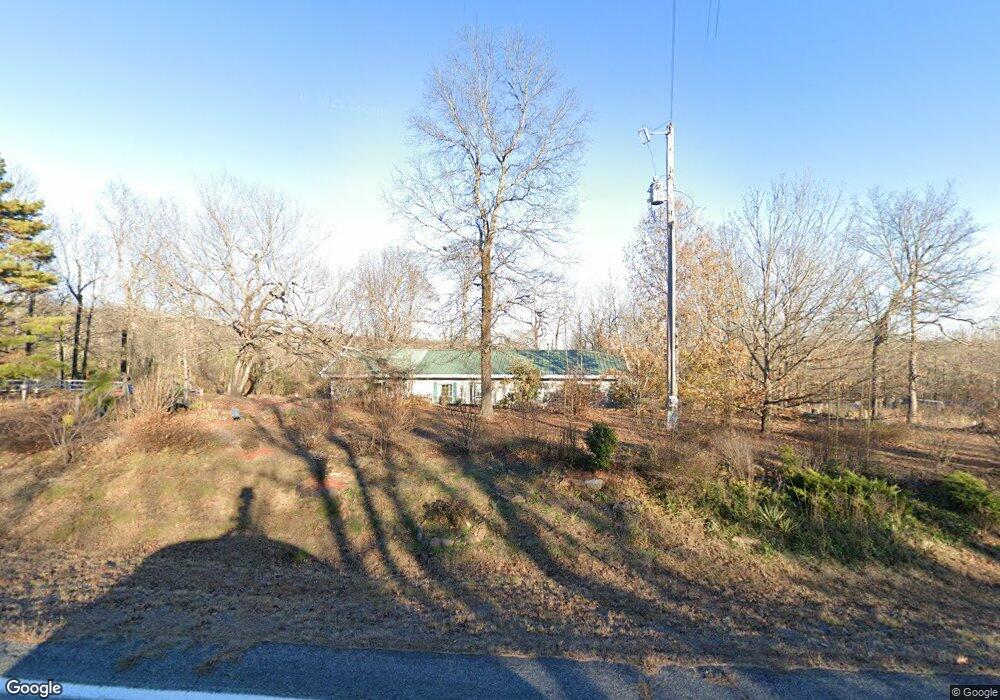
5413 Highway 254 E Leslie, AR 72645
Estimated Value: $165,665 - $405,000
Studio
1
Bath
884
Sq Ft
$287/Sq Ft
Est. Value
About This Home
This home is located at 5413 Highway 254 E, Leslie, AR 72645 and is currently estimated at $253,666, approximately $286 per square foot. 5413 Highway 254 E is a home located in Searcy County with nearby schools including Marshall Elementary School, Leslie Elementary School, and Marshall High School.
Ownership History
Date
Name
Owned For
Owner Type
Purchase Details
Closed on
Oct 31, 2001
Bought by
Lawson Karen
Current Estimated Value
Purchase Details
Closed on
May 5, 1999
Bought by
Brown Kenneth A
Purchase Details
Closed on
Sep 27, 1996
Bought by
Brown Kenneth A and Brown Carolyn E
Purchase Details
Closed on
Jun 1, 1995
Bought by
Ragland Harold and Mary Beth
Purchase Details
Closed on
Sep 1, 1993
Bought by
Robinson
Purchase Details
Closed on
May 1, 1993
Bought by
Tumbleson
Purchase Details
Closed on
Jan 1, 1910
Bought by
Stokes
Create a Home Valuation Report for This Property
The Home Valuation Report is an in-depth analysis detailing your home's value as well as a comparison with similar homes in the area
Purchase History
| Date | Buyer | Sale Price | Title Company |
|---|---|---|---|
| Lawson Karen | $12,500 | -- | |
| Brown Kenneth A | -- | -- | |
| Brown Kenneth A | $20,000 | -- | |
| Ragland Harold | $14,000 | -- | |
| Robinson | $10,000 | -- | |
| Tumbleson | $5,000 | -- | |
| Stokes | -- | -- |
Source: Public Records
Mortgage History
| Date | Status | Borrower | Loan Amount |
|---|---|---|---|
| Open | Stokes | $95,000 |
Source: Public Records
Tax History
| Year | Tax Paid | Tax Assessment Tax Assessment Total Assessment is a certain percentage of the fair market value that is determined by local assessors to be the total taxable value of land and additions on the property. | Land | Improvement |
|---|---|---|---|---|
| 2025 | $458 | $28,780 | $1,570 | $27,210 |
| 2024 | $458 | $28,780 | $1,570 | $27,210 |
| 2023 | $494 | $28,780 | $1,570 | $27,210 |
| 2022 | $544 | $28,780 | $1,570 | $27,210 |
| 2021 | $527 | $18,960 | $980 | $17,980 |
| 2020 | $527 | $18,960 | $980 | $17,980 |
| 2019 | $545 | $18,960 | $980 | $17,980 |
| 2018 | $569 | $18,960 | $980 | $17,980 |
| 2017 | $542 | $18,000 | $980 | $17,020 |
| 2016 | $619 | $20,870 | $980 | $19,890 |
| 2015 | $619 | $20,870 | $980 | $19,890 |
| 2014 | $619 | $18,780 | $980 | $17,800 |
Source: Public Records
Map
Nearby Homes
- 150 Woopsee Rd
- 00 Arkansas 254
- 0 Shady Grove Rd Unit 25049462
- 2340 Shady Grove Rd
- 201 Peyton Mountain Loop
- 1656 Peyton Mountain Rd
- 001 Peyton Creek Rd
- 685 Arkansas 254
- 5354 End Line Rd
- 000 Hwy 254 E
- 0 Karen Dr
- 849-889 Presnell Rd
- 313 Cone Ln
- 313 Cone Ln Unit LotWP001
- 952 Wildwood Ln
- 5497 S Mountain Rd
- 2462 Hilltop Rd
- 7897 Trace Ridge Rd
- 0 Ar 254 Hwy W
- 17640 S Highway 27
- 5462 Highway 254 E
- E Hwy 254
- 5261 E Hwy 254
- 5668 Highway 254 E
- 4773 Highway 254 E
- 4877 Highway 254 E
- 207 Shady Grove Rd
- 5766 Hwy 254 E
- 295 Shady Grove Rd
- na Faith Ln
- 611 Queen Simmons Rd
- 4787 Highway 254 E
- 372 Shady Grove Rd
- 10 +/- Whoopsie Ln
- 135 Woopsee Rd
- 135 Woopsie Rd
- 6071 Highway 254 E
- 150 Woopsie Rd
- 150 Woopsie Rd
- 150 Woopsie Rd
Your Personal Tour Guide
Ask me questions while you tour the home.