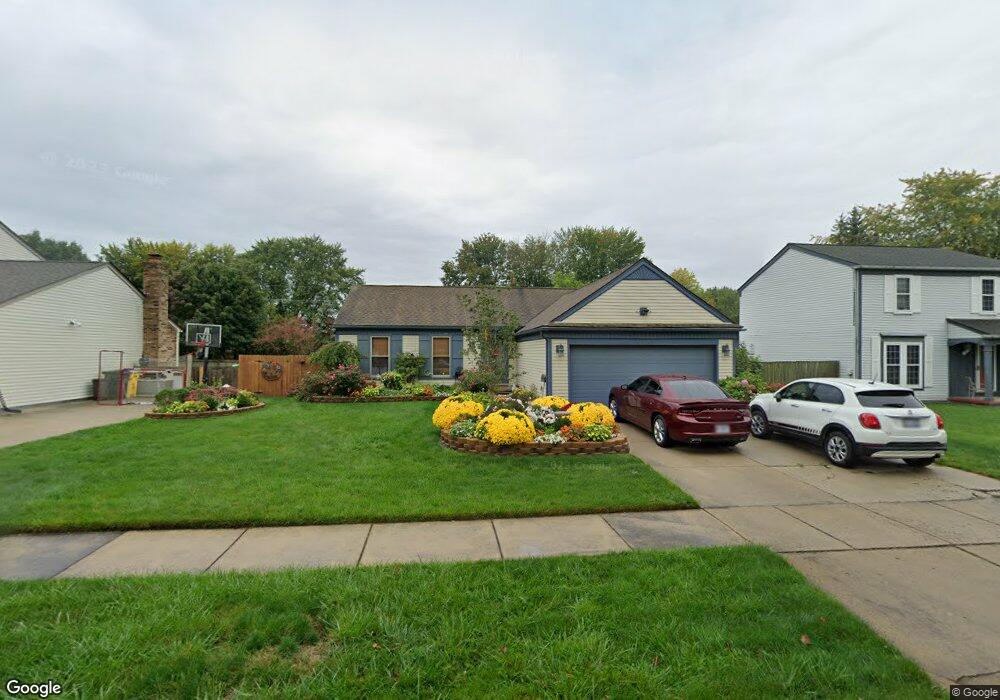
54145 Bradshaw Dr New Baltimore, MI 48047
Estimated Value: $251,875 - $311,000
3
Beds
1
Bath
1,192
Sq Ft
$245/Sq Ft
Est. Value
About This Home
This home is located at 54145 Bradshaw Dr, New Baltimore, MI 48047 and is currently estimated at $291,969, approximately $244 per square foot. 54145 Bradshaw Dr is a home located in Macomb County with nearby schools including Ashley Elementary School, Anchor Bay Middle School North, and Anchor Bay High School.
Ownership History
Date
Name
Owned For
Owner Type
Purchase Details
Closed on
Oct 5, 2002
Sold by
Price Denise L and Pishko Denise Price
Bought by
Pishko Kevin
Current Estimated Value
Purchase Details
Closed on
Apr 28, 2000
Sold by
Wolford Greg
Bought by
Price Denise L
Home Financials for this Owner
Home Financials are based on the most recent Mortgage that was taken out on this home.
Original Mortgage
$147,425
Outstanding Balance
$50,326
Interest Rate
8.18%
Mortgage Type
Purchase Money Mortgage
Estimated Equity
$241,643
Purchase Details
Closed on
Mar 19, 1996
Sold by
Zelenak M and Zelenak E
Bought by
Wolford G and Wolford D
Create a Home Valuation Report for This Property
The Home Valuation Report is an in-depth analysis detailing your home's value as well as a comparison with similar homes in the area
Home Values in the Area
Average Home Value in this Area
Purchase History
| Date | Buyer | Sale Price | Title Company |
|---|---|---|---|
| Pishko Kevin | -- | -- | |
| Price Denise L | $147,500 | -- | |
| Wolford G | $114,000 | -- |
Source: Public Records
Mortgage History
| Date | Status | Borrower | Loan Amount |
|---|---|---|---|
| Open | Price Denise L | $147,425 |
Source: Public Records
Tax History Compared to Growth
Tax History
| Year | Tax Paid | Tax Assessment Tax Assessment Total Assessment is a certain percentage of the fair market value that is determined by local assessors to be the total taxable value of land and additions on the property. | Land | Improvement |
|---|---|---|---|---|
| 2025 | $2,637 | $104,300 | $0 | $0 |
| 2024 | $2,202 | $101,000 | $0 | $0 |
| 2023 | $2,092 | $90,000 | $0 | $0 |
| 2022 | $2,386 | $84,500 | $0 | $0 |
| 2021 | $2,298 | $81,400 | $0 | $0 |
| 2020 | $1,936 | $76,900 | $0 | $0 |
| 2019 | $2,189 | $73,100 | $0 | $0 |
| 2018 | $2,153 | $64,200 | $0 | $0 |
| 2017 | $2,141 | $59,800 | $20,800 | $39,000 |
| 2016 | $2,125 | $59,800 | $0 | $0 |
| 2015 | -- | $56,000 | $0 | $0 |
| 2014 | -- | $50,100 | $0 | $0 |
Source: Public Records
Map
Nearby Homes
- 54253 Bradshaw Dr
- 35614 Hermitage Ct
- 54822 Heron Cir
- 54820 Mockingbird Dr
- 54790 Heron Cir
- 54759 Heron Cir
- 54375 Heron Cir
- Sawyer Plan at Creekside Park
- Peyton Plan at Creekside Park
- Aubrey Plan at Creekside Park
- Brooklyn Plan at Creekside Park
- Juliet Plan at Creekside Park
- 54695 Heron Cir
- 34433 Sandpiper Ct
- 53302 Zachary Dr
- 54620 Washington St
- 54597 Mockingbird
- - Baker Rd
- 54791 Heron Cir
- 35542 Addison Dr
- 54129 Bradshaw Dr
- 54167 Bradshaw Dr
- 54107 Bradshaw Dr
- 54181 Bradshaw Dr
- 54154 Bradshaw Dr
- 54138 Bradshaw Dr
- 54176 Bradshaw Dr
- 54095 Bradshaw Dr
- 54197 Bradshaw Dr
- 54116 Bradshaw Dr
- 54190 Bradshaw Dr
- 53986 Kirk Ct
- 54084 Bradshaw Dr
- 53978 Kirk Ct
- 54077 Bradshaw Dr
- 54219 Bradshaw Dr
- 54208 Bradshaw Dr
- 54225 Lytton Dr
- 54219 Lytton Dr
- 53994 Kirk Ct