Estimated Value: $141,000 - $163,000
2
Beds
1
Bath
960
Sq Ft
$161/Sq Ft
Est. Value
About This Home
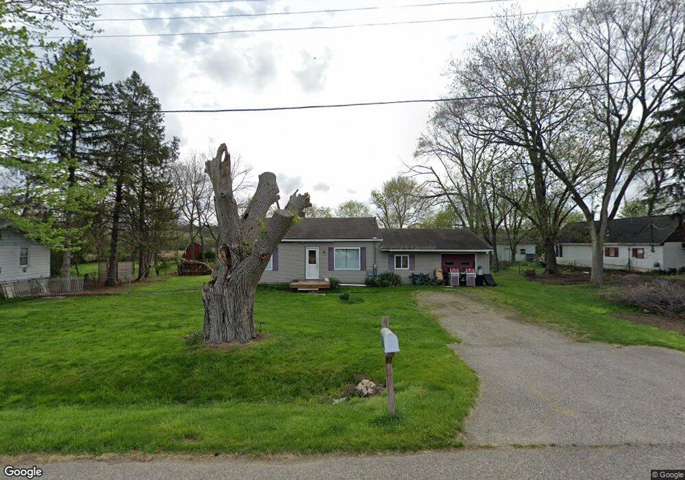
This home is located at 5415 Spicer Heights, Flint, MI 48507 and is currently estimated at $154,800, approximately $161 per square foot. 5415 Spicer Heights is a home located in Genesee County with nearby schools including Anderson Elementary School, McGrath Elementary School, and Grand Blanc West Middle School.
Ownership History
Date
Name
Owned For
Owner Type
Purchase Details
Closed on
Jan 7, 2009
Sold by
Hoover Brian O and Hoover Judi
Bought by
Lasalle Bank Na
Current Estimated Value
Purchase Details
Closed on
Jan 18, 2002
Sold by
B F Partners Llc
Bought by
Hoover Brian O
Purchase Details
Closed on
Mar 24, 2000
Sold by
Taxvest Ltd Partnership
Bought by
Bf Partners Llc
Create a Home Valuation Report for This Property
The Home Valuation Report is an in-depth analysis detailing your home's value as well as a comparison with similar homes in the area
Home Values in the Area
Average Home Value in this Area
Purchase History
| Date | Buyer | Sale Price | Title Company |
|---|---|---|---|
| Lasalle Bank Na | $119,286 | None Available | |
| Hoover Brian O | $80,000 | Guaranty Title | |
| Bf Partners Llc | -- | -- |
Source: Public Records
Tax History Compared to Growth
Tax History
| Year | Tax Paid | Tax Assessment Tax Assessment Total Assessment is a certain percentage of the fair market value that is determined by local assessors to be the total taxable value of land and additions on the property. | Land | Improvement |
|---|---|---|---|---|
| 2025 | $2,078 | $68,000 | $0 | $0 |
| 2024 | $1,396 | $58,100 | $0 | $0 |
| 2023 | $1,331 | $40,600 | $0 | $0 |
| 2022 | $2,522 | $38,000 | $0 | $0 |
| 2021 | $2,485 | $36,800 | $0 | $0 |
| 2020 | $1,210 | $37,400 | $0 | $0 |
| 2019 | $1,191 | $31,100 | $0 | $0 |
| 2018 | $2,405 | $30,600 | $0 | $0 |
| 2017 | $2,342 | $28,500 | $0 | $0 |
| 2016 | $2,307 | $27,200 | $0 | $0 |
| 2015 | $2,192 | $26,400 | $0 | $0 |
| 2012 | -- | $27,400 | $27,400 | $0 |
Source: Public Records
Map
Nearby Homes
- 3092 Durant Heights
- 00 Sloan Heights
- 3049 Baker Heights
- 3077 Kettering Heights
- 00 Durant Heights
- 1234 Fisher Heights
- VL S Saginaw St
- 00 S Dort Hwy
- 2346 Rollins St
- 6085 Westdale Dr
- 01 S Saginaw St
- 000 S Saginaw St
- 00 S Saginaw St
- 3246 E Maple Ave
- 6094 Grove Ave
- 6230 Woodsdale Dr
- 3.29(+/-) Acres E Hill Rd
- 5555 E Hill Rd
- 5391 Antoinette Dr
- 2357 Southampton Ave
- 5399 Spicer Heights
- 5395 Spicer Heights
- 5425 Spicer Heights
- 5389 Spicer Heights
- 3092 Strong Heights
- 5383 Spicer Heights
- 3091 Strong Heights
- 5383 Spicer Heights
- 3083 Strong Heights
- 3086 Strong Heights
- 3081 Baker Heights
- 3103 Durant Heights
- 3076 Strong Heights
- 3077 Strong Heights
- 3077 Baker Heights
- 3071 Strong Heights
- 5365 Spicer Heights
- 3147 Rhoda St
- 3147 Rhoda St
- 3066 Strong