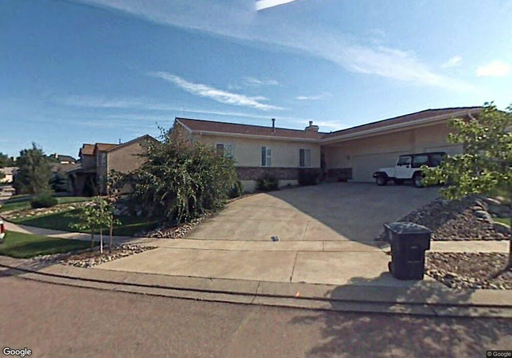
5415 Wells Fargo Dr Colorado Springs, CO 80918
Vista Grande NeighborhoodEstimated Value: $565,474 - $670,000
3
Beds
2
Baths
2,024
Sq Ft
$308/Sq Ft
Est. Value
About This Home
This home is located at 5415 Wells Fargo Dr, Colorado Springs, CO 80918 and is currently estimated at $623,869, approximately $308 per square foot. 5415 Wells Fargo Dr is a home located in El Paso County with nearby schools including Martinez Elementary School, Jenkins Middle School, and Doherty High School.
Ownership History
Date
Name
Owned For
Owner Type
Purchase Details
Closed on
Nov 6, 2009
Sold by
Slibsager Dennis and Slibsager Lorna
Bought by
Slibsager Dennis M and Slibsager Lorna G
Current Estimated Value
Home Financials for this Owner
Home Financials are based on the most recent Mortgage that was taken out on this home.
Original Mortgage
$174,300
Outstanding Balance
$113,228
Interest Rate
4.9%
Mortgage Type
New Conventional
Estimated Equity
$510,641
Purchase Details
Closed on
Apr 21, 1999
Sold by
Gendron Homes Inc Employee
Bought by
Slibsager Dennis and Slibsager Lorna
Home Financials for this Owner
Home Financials are based on the most recent Mortgage that was taken out on this home.
Original Mortgage
$208,850
Interest Rate
7.07%
Create a Home Valuation Report for This Property
The Home Valuation Report is an in-depth analysis detailing your home's value as well as a comparison with similar homes in the area
Home Values in the Area
Average Home Value in this Area
Purchase History
| Date | Buyer | Sale Price | Title Company |
|---|---|---|---|
| Slibsager Dennis M | -- | Peoples National Title Llc | |
| Slibsager Dennis | $232,200 | Unified Title Co Inc |
Source: Public Records
Mortgage History
| Date | Status | Borrower | Loan Amount |
|---|---|---|---|
| Open | Slibsager Dennis M | $174,300 | |
| Closed | Slibsager Dennis | $208,850 |
Source: Public Records
Tax History Compared to Growth
Tax History
| Year | Tax Paid | Tax Assessment Tax Assessment Total Assessment is a certain percentage of the fair market value that is determined by local assessors to be the total taxable value of land and additions on the property. | Land | Improvement |
|---|---|---|---|---|
| 2025 | $2,138 | $40,220 | -- | -- |
| 2024 | $2,019 | $40,340 | $6,190 | $34,150 |
| 2023 | $2,019 | $40,340 | $6,190 | $34,150 |
| 2022 | $1,826 | $30,490 | $5,490 | $25,000 |
| 2021 | $1,975 | $31,370 | $5,650 | $25,720 |
| 2020 | $1,844 | $25,680 | $4,900 | $20,780 |
| 2019 | $1,835 | $25,680 | $4,900 | $20,780 |
| 2018 | $1,783 | $23,060 | $4,940 | $18,120 |
| 2017 | $1,693 | $23,060 | $4,940 | $18,120 |
| 2016 | $1,398 | $22,580 | $5,010 | $17,570 |
| 2015 | $1,393 | $22,580 | $5,010 | $17,570 |
| 2014 | $1,366 | $21,300 | $5,010 | $16,290 |
Source: Public Records
Map
Nearby Homes
- 5347 Wells Fargo Dr
- 4740 Rustler Ct
- 5210 Turquoise Dr
- 5978 Maroon Mesa Dr
- 5635 Altitude Dr
- 6103 Treeledge Dr
- 0 Copper Dr Unit 2206120
- 5739 Wells Fargo Dr E
- 5421 Copper Dr
- 4735 Seton Place
- 5904 Mapleton Dr
- 6465 Whirlwind Dr
- 5745 Doe Skin Ct
- 6243 Fowler Mill Point
- 6256 Fowler Mill Point
- 5485 Castilian Villas Point
- 5747 Tradewind Point
- 4718 Rowland Heights
- 5245 Sapphire Dr
- 5162 Sunset Ridge Dr
- 5423 Wells Fargo Dr
- 5410 Saddle Rock Rd
- 5420 Saddle Rock Rd
- 5430 Saddle Rock Rd
- 5428 Wells Fargo Dr
- 5420 Wells Fargo Dr
- 5431 Wells Fargo Dr
- 5436 Wells Fargo Dr
- 5412 Wells Fargo Dr
- 5440 Saddle Rock Rd
- 5444 Wells Fargo Dr
- 5404 Wells Fargo Dr
- 4705 Buckaroo Dr
- 5355 Wells Fargo Dr
- 5447 Wells Fargo Dr
- 5452 Wells Fargo Dr
- 5435 Saddle Rock Rd
- 5450 Saddle Rock Rd
- 5360 Wells Fargo Dr
- 5445 Saddle Rock Rd