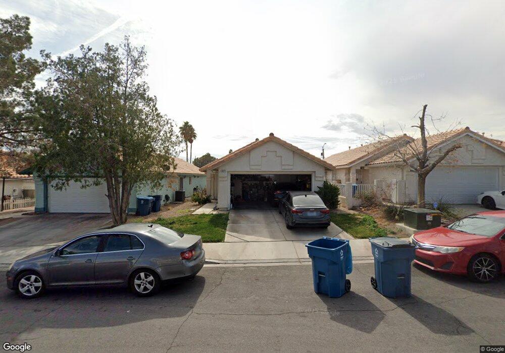
5417 Moonstruck Ave Las Vegas, NV 89107
Michael Way NeighborhoodEstimated Value: $360,000 - $384,000
3
Beds
2
Baths
1,325
Sq Ft
$279/Sq Ft
Est. Value
About This Home
This home is located at 5417 Moonstruck Ave, Las Vegas, NV 89107 and is currently estimated at $370,011, approximately $279 per square foot. 5417 Moonstruck Ave is a home located in Clark County with nearby schools including J.T. McWlliams Elementary School, Robert O Gibson Middle School, and Western High School.
Ownership History
Date
Name
Owned For
Owner Type
Purchase Details
Closed on
Dec 20, 1994
Sold by
National Horizon Corp
Bought by
Talley Bryan W and Talley Stacy R
Current Estimated Value
Home Financials for this Owner
Home Financials are based on the most recent Mortgage that was taken out on this home.
Original Mortgage
$98,875
Interest Rate
8.51%
Mortgage Type
FHA
Create a Home Valuation Report for This Property
The Home Valuation Report is an in-depth analysis detailing your home's value as well as a comparison with similar homes in the area
Home Values in the Area
Average Home Value in this Area
Purchase History
| Date | Buyer | Sale Price | Title Company |
|---|---|---|---|
| Talley Bryan W | $100,000 | Land Title |
Source: Public Records
Mortgage History
| Date | Status | Borrower | Loan Amount |
|---|---|---|---|
| Previous Owner | Talley Bryan W | $98,875 |
Source: Public Records
Tax History Compared to Growth
Tax History
| Year | Tax Paid | Tax Assessment Tax Assessment Total Assessment is a certain percentage of the fair market value that is determined by local assessors to be the total taxable value of land and additions on the property. | Land | Improvement |
|---|---|---|---|---|
| 2025 | $1,556 | $70,221 | $25,550 | $44,671 |
| 2024 | $1,441 | $70,221 | $25,550 | $44,671 |
| 2023 | $1,441 | $68,712 | $26,250 | $42,462 |
| 2022 | $1,335 | $59,965 | $21,000 | $38,965 |
| 2021 | $1,236 | $58,100 | $21,000 | $37,100 |
| 2020 | $1,145 | $56,895 | $19,950 | $36,945 |
| 2019 | $1,073 | $52,003 | $15,400 | $36,603 |
| 2018 | $1,024 | $47,107 | $11,900 | $35,207 |
| 2017 | $1,536 | $46,867 | $11,200 | $35,667 |
| 2016 | $960 | $42,257 | $8,400 | $33,857 |
| 2015 | $957 | $32,709 | $5,600 | $27,109 |
| 2014 | $929 | $27,483 | $4,550 | $22,933 |
Source: Public Records
Map
Nearby Homes
- 5420 Moonstruck Ave
- 600 Woodmount Dr
- 5400 Maddox Ave
- 5305 Sugarfoot Ave
- 5612 Pearldrop Ave
- 5713 Whiteridge Ave
- 601 Huntington St
- 5709 Goldmount Ave
- 304 Orland St Unit 53
- 304 Orland St Unit 56
- 304 Orland St Unit 39
- 304 Orland St Unit 38
- 304 Orland St Unit 47
- 304 Orland St Unit 43
- 212 Orland St Unit 23
- 212 Orland St Unit 28
- 212 Orland St Unit 22
- 212 Orland St Unit 19
- 212 Orland St Unit 17
- 208 Orland St Unit 10
- 5413 Moonstruck Ave
- 5421 Moonstruck Ave
- 5425 Moonstruck Ave
- 5409 Moonstruck Ave Unit 4
- 5429 Moonstruck Ave
- 5405 Moonstruck Ave
- 5433 Moonstruck Ave
- 5412 Moonstruck Ave
- 5413 Bromley Ave
- 5501 Bromley Ave
- 5424 Moonstruck Ave
- 5408 Moonstruck Ave
- 5437 Moonstruck Ave
- 5428 Moonstruck Ave
- 5401 Moonstruck Ave
- 5409 Bromley Ave
- 5432 Moonstruck Ave
- 400 Sarajane Ln