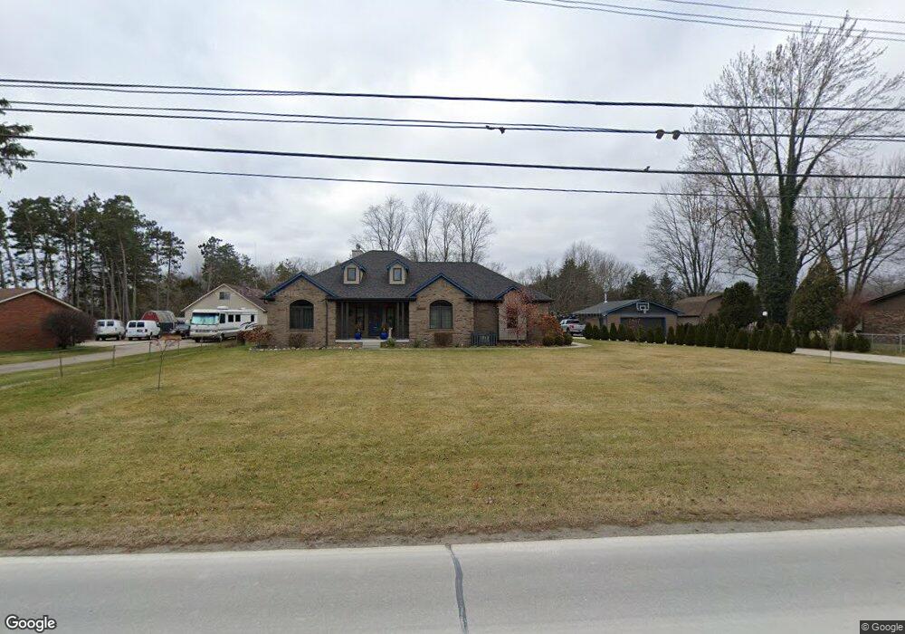
54171 Ridge Rd New Baltimore, MI 48047
Estimated Value: $384,000 - $737,923
4
Beds
1
Bath
1,865
Sq Ft
$286/Sq Ft
Est. Value
About This Home
This home is located at 54171 Ridge Rd, New Baltimore, MI 48047 and is currently estimated at $533,481, approximately $286 per square foot. 54171 Ridge Rd is a home located in Macomb County with nearby schools including Ashley Elementary School, Anchor Bay Middle School North, and Anchor Bay High School.
Ownership History
Date
Name
Owned For
Owner Type
Purchase Details
Closed on
Feb 21, 2020
Sold by
Brancato Carmen M
Bought by
Brancato Carmen M and Brancato Mona H
Current Estimated Value
Home Financials for this Owner
Home Financials are based on the most recent Mortgage that was taken out on this home.
Original Mortgage
$337,000
Outstanding Balance
$232,188
Interest Rate
3.6%
Mortgage Type
New Conventional
Estimated Equity
$301,293
Purchase Details
Closed on
Jul 19, 2011
Sold by
Dsl Real Estate Group 6 Llc
Bought by
Brancato Carmen
Purchase Details
Closed on
Sep 3, 2008
Sold by
Cms Equities Llc
Bought by
Dsl Real Estate Group 6 Llc
Purchase Details
Closed on
Mar 21, 2008
Sold by
Roman Tony E and Roman Susan M
Bought by
Lasalle Bank Na and Bear Stearns Asset Backed Securities Inc
Create a Home Valuation Report for This Property
The Home Valuation Report is an in-depth analysis detailing your home's value as well as a comparison with similar homes in the area
Home Values in the Area
Average Home Value in this Area
Purchase History
| Date | Buyer | Sale Price | Title Company |
|---|---|---|---|
| Brancato Carmen M | -- | Mutual Title Agency | |
| Brancato Carmen | $80,000 | First American Title Ins Co | |
| Dsl Real Estate Group 6 Llc | $75,000 | Colonial Title Company | |
| Lasalle Bank Na | $80,000 | None Available |
Source: Public Records
Mortgage History
| Date | Status | Borrower | Loan Amount |
|---|---|---|---|
| Open | Brancato Carmen M | $337,000 |
Source: Public Records
Tax History Compared to Growth
Tax History
| Year | Tax Paid | Tax Assessment Tax Assessment Total Assessment is a certain percentage of the fair market value that is determined by local assessors to be the total taxable value of land and additions on the property. | Land | Improvement |
|---|---|---|---|---|
| 2025 | $8,647 | $327,000 | $0 | $0 |
| 2024 | $7,243 | $314,900 | $0 | $0 |
| 2023 | $6,918 | $291,600 | $0 | $0 |
| 2022 | $7,898 | $270,400 | $0 | $0 |
| 2021 | $7,605 | $258,500 | $0 | $0 |
| 2020 | $6,403 | $247,000 | $0 | $0 |
| 2019 | $7,245 | $243,600 | $0 | $0 |
| 2018 | $7,102 | $191,000 | $0 | $0 |
| 2017 | $7,087 | $184,800 | $43,900 | $140,900 |
| 2016 | $7,033 | $184,800 | $0 | $0 |
| 2015 | -- | $89,600 | $0 | $0 |
| 2014 | -- | $39,900 | $0 | $0 |
Source: Public Records
Map
Nearby Homes
- 35542 Addison Dr
- 35683 Kilkenny Dr Unit 26
- 35603 Addison Dr Unit 166
- Bingham Colonial Plan at Windridge Estates
- Mistwood Colonial Plan at Windridge Estates
- The Hampton Colonial Plan at Windridge Estates
- The Magnolia Colonial Plan at Windridge Estates
- The Newberry Split Level Plan at Windridge Estates
- The Wesley Ranch Plan at Windridge Estates
- Wexford Ranch Plan at Windridge Estates
- 35689 Windridge Dr Unit 143
- 35704 Addison Dr
- 35736 Addison Dr Unit VAC
- 35795 Addison Dr Unit 177
- 35614 Hermitage Ct
- 53531 Bree Dr
- 54261 Cascade Ct Unit 96
- 35925 Windridge Dr Unit 82
- 35873 Glenville Dr Unit 182
- 54253 Bradshaw Dr
- 54133 Ridge Rd
- 54211 Ridge Rd
- VACANT Ridge Rd
- 0 Ridge Rd Unit 28190260
- 0 Ridge Rd Unit 29037665
- 0 Ridge Rd Unit 213022756
- 0 Ridge Rd Unit 216033290
- 0 Ridge Rd Unit 31347192
- 0 Ridge Rd Unit 4267160
- 0 Ridge Rd Unit 4959666
- 0 Ridge Rd Unit 4266345
- 0 Ridge Rd Unit 4362606
- 0 Ridge Rd Unit 4955489
- 0 Ridge Rd Unit 4529390
- 0 Ridge Rd Unit 884727
- 0 Ridge Rd Unit 889808
- 0 Ridge Rd Unit 908410
- 0 Ridge Rd Unit 5409325
- 0 Ridge Rd Unit 5416509
- 0 Ridge Rd Unit 5416404