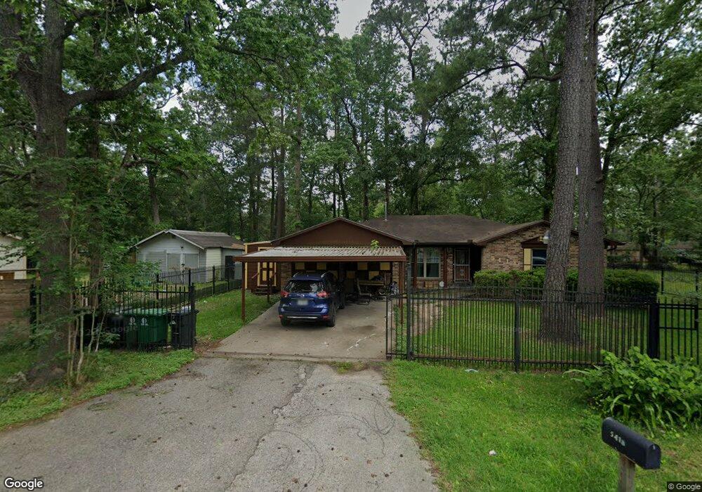
5418 Bretshire Dr Houston, TX 77016
East Little York NeighborhoodEstimated Value: $208,000 - $234,000
3
Beds
2
Baths
1,843
Sq Ft
$119/Sq Ft
Est. Value
About This Home
This home is located at 5418 Bretshire Dr, Houston, TX 77016 and is currently estimated at $219,267, approximately $118 per square foot. 5418 Bretshire Dr is a home located in Harris County with nearby schools including Shadydale Elementary School, Forest Brook Middle, and North Forest High School.
Ownership History
Date
Name
Owned For
Owner Type
Purchase Details
Closed on
Jun 19, 1995
Sold by
Casey Will and Casey Joanna
Bought by
Stewart Della R
Current Estimated Value
Home Financials for this Owner
Home Financials are based on the most recent Mortgage that was taken out on this home.
Original Mortgage
$47,444
Interest Rate
7.8%
Create a Home Valuation Report for This Property
The Home Valuation Report is an in-depth analysis detailing your home's value as well as a comparison with similar homes in the area
Home Values in the Area
Average Home Value in this Area
Purchase History
| Date | Buyer | Sale Price | Title Company |
|---|---|---|---|
| Stewart Della R | -- | Texas American Title Company |
Source: Public Records
Mortgage History
| Date | Status | Borrower | Loan Amount |
|---|---|---|---|
| Closed | Stewart Della R | $47,444 |
Source: Public Records
Tax History Compared to Growth
Tax History
| Year | Tax Paid | Tax Assessment Tax Assessment Total Assessment is a certain percentage of the fair market value that is determined by local assessors to be the total taxable value of land and additions on the property. | Land | Improvement |
|---|---|---|---|---|
| 2025 | $27 | $223,597 | $58,828 | $164,769 |
| 2024 | $27 | $223,597 | $58,828 | $164,769 |
| 2023 | $27 | $237,996 | $36,335 | $201,661 |
| 2022 | $3,576 | $199,879 | $24,223 | $175,656 |
| 2021 | $3,441 | $176,610 | $24,223 | $152,387 |
| 2020 | $3,250 | $162,200 | $18,687 | $143,513 |
| 2019 | $3,087 | $169,091 | $12,458 | $156,633 |
| 2018 | $588 | $110,913 | $12,458 | $98,455 |
| 2017 | $2,660 | $110,913 | $12,458 | $98,455 |
| 2016 | $2,418 | $105,196 | $12,458 | $92,738 |
| 2015 | $502 | $89,907 | $12,458 | $77,449 |
| 2014 | $502 | $89,907 | $12,458 | $77,449 |
Source: Public Records
Map
Nearby Homes
- 5621 Haywood St
- 6001 Bretshire Dr
- 10221 Bretton Dr
- 5123 Francine Ln
- 5413 Glen Nook Dr
- 5130 Farb Dr
- 5418 Parker Rd
- 10434 Envoy St
- 5914 Breland St
- 5022 Bretshire Dr
- 10122 Rockaway Dr
- 10201 Homestead Rd
- 10430 Royal Oaks Dr
- 5618 Briarwick Ln
- 9838 Camay Dr
- 10806 Bird of Paradise Ln
- 10808 Bird of Paradise Ln
- 10810 Bird of Paradise Ln
- 10535 Hollyglen Dr
- 10526 Hollyglen Dr
- 5414 Bretshire Dr
- 5504 Bretshire Dr
- 5425 Styling Dr
- 0 Wicklowe St Unit 3205371
- 0 Wicklowe St Unit 7522346
- 0 Wicklowe St Unit 4476440
- 0 Wicklowe St Unit 36494214
- 0 Wicklowe St Unit 21583655
- 0 Wicklowe St Unit 96591262
- 0 Wicklowe St Unit 38561485
- 5412 Bretshire Dr
- 5501 Bretshire Dr
- 5411 Styling Dr
- Lot 211 Bretshire Dr
- 5415 Bretshire Dr
- 5411 Bretshire Dr
- 5510 Bretshire Dr
- 5401 Styling Dr
- 10310 Wicklowe St
- 10309 Wicklowe St