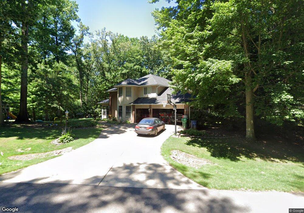
5418 N Lindsay La Porte, IN 46350
Estimated Value: $457,000 - $590,000
4
Beds
4
Baths
2,949
Sq Ft
$177/Sq Ft
Est. Value
About This Home
This home is located at 5418 N Lindsay, La Porte, IN 46350 and is currently estimated at $523,397, approximately $177 per square foot. 5418 N Lindsay is a home located in LaPorte County with nearby schools including New Prairie High School and Sacred Heart Apostolic School.
Ownership History
Date
Name
Owned For
Owner Type
Purchase Details
Closed on
Apr 27, 2007
Sold by
Cartus Financial Corp
Bought by
Mack Brian D
Current Estimated Value
Home Financials for this Owner
Home Financials are based on the most recent Mortgage that was taken out on this home.
Original Mortgage
$220,000
Interest Rate
6.76%
Mortgage Type
Unknown
Purchase Details
Closed on
Feb 11, 2006
Sold by
Laudadio Joseph Matthew and Laudadio Sue Ellen
Bought by
Cendant Mobility Financial Corp
Create a Home Valuation Report for This Property
The Home Valuation Report is an in-depth analysis detailing your home's value as well as a comparison with similar homes in the area
Home Values in the Area
Average Home Value in this Area
Purchase History
| Date | Buyer | Sale Price | Title Company |
|---|---|---|---|
| Mack Brian D | -- | Multiple | |
| Cendant Mobility Financial Corp | -- | Multiple |
Source: Public Records
Mortgage History
| Date | Status | Borrower | Loan Amount |
|---|---|---|---|
| Previous Owner | Mack Brian D | $220,000 |
Source: Public Records
Tax History Compared to Growth
Tax History
| Year | Tax Paid | Tax Assessment Tax Assessment Total Assessment is a certain percentage of the fair market value that is determined by local assessors to be the total taxable value of land and additions on the property. | Land | Improvement |
|---|---|---|---|---|
| 2024 | $3,553 | $325,900 | $43,900 | $282,000 |
| 2023 | $3,481 | $317,500 | $43,900 | $273,600 |
| 2022 | $3,188 | $297,300 | $43,900 | $253,400 |
| 2021 | $2,987 | $278,900 | $43,900 | $235,000 |
| 2020 | $3,059 | $278,900 | $43,900 | $235,000 |
| 2019 | $3,107 | $284,700 | $49,500 | $235,200 |
| 2018 | $2,884 | $259,800 | $36,200 | $223,600 |
| 2017 | $2,734 | $257,100 | $26,400 | $230,700 |
| 2016 | $2,670 | $234,800 | $26,400 | $208,400 |
| 2014 | $2,570 | $254,100 | $42,500 | $211,600 |
Source: Public Records
Map
Nearby Homes
- Lots 41-44 Campbell
- 5405 N Campbell
- 5223 N Barclay
- 0 Route 20 Unit 155390
- 4755 N Range Rd
- 4951 N Meadow Ct
- 344 E 650 N
- 4233 N Blueridge Dr
- 4711 N 100 W
- 1232 W 650 N
- 6707 N 200 E
- N Sr 39
- 7701 N Fail Rd
- 000 N US Highway 35 Rd
- 3471 N Karen Kourt
- 00 W Valley Blvd
- 0 W 250 N
- The Badin Plan at Wagner Estates
- The Kelley Plan at Wagner Estates
- The Leahy Plan at Wagner Estates
- 5428 N Lindsay
- 0 N Campbell Unit 339412
- 0 N Campbell Unit 395337
- 0 N Campbell Unit 416440
- 0 N Campbell Unit 42 201812881
- 0 N Campbell Unit 201947500
- 0 N Campbell Unit 464059
- Lot43 45 Campbell
- 0-Lot43 45 Campbell
- 5431 N Lindsay
- 5405 Campbell
- 5405 Campbell
- 5405 Campbell
- 0-Lot 90 N Duncan Ln
- 0-Lot 89 N Duncan Ln
- Lot 89 N Duncan Ln
- Lot 90 N Duncan Ln
- 5433 Campbell
- 5456 Lindsay N
- 5441 N Murray