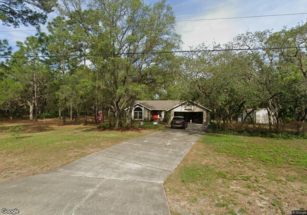
5418 N Nakoma Dr Beverly Hills, FL 34465
Estimated Value: $297,401 - $366,000
3
Beds
2
Baths
1,498
Sq Ft
$225/Sq Ft
Est. Value
About This Home
This home is located at 5418 N Nakoma Dr, Beverly Hills, FL 34465 and is currently estimated at $336,350, approximately $224 per square foot. 5418 N Nakoma Dr is a home located in Citrus County with nearby schools including Central Ridge Elementary School, Citrus Springs Middle School, and Lecanto High School.
Ownership History
Date
Name
Owned For
Owner Type
Purchase Details
Closed on
Jun 15, 2022
Sold by
Robinson Mark A and Robinson Deann
Bought by
Robinson Family Trust
Current Estimated Value
Purchase Details
Closed on
Nov 1, 1997
Bought by
Robinson Mark A and Robinson Deann
Purchase Details
Closed on
Mar 1, 1992
Bought by
Robinson Mark A and Robinson Deann
Purchase Details
Closed on
Apr 1, 1989
Bought by
Robinson Mark A and Robinson Deann
Purchase Details
Closed on
May 1, 1987
Bought by
Robinson Mark A and Robinson Deann
Create a Home Valuation Report for This Property
The Home Valuation Report is an in-depth analysis detailing your home's value as well as a comparison with similar homes in the area
Home Values in the Area
Average Home Value in this Area
Purchase History
| Date | Buyer | Sale Price | Title Company |
|---|---|---|---|
| Robinson Family Trust | -- | Fitzpatrick & Fitzpatrick Pa | |
| Robinson Mark A | $92,000 | -- | |
| Robinson Mark A | $84,000 | -- | |
| Robinson Mark A | $20,800 | -- | |
| Robinson Mark A | $7,304,100 | -- |
Source: Public Records
Tax History Compared to Growth
Tax History
| Year | Tax Paid | Tax Assessment Tax Assessment Total Assessment is a certain percentage of the fair market value that is determined by local assessors to be the total taxable value of land and additions on the property. | Land | Improvement |
|---|---|---|---|---|
| 2024 | $1,128 | $108,387 | -- | -- |
| 2023 | $1,128 | $105,230 | $0 | $0 |
| 2022 | $1,055 | $102,165 | $0 | $0 |
| 2021 | $1,012 | $99,189 | $0 | $0 |
| 2020 | $947 | $139,633 | $18,050 | $121,583 |
| 2019 | $930 | $132,504 | $17,770 | $114,734 |
| 2018 | $899 | $114,560 | $15,230 | $99,330 |
| 2017 | $890 | $91,908 | $16,740 | $75,168 |
| 2016 | $894 | $90,018 | $14,170 | $75,848 |
| 2015 | $902 | $89,392 | $13,590 | $75,802 |
| 2014 | $865 | $85,706 | $16,382 | $69,324 |
Source: Public Records
Map
Nearby Homes
- 2210 W La Bonte Cir
- 5361 N Peppermint Dr
- 1425 W Pinehill Dr
- 1993 W Learwood Place
- 5596 N Lamp Post Dr
- 5386 N Lena Dr
- 5063 N Peppermint Dr
- 5064 N Peppermint Dr
- 1373 W Pinehill Dr
- 6686 N Bedstrow Blvd
- 5626 N Bedstrow Blvd
- 2261 W Begonia Dr
- 5839 N Maroon Way
- 2196 W Pine Ridge Blvd
- 5326 N Red Ribbon Point
- 1234 W Sphere Place
- 6098 N Peardale Terrace
- 5412 N Mallows Cir
- 5862 N Summerfield Point
- 4889 N Peppermint Dr
- 5436 N Nakoma Dr
- 5376 N Nakoma Dr
- 1823 W La Bonte Cir
- 1835 W La Bonte Cir
- 5377 N Lamp Post Dr
- 1845 W La Bonte Cir
- 1811 W La Bonte Cir
- 5479 N Nakoma Dr
- 5366 N Lamp Post
- 1857 W La Bonte Cir Unit 3
- 1857 W La Bonte Cir
- 5538 N Nakoma Dr
- 1830 W La Bonte Cir
- 5398 N Bedstrow Blvd
- 5378 N Lamp Post Dr
- 5426 N Bedstrow Blvd
- 1812 W La Bonte Cir
- 5386 N Lamp Post Dr
- 1846 W La Bonte Cir
- 1869 W La Bonte Cir