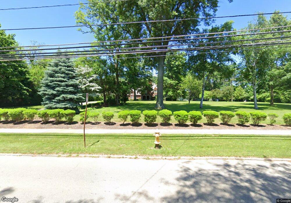
542 Broad St Wadsworth, OH 44281
Estimated Value: $501,000 - $1,058,000
4
Beds
7
Baths
5,862
Sq Ft
$129/Sq Ft
Est. Value
About This Home
This home is located at 542 Broad St, Wadsworth, OH 44281 and is currently estimated at $759,002, approximately $129 per square foot. 542 Broad St is a home located in Medina County with nearby schools including Overlook Elementary School, Wadsworth Middle School, and Central Intermediate School.
Ownership History
Date
Name
Owned For
Owner Type
Purchase Details
Closed on
Aug 10, 2021
Sold by
Adams Irene R
Bought by
Wilson Pamela J
Current Estimated Value
Purchase Details
Closed on
Dec 6, 2012
Sold by
Adams Wayne G
Bought by
Adams Irene R
Purchase Details
Closed on
Oct 18, 2012
Sold by
Estate Of Bryan O Adams
Bought by
Bryan O Adams Trust
Purchase Details
Closed on
Dec 20, 2002
Sold by
Adams Bryan O
Bought by
Given Irene R
Purchase Details
Closed on
Sep 6, 2001
Sold by
Mcanlis John G and Mcanlis Joan
Bought by
Adams Bryan O
Purchase Details
Closed on
Aug 24, 1998
Sold by
Mcanlis Joan L and Mcanlis John C
Bought by
Dye James and Dye Andralette
Home Financials for this Owner
Home Financials are based on the most recent Mortgage that was taken out on this home.
Original Mortgage
$400,000
Interest Rate
8%
Mortgage Type
Seller Take Back
Create a Home Valuation Report for This Property
The Home Valuation Report is an in-depth analysis detailing your home's value as well as a comparison with similar homes in the area
Home Values in the Area
Average Home Value in this Area
Purchase History
| Date | Buyer | Sale Price | Title Company |
|---|---|---|---|
| Wilson Pamela J | -- | None Available | |
| Adams Irene R | -- | None Available | |
| Bryan O Adams Trust | -- | None Available | |
| Given Irene R | -- | -- | |
| Adams Bryan O | $455,000 | -- | |
| Dye James | $550,000 | -- |
Source: Public Records
Mortgage History
| Date | Status | Borrower | Loan Amount |
|---|---|---|---|
| Previous Owner | Dye James | $400,000 |
Source: Public Records
Tax History Compared to Growth
Tax History
| Year | Tax Paid | Tax Assessment Tax Assessment Total Assessment is a certain percentage of the fair market value that is determined by local assessors to be the total taxable value of land and additions on the property. | Land | Improvement |
|---|---|---|---|---|
| 2024 | $9,603 | $226,930 | $40,020 | $186,910 |
| 2023 | $9,603 | $226,930 | $40,020 | $186,910 |
| 2022 | $9,658 | $226,930 | $40,020 | $186,910 |
| 2021 | $9,057 | $181,540 | $32,010 | $149,530 |
| 2020 | $7,988 | $181,540 | $32,010 | $149,530 |
| 2019 | $7,999 | $181,540 | $32,010 | $149,530 |
| 2018 | $6,939 | $149,170 | $32,860 | $116,310 |
| 2017 | $6,942 | $149,170 | $32,860 | $116,310 |
| 2016 | $7,057 | $149,170 | $32,860 | $116,310 |
| 2015 | $6,752 | $136,860 | $30,150 | $106,710 |
| 2014 | $6,863 | $136,860 | $30,150 | $106,710 |
| 2013 | $6,872 | $136,860 | $30,150 | $106,710 |
Source: Public Records
Map
Nearby Homes
- 493 Broad St Unit 495
- 264 Windfall Ln
- 178 Fairlawn Ave
- 273 E Boyer St
- 141 Humbolt Ave
- 411 Treeview Dr
- 878 Longbrook Dr
- 269 Water St
- 957 Devonwood Dr Unit 15
- 119 Park St
- 440 Dohner Dr
- 268 E Walnut St
- 201 Water St
- 301 S Lyman St
- 0 Greenwich Rd
- 675 Woodcrest Dr
- 362 Silver Meadow Dr
- 118 E Prospect St
- 235 High St
- 352 N Lyman St
- 126 High Point Dr
- 136 High Point Dr
- 120 High Point Dr
- 568 Broad St
- 144 High Point Dr
- 106 High Point Dr
- 154 High Point Dr
- 176 Tanglewood Trail
- 170 Tanglewood Trail
- 575 Broad St
- 549 Broad St
- 557 Broad St
- 569 v/l Broad St
- 127 High Point Dr
- 561 Broad St
- 121 High Point Dr
- 137 High Point Dr
- 565 Broad St
- 565 Broad St
- 162 High Point Dr
