Estimated Value: $286,513 - $365,000
--
Bed
--
Bath
1,232
Sq Ft
$255/Sq Ft
Est. Value
About This Home
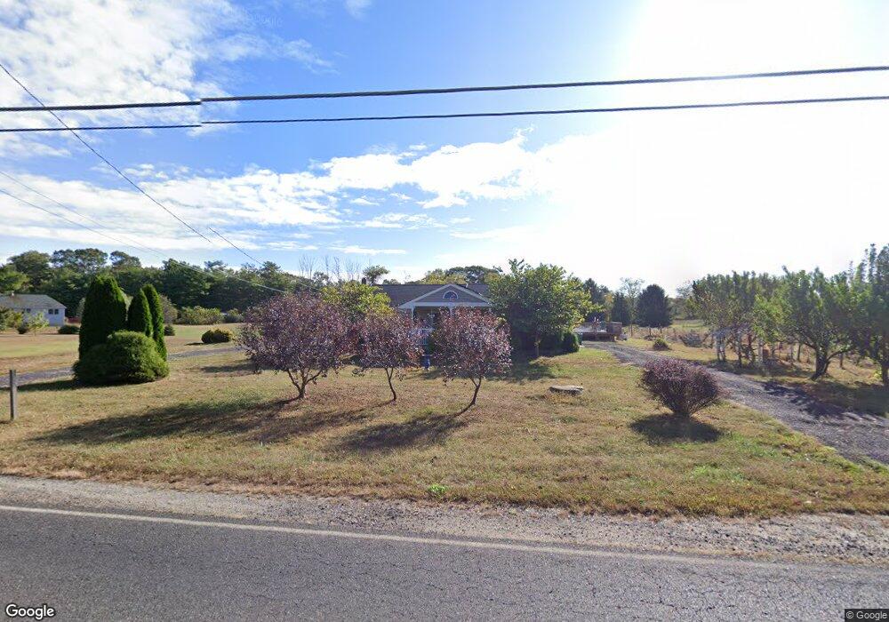
This home is located at 542 Buck Rd, Elmer, NJ 08318 and is currently estimated at $313,878, approximately $254 per square foot. 542 Buck Rd is a home located in Salem County with nearby schools including Elmer Elementary School, Pittsgrove Township Middle School, and Arthur P. Schalick High School.
Ownership History
Date
Name
Owned For
Owner Type
Purchase Details
Closed on
Jul 22, 1998
Sold by
Earnest Gladys and Sims Beatrice
Bought by
Pinkerton John E and Pinkerton Sharon L
Current Estimated Value
Home Financials for this Owner
Home Financials are based on the most recent Mortgage that was taken out on this home.
Original Mortgage
$96,933
Outstanding Balance
$19,820
Interest Rate
6.99%
Mortgage Type
FHA
Estimated Equity
$294,058
Purchase Details
Closed on
Jul 2, 1996
Sold by
Stiles Frank W and Stiles Mary
Bought by
Earnest Gladys and Sims Beatrice
Create a Home Valuation Report for This Property
The Home Valuation Report is an in-depth analysis detailing your home's value as well as a comparison with similar homes in the area
Home Values in the Area
Average Home Value in this Area
Purchase History
| Date | Buyer | Sale Price | Title Company |
|---|---|---|---|
| Pinkerton John E | $97,000 | -- | |
| Earnest Gladys | -- | -- |
Source: Public Records
Mortgage History
| Date | Status | Borrower | Loan Amount |
|---|---|---|---|
| Open | Pinkerton John E | $96,933 |
Source: Public Records
Tax History Compared to Growth
Tax History
| Year | Tax Paid | Tax Assessment Tax Assessment Total Assessment is a certain percentage of the fair market value that is determined by local assessors to be the total taxable value of land and additions on the property. | Land | Improvement |
|---|---|---|---|---|
| 2025 | $7,350 | $173,800 | $41,200 | $132,600 |
| 2024 | $6,962 | $173,800 | $41,200 | $132,600 |
| 2023 | $6,962 | $173,800 | $41,200 | $132,600 |
| 2022 | $6,881 | $173,800 | $41,200 | $132,600 |
| 2021 | $6,688 | $173,800 | $41,200 | $132,600 |
| 2020 | $6,504 | $173,800 | $41,200 | $132,600 |
| 2019 | $6,392 | $173,800 | $41,200 | $132,600 |
| 2018 | $6,250 | $173,800 | $41,200 | $132,600 |
| 2017 | $6,012 | $173,800 | $41,200 | $132,600 |
| 2016 | $5,704 | $173,800 | $41,200 | $132,600 |
| 2015 | $5,428 | $173,800 | $41,200 | $132,600 |
| 2014 | $5,202 | $173,800 | $41,200 | $132,600 |
Source: Public Records
Map
Nearby Homes
- 0 00011 04 Lawrence Corner Rd
- 0 00011 03 Lawrence Corner Rd
- 0 00011 02 Lawrence Corner Rd
- 0 00011 010 Mckishen Rd
- 0 00011 09 Mckishen Rd
- 0 Mckishen Rd
- 0 00011 05 Mckishen Rd
- 0 00011 08 Mckishen Rd
- 0 00011 07 Mckishen Rd
- 51 Laurel Ave
- 617 Lower Mill Rd
- 520 S Main St
- 138 Upper Neck Rd
- 1088 Lakewood Place
- 315 S Main St
- 1102 Swans Way
- 217 S Main St
- 211 213 S Main St
- 117 Hazelwood Dr
- 95 Park Ave
- 537 Buck Rd
- 263 Lawrence Corner Rd
- 560 Buck Rd
- 275 Lawrence Corner Rd
- 250 Lawrence Corner Rd
- 572 Buck Rd
- 571 Buck Rd
- 521 Buck Rd
- 284 Lawrence Corner Rd
- 551 Buck Rd
- 291 Lawrence Corner Rd
- 264 Lawrence Corner Rd
- 563 Buck Rd
- 223 Lawrence Corner Rd
- 549 Buck Rd
- 0 Lawrence Corner Rd Unit 1007606450
- 0 Lawrence Corner Rd Unit 1007455612
- 0 Lawrence Corner Rd Unit 1007285794
- 0 Lawrence Corner Rd Unit 6694200
- 212 Lawrence Corner Rd