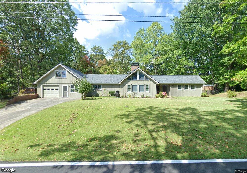
542 Calhoun Rd Dahlonega, GA 30533
Estimated Value: $333,102 - $487,000
--
Bed
2
Baths
2,088
Sq Ft
$203/Sq Ft
Est. Value
About This Home
This home is located at 542 Calhoun Rd, Dahlonega, GA 30533 and is currently estimated at $423,026, approximately $202 per square foot. 542 Calhoun Rd is a home located in Lumpkin County with nearby schools including Clay County Middle School and Lumpkin County High School.
Ownership History
Date
Name
Owned For
Owner Type
Purchase Details
Closed on
Oct 19, 2000
Sold by
Faile Cherry
Bought by
Faile Cherry
Current Estimated Value
Purchase Details
Closed on
Aug 4, 1997
Sold by
Faile George Marion
Bought by
Faile Cherry
Purchase Details
Closed on
Jun 1, 1975
Bought by
Faile George Marion
Create a Home Valuation Report for This Property
The Home Valuation Report is an in-depth analysis detailing your home's value as well as a comparison with similar homes in the area
Home Values in the Area
Average Home Value in this Area
Purchase History
| Date | Buyer | Sale Price | Title Company |
|---|---|---|---|
| Faile Cherry | $1,000 | -- | |
| Faile Cherry | $80,000 | -- | |
| Faile George Marion | -- | -- |
Source: Public Records
Tax History Compared to Growth
Tax History
| Year | Tax Paid | Tax Assessment Tax Assessment Total Assessment is a certain percentage of the fair market value that is determined by local assessors to be the total taxable value of land and additions on the property. | Land | Improvement |
|---|---|---|---|---|
| 2024 | $301 | $111,092 | $16,000 | $95,092 |
| 2023 | $321 | $106,393 | $16,000 | $90,393 |
| 2022 | $541 | $99,865 | $16,000 | $83,865 |
| 2021 | $247 | $79,915 | $10,000 | $69,915 |
| 2020 | $66 | $69,112 | $10,000 | $59,112 |
| 2019 | $138 | $73,112 | $14,000 | $59,112 |
| 2018 | $2,335 | $65,809 | $14,000 | $51,809 |
| 2017 | $2,318 | $64,275 | $14,000 | $50,275 |
| 2016 | $2,255 | $59,614 | $14,000 | $45,614 |
| 2015 | $1,949 | $59,614 | $14,000 | $45,614 |
| 2014 | $1,949 | $60,212 | $14,000 | $46,212 |
| 2013 | -- | $60,810 | $14,000 | $46,810 |
Source: Public Records
Map
Nearby Homes
- 735 Calhoun Rd
- 99 Madeline Anthony Rd
- 99 Madeline Anthony Road Lots 44 and 45
- 0 Crown Mountain Unit 7682225
- 0 Crown Mountain Unit 10644759
- LOT 13 Crown Mountain Way
- Lot 28 Crown Mountain Way
- Lot 30 Crown Mountain Way
- Lot 20 Crown Mountain Way
- 0 Crown Mountain Way Unit 7666031
- 567 Crown Mountain Way
- 0 Calhoun Rd Unit 7643314
- 0 Calhoun Rd Unit 10598012
- 00 Calhoun Rd
- 1170 Calhoun Rd
- 0 Alicia Ln
- 168 W Main St
- 1415 Calhoun Rd
- 0 Highway 9 S Unit 10487179
- 0 Highway 9 S Unit 7548614
- 494 Calhoun Rd
- 501 Calhoun Rd
- 552 Calhoun Rd
- LOT 16 Calhoun Rd
- 559 Calhoun Rd
- 0 Timber Oak Ln
- 80 Timber Oak Ln
- 590 Calhoun Rd
- 69 Timber Oak Ln
- 629 Calhoun Rd
- 628 Calhoun Rd
- 88 Timber Oak Ln
- 437 Calhoun Rd
- 00 Crown Mountain Dr
- 109 Timber Oak Ln
- 591 Calhoun Rd
- 1 Crown Mountain Dr
- 659 Calhoun Rd
- 118 Timber Oak Ln
- 7 Crown Mountain Dr