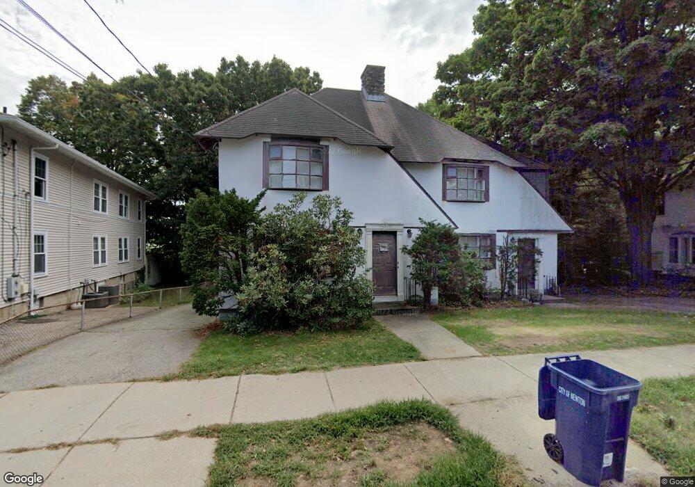
542 California St Newtonville, MA 02460
Nonantum NeighborhoodEstimated Value: $1,024,000 - $1,404,549
3
Beds
3
Baths
2,179
Sq Ft
$554/Sq Ft
Est. Value
About This Home
This home is located at 542 California St, Newtonville, MA 02460 and is currently estimated at $1,206,387, approximately $553 per square foot. 542 California St is a home located in Middlesex County with nearby schools including Horace Mann Elementary School, Lincoln-Eliot Elementary School, and F.A. Day Middle School.
Ownership History
Date
Name
Owned For
Owner Type
Purchase Details
Closed on
Jul 28, 2022
Sold by
Deangelis Rt
Bought by
Deangelis Mary A
Current Estimated Value
Purchase Details
Closed on
Aug 1, 1985
Bought by
Deangelis Louis P and Deangelis Mary A
Create a Home Valuation Report for This Property
The Home Valuation Report is an in-depth analysis detailing your home's value as well as a comparison with similar homes in the area
Home Values in the Area
Average Home Value in this Area
Purchase History
| Date | Buyer | Sale Price | Title Company |
|---|---|---|---|
| Deangelis Mary A | -- | None Available | |
| Deangelis Louis P | $238,000 | -- |
Source: Public Records
Mortgage History
| Date | Status | Borrower | Loan Amount |
|---|---|---|---|
| Previous Owner | Deangelis Louis P | $50,000 | |
| Previous Owner | Deangelis Louis P | $105,000 |
Source: Public Records
Tax History Compared to Growth
Tax History
| Year | Tax Paid | Tax Assessment Tax Assessment Total Assessment is a certain percentage of the fair market value that is determined by local assessors to be the total taxable value of land and additions on the property. | Land | Improvement |
|---|---|---|---|---|
| 2025 | $9,811 | $1,001,100 | $624,800 | $376,300 |
| 2024 | $9,486 | $971,900 | $606,600 | $365,300 |
| 2023 | $9,043 | $888,300 | $485,200 | $403,100 |
| 2022 | $8,653 | $822,500 | $449,300 | $373,200 |
| 2021 | $8,869 | $754,600 | $412,200 | $342,400 |
| 2020 | $7,878 | $754,600 | $412,200 | $342,400 |
| 2019 | $7,369 | $705,200 | $385,200 | $320,000 |
| 2018 | $7,232 | $668,400 | $361,300 | $307,100 |
| 2017 | $6,819 | $613,200 | $331,500 | $281,700 |
| 2016 | $6,402 | $562,600 | $304,100 | $258,500 |
| 2015 | $6,105 | $525,800 | $284,200 | $241,600 |
Source: Public Records
Map
Nearby Homes
- 177 Nevada St
- 191 Linwood Ave
- 286 Nevada St Unit 286
- 282 Nevada St Unit 282
- 57 Walnut St
- 354 Linwood Ave Unit 1
- 611 Watertown St Unit 14
- 42-44 Judkins St
- 1 Farwell Cir
- 158 Adams St
- 32-34 Rossmere St
- 49 Hawthorn St
- 3 Repton Cir Unit 3204
- 321 Albemarle Rd
- 168 Walnut St
- 3 Ashmont Ave
- 34 West St Unit A
- 188-190 Adams St
- 11 Murphy Ct
- 53 West St
- 542 California St Unit 2
- 548 California St
- 541 California St
- 537 California St
- 547 California St
- 558 California St
- 553 California St
- 524 California St Unit 2
- 524 California St Unit 1
- 524 California St
- 529 California St
- 185 Nevada St
- 557 California St
- 562 California St
- 525 California St
- 216 Nevada St
- 216 Nevada St Unit Rear TH
- 64 Wyoming Rd
- 68 Wyoming Rd
- 82 Wyoming Rd