
Estimated payment $691/month
Highlights
- Water Access
- Mountain View
- No HOA
- Home fronts a creek
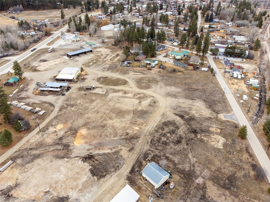
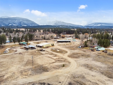
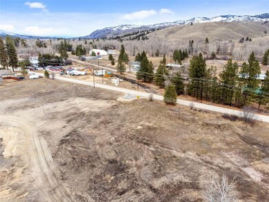
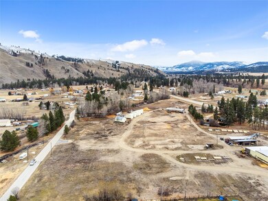
About This Lot
Welcome to the new Tree-Mendous Place Subdivision within walking distance to downtown Darby. This lot has access to Tin Cup Creek, and is approximately a quarter acre. The Bitterroot River, popular for its fly fishing, is just minutes away, and West Fork Road leading to Painted Rocks Reservoir, is only a few miles south on Hwy 93. HOA will be required in the future to cover the cost of maintaining stormwater basin. Amount of yearly HOA fee TBD.
Listing Agent
Engel & Völkers Western Frontier - Hamilton License #RRE-RBS-LIC-98383 Listed on: 01/15/2025

Property Details
Property Type
- Land
Est. Annual Taxes
- $252
Lot Details
- 0.25 Acre Lot
- Home fronts a creek
Additional Features
- Mountain Views
- Phone Available
Listing and Financial Details
- Assessor Parcel Number 13117614202160000
Community Details
Overview
- No Home Owners Association
- Tree Mendous Place Subdivision
Recreation
- Water Access
Map
Home Values in the Area
Average Home Value in this Area
Tax History
| Year | Tax Paid | Tax Assessment Tax Assessment Total Assessment is a certain percentage of the fair market value that is determined by local assessors to be the total taxable value of land and additions on the property. | Land | Improvement |
|---|---|---|---|---|
| 2025 | $401 | $126,959 | $0 | $0 |
| 2024 | $237 | $43,611 | $0 | $0 |
| 2023 | $2,622 | $347,800 | $0 | $0 |
| 2022 | $2,120 | $237,000 | $0 | $0 |
| 2021 | $2,292 | $237,000 | $0 | $0 |
| 2020 | $2,263 | $226,859 | $0 | $0 |
| 2019 | $1,873 | $227,366 | $0 | $0 |
| 2018 | $1,551 | $178,760 | $0 | $0 |
| 2017 | $1,677 | $192,930 | $0 | $0 |
| 2016 | $1,632 | $187,572 | $0 | $0 |
| 2015 | $1,629 | $187,572 | $0 | $0 |
| 2014 | $2,074 | $194,617 | $0 | $0 |
Property History
| Date | Event | Price | List to Sale | Price per Sq Ft |
|---|---|---|---|---|
| 07/24/2025 07/24/25 | Price Changed | $127,500 | -7.3% | -- |
| 01/15/2025 01/15/25 | For Sale | $137,500 | -- | -- |
Purchase History
| Date | Type | Sale Price | Title Company |
|---|---|---|---|
| Quit Claim Deed | -- | -- |
Source: Montana Regional MLS
MLS Number: 30038784
APN: 13-1176-14-2-02-16-0000
Disclaimer: Certain information contained herein is derived from information provided by parties other than Homes.com. All information provided is deemed reliable, but is not guaranteed to be accurate and should be independently verified.
![]() IDX information is provided exclusively for personal, non-commercial use, and may not be used for any purpose other than to identify prospective properties consumers may be interested in purchasing. Information is deemed reliable but not guaranteed.
IDX information is provided exclusively for personal, non-commercial use, and may not be used for any purpose other than to identify prospective properties consumers may be interested in purchasing. Information is deemed reliable but not guaranteed.
- 538 Cant Way
- 132 Kay Ln
- 136 Kay Ln
- Lots 1-3 & 6-14 Tree-Mendous Place Subdivision
- Lot 8 Kay Ln
- 118 Kay Ln
- 539 Cant Way
- Lot 13 Kay Ln
- Lot 12 Kay Ln
- 137 Kay Ln
- 162 Kay Ln
- 172 Kay Ln
- 120 Joe Abbey Ln
- NHN S Main St
- 212 N Water St
- 106 E Southwic Ave
- 105 S Clifton St
- 202 E Waldo St
- 102 Kerlee Ave
- 106 Hale Ave